
One Day in Ponidzie
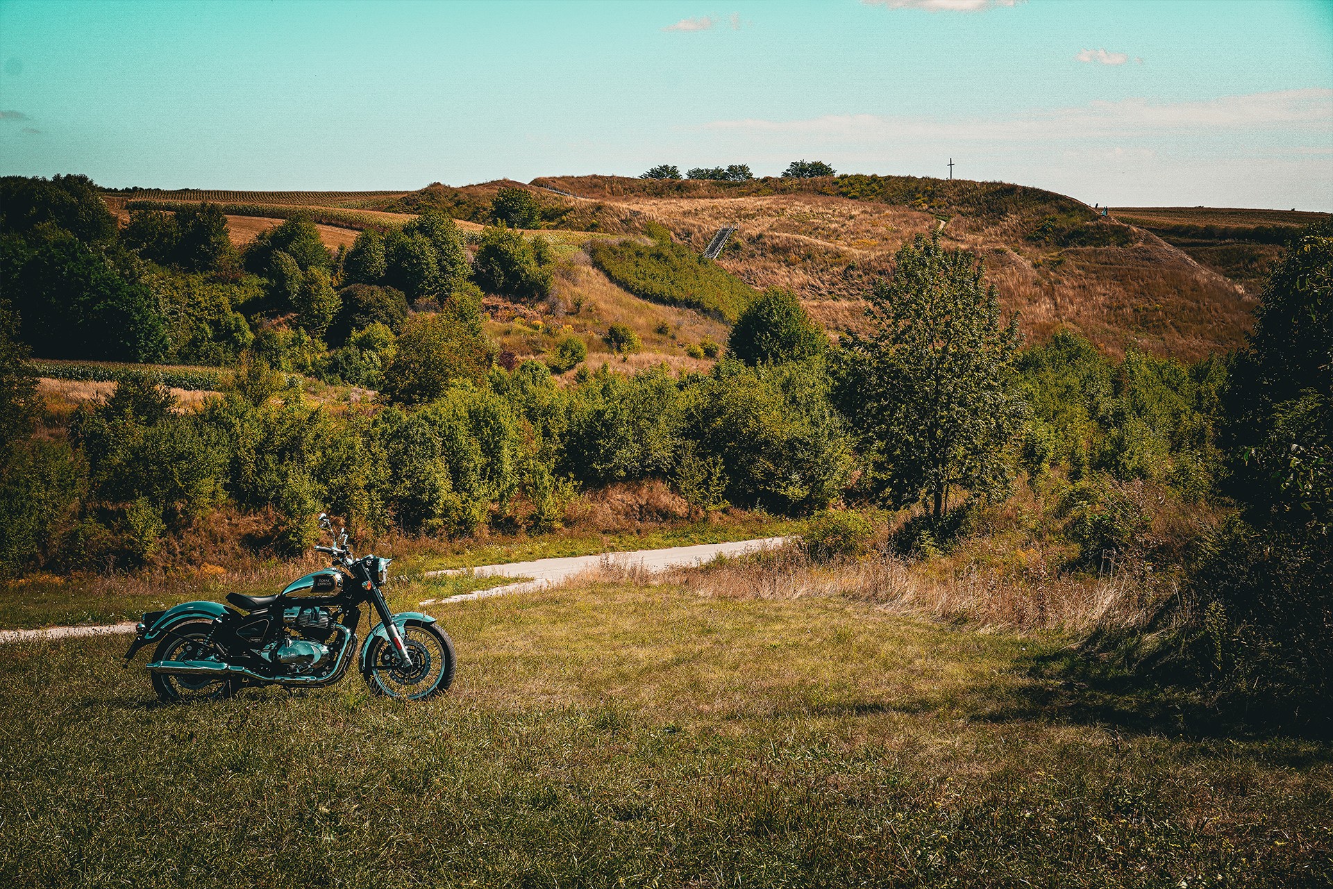
It is hard not to notice that motorcyclists, cyclists, and tourists setting off from Kraków most often choose two directions. The south, of course, remains the most popular, attracting not only Kraków residents but also people from at least half of Poland who are starved for mountain views. The closer vicinities of Ojców, Wieliczka, and the Niepołomice Forest also experience a heavy influx of visitors. However, the further away from the city you get, the more the traffic gradually thins out—until it finally almost disappears.
The direction described this time belongs precisely to that second category. Of course, there are regions even less frequently visited by tourists leaving the former capital of Poland, but here too, one can speak of a certain mysterious emptiness.
And that is a shame, because—as you will see for yourselves—this is a route that is practically mandatory. Not only for motorcyclists and cyclists, but basically for anyone who loves to travel and discover less obvious places.
The Miechów Upland, the region of sub-Kraków loess soils, the Wodzisław Hump, and the Nida valley are virtually packed with picturesque landscapes, history, historical monuments, unique nature, and fascinating curiosities that you can literally stumble upon along the way.
The route itinerary has been designed so that most of the points can be seen in a single day. This is entirely possible, although it is definitely worth allocating at least a few days to get to know the region at a peaceful pace.
We begin our journey in the northern part of Kraków and head toward Raciborowice. We are not starting from the city center, because if we wanted to catch even a fraction of the attractions offered by Kraków itself, we most likely wouldn’t leave its borders on the same day.
Raciborowice itself certainly deserves a separate visit. This time, it’s worth just taking a quick look at the old watermill and the Church of St. Margaret, funded by Jan Długosz—a figure who will appear more than once along our route.

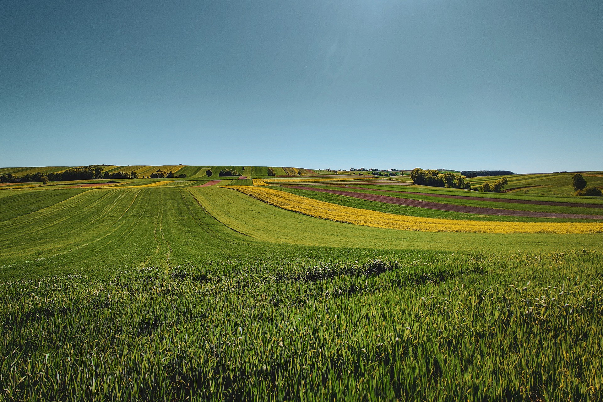
The next point worth mentioning is Wysołek Luborzycki and another Gothic church, whose earlier versions fell victim to Mongol invasions twice. From this moment on, a peaceful ride awaits us through sub-Kraków villages situated on the so-called sub-Kraków loess. The impact of the ice sheet, with which these fertile soils are associated, is visible here to the naked eye—both in the color of the earth, the type of crops, and the topography itself.
And while geological matters might seem rather trivial in the context of a motorcycle route, they actually hold immense significance for the character of the entire region. This applies both to the activity of rivers, which are a main element of the landscape, and to the processes occurring in the foreland of the ice sheet, as well as eras much earlier than the Pleistocene. What is most interesting—most of these phenomena and their impact on the development of the area remain visible to this day.
Since we are still in a region dominated by loess deposits, it is worth emphasizing that these lands were exceptionally favored by the first newcomers from the south as a place to live. Traces of centuries-old human presence, plowed up and scattered across the fields, are nothing unusual here. The sheer volume of artifacts, particularly from the Neolithic, Bronze Age, and Iron Age, can be quite overwhelming.
Wrocimowice
Keeping in mind the typically agricultural character of the region, we continue to head north. A peaceful and almost traffic-free ride will accompany us all the way to Wrocimowice. Aside from the Baroque Church of St. Andrew, visible from afar, this village might ring a bell for more attentive travelers due to another element—or rather, a specific figure.
It was from here that Marcin of Wrocimowice, the Kraków flag-bearer immortalized in Jan Matejko’s painting “The Battle of Grunwald,” originated. And it was he who carried the main banner of the Polish forces during the battle.
Today’s image of a quiet village might seem somewhat surprising when contrasted with the history of such a significant knight, and the fact that both he and his son emphasized their connections to the settlement by using its name as their surname. This discrepancy is easily explained thanks to modern technology, specifically LiDAR remote sensing.

Just behind the church, on a hill hidden beneath dense vegetation, lie the relics of a medieval stronghold and the remains of an old castle. A commemorative plaque placed near the slope and a cross standing on a characteristic promontory of the hill also serve as reminders of the historical significance of this place.
Since time is pressing, it is best to leave this type of curiosity for a separate trip. This time, we move on—heading toward the field of a battle just as famous as Grunwald, though much later: the Battle of Racławice.
Racławice
The hill towering over Janowiczki hides not only the Tadeusz Kościuszko Mound—which resembles a pyramid more than a classic mound—and General Tormasov’s earthworks, but also the relics of an old castle. It was the earth fortifications existing there that facilitated the later fortification of positions.
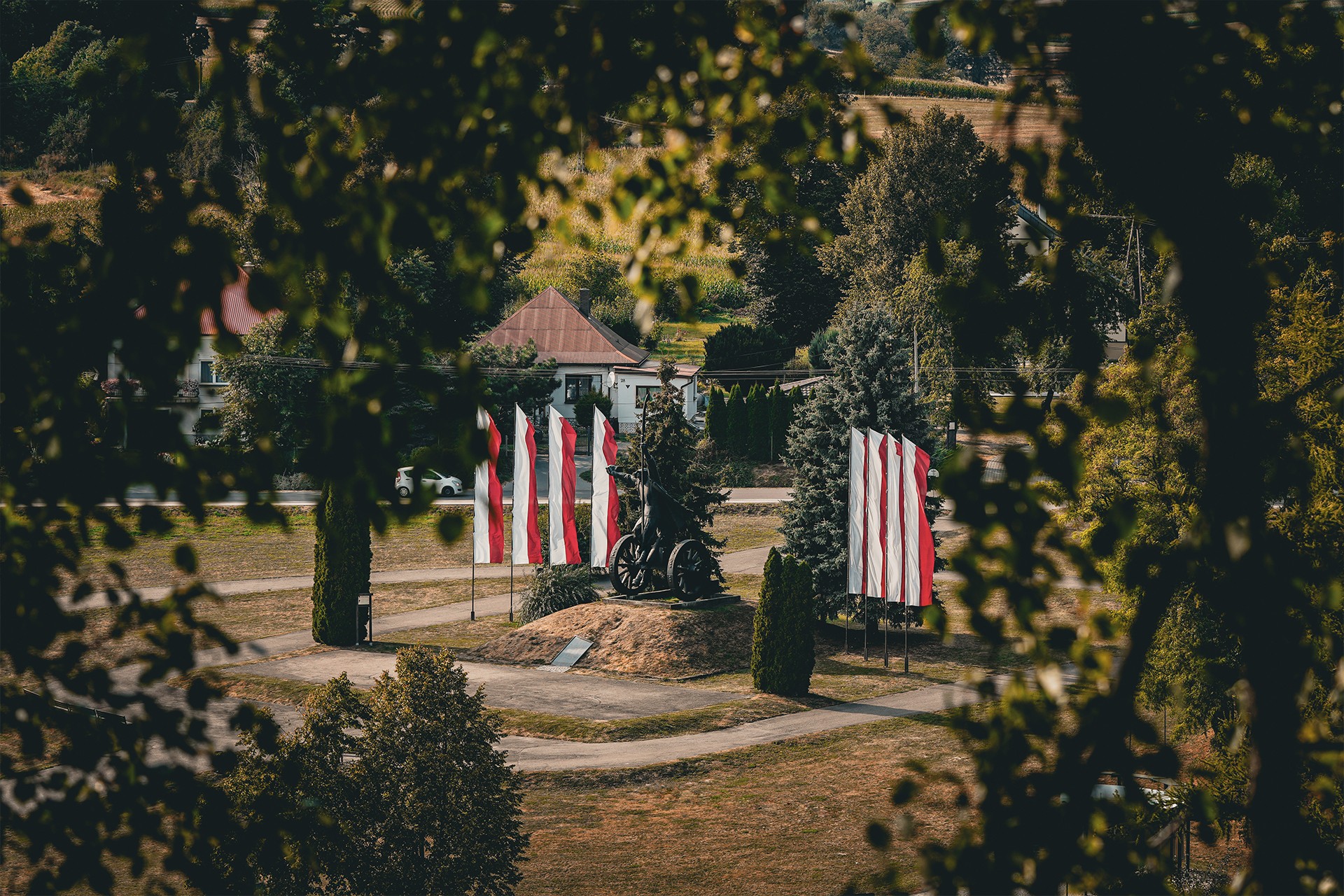
Although the Bartosz Głowacki monument remains the most important point for most visitors, it is also worth paying attention to lesser-known places located literally a stone’s throw from the monument. These include the graves of the fallen, the manor house in Janowiczki, and, located across the street, the house of a decent man, Walery Sławek—described as one of the last politicians of the Second Polish Republic guided by moral principles.
Of course, it would also be worthwhile to visit the main grave of the scythemen (kosynierzy) and the cross known from the “Racławice Panorama,” but like many other places on this route, it is best to leave them for a separate, calmer trip.
Wały
After a brief stop near Racławice, we head toward the first of numerous strict nature reserves on the route. The name of the “Wały” (Ramparts) reserve does not appear by accident, as these types of landforms are characteristic of the region. It is their southern exposure and geological structure, which favors rapid warming of the ground, that makes them an exceptionally suitable habitat for steppe vegetation, including many protected species, as well as warmth-loving animals.
It is worth noting that the landforms characteristic of the region, the so-called “wały,” though formed in a slightly different way, were already passed earlier in the vicinity of the village of Zakrzów. For a better view of them, however, it is worth following the main road leading through Błogocice, where they can be observed from a broader perspective.
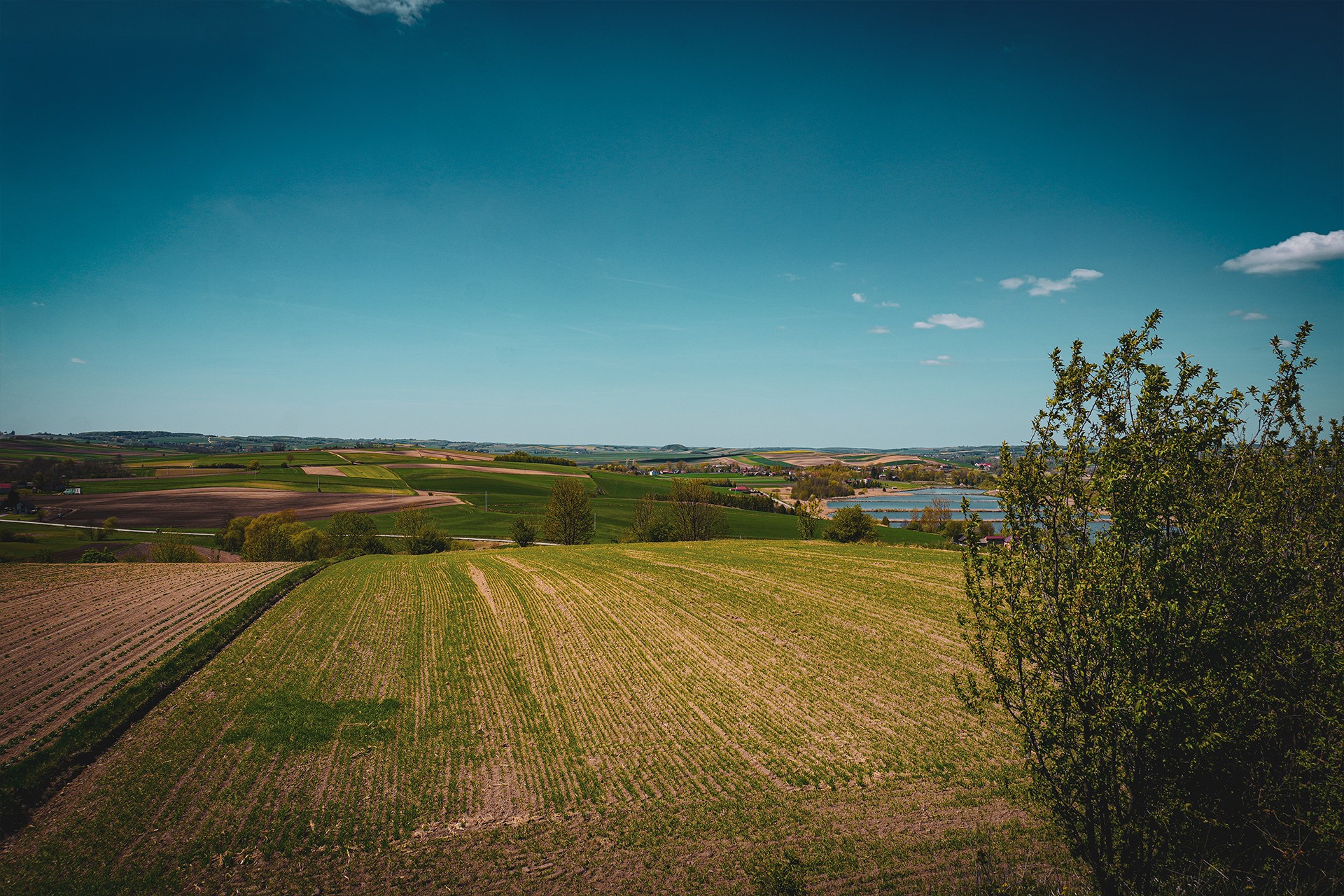
After climbing the hill towering over the valley, it is also worth visiting one of the few observation towers north of Kraków, located in Dosłońce. If the air clarity does not allow for admiring the mountains, there is no reason for disappointment—picturesque landscapes will accompany us until the end of the journey. To ensure there are even more of them, the next section of the route leads through rolling hills.
After Miroszów, we drop down into the valley for a moment, only to climb back uphill after a short stretch toward one of the more characteristic places on the route. We are talking about the burial mound in Szczotkowice—one of the most impressive structures of this type in the region, and perhaps in all of Poland. At this point, it is worth emphasizing that the area being traversed could successfully be called the “region of burial mounds.”
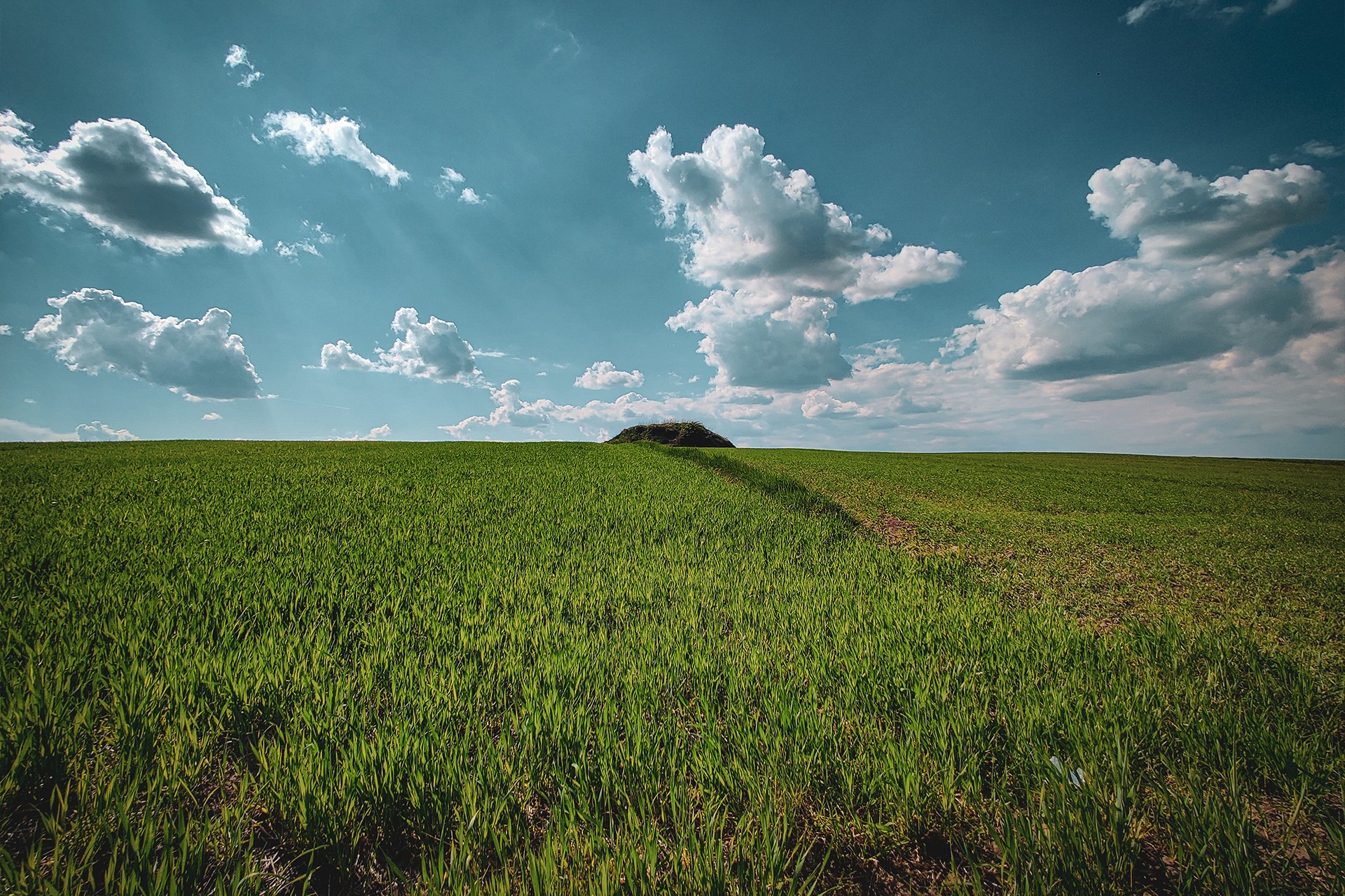
In reality, during the route so far, we have passed at least ten of them. And we are talking only about officially identified sites, because prehistoric graves still awaiting inventory are much more numerous. To this, we must add those that remain unrecognized to this day or have been completely leveled. There are very many sites of this type, and perhaps they will be described more broadly for the first time on the 100KRK website.
We, however, are focusing on the aforementioned site of the Trzciniec culture. Although information can be found on the internet stating that the mound has survived millennia intact—despite plowing, erosion, and human interference—more detailed sources indicate that it has already been excavated, and its current form is largely the result of reconstruction work. One thing remains certain: the mound in Szczotkowice serves not only as a shelter for foxes and badgers, which have dug over a dozen burrows into the slopes of the mound, but also as an excellent viewpoint with a panorama encompassing nearby Działoszyce, the characteristic Cybowa Góra, and the hills in Bronocice, which are our next destination.
Bronocice
Bronocice, located right by the bed of the Nidzica River, is known primarily—and often exclusively—for a vast prehistoric settlement whose excavations yielded results of exceptional importance. It was here that the famous “Bronocice Pot” was discovered, featuring an depiction etched onto its body interpreted as one of the oldest images of a wheeled vehicle. To commemorate this discovery, a monument with a memorial plaque dedicated to “The Ancestors and Archaeologists” was erected at the top of the hill.
Although the discovery itself is undoubtedly groundbreaking—the vessel is dated to the period 3635–3370 BCE and is kept in the Archaeological Museum in Kraków, where only a copy is displayed for visitors—finds of this type often become the subject of disputes over priority and interpretation.

This artifact quite clearly shows that preconceptions about the inhabitants of Central Europe as “backward” communities compared to Mesopotamia are, as is often the case, inaccurate. Unfortunately, this kind of knowledge still breaks through to public awareness relatively slowly.
Aside from their archaeological “treasures” still waiting to be uncovered, the Bronocice hills are also an extremely picturesque place. We reach the destination itself—the monument—via winding roads cutting into loess gorges. However, part of their original charm was lost a few years ago when most of the local roads were paved with asphalt. The last fully natural track remains the road from the south, but due to the nature of the route, we are skipping it this time.
Działoszyce
We say goodbye to the archaeology that is omnipresent in this area and head to Działoszyce—a town with a rich history. Today, the most important monument is the church founded around 1220 by Iwo Odrowąż, similar to many other churches from this period around Kraków, including those we passed on today’s route.
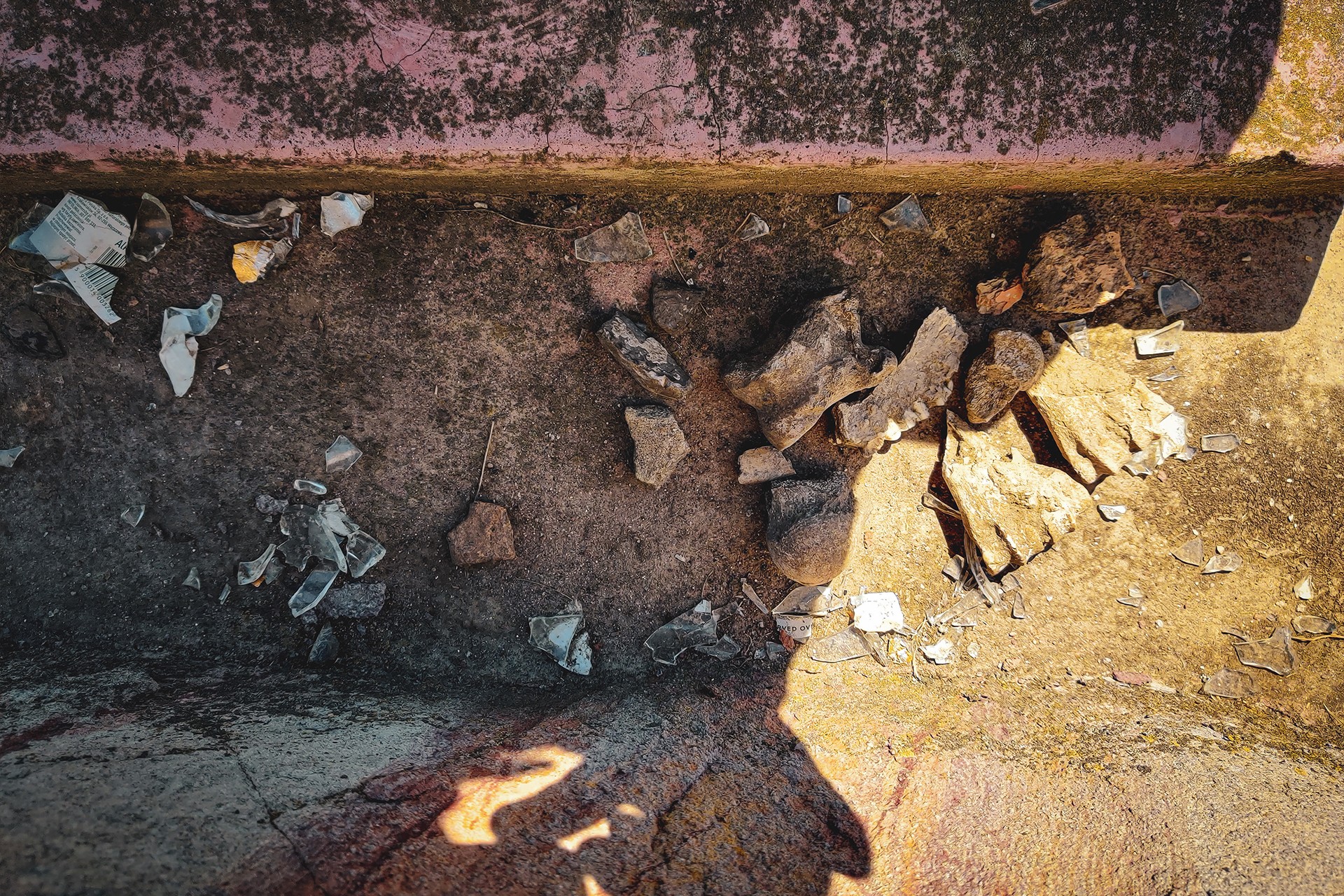
The ruins of the old synagogue should also be mentioned. Along with crumbling structures of this type, a fuller picture of the region’s history is gradually fading away. It is worth emphasizing that so-called “private towns,” such as Działoszyce, were once inhabited predominantly by a Jewish population. In 1820, the town had 1,692 residents, of whom only 436 were of the Christian faith. This situation changed dramatically during World War II, as evidenced by a mass grave and an obelisk funded on the 50th anniversary of its outbreak.
When visiting Działoszyce, it is also worth mentioning the demonstration of February 18, 1918, which served as a prelude to the formation of the First Pińczów Republic—one of the most recognizable peasant republics, yet still relatively little known outside the region. This, however, is a topic for a separate description that could connect the Kościuszko Uprising with the Pińczów Republics. The second of these themes will make itself known again further down the route anyway.
The Stronghold in Stradów
After a dozen or so minutes of peaceful riding among fields, we re-enter a network of winding, narrow lanes leading to one of the most interesting and largest sites on our route. The early medieval Vistulan stronghold in Stradów is not only one of the most impressive monuments in the region but also the largest stronghold in Poland. However, looking solely at the ramparts of the stronghold proper, it is difficult to immediately realize the true scale of the entire layout.
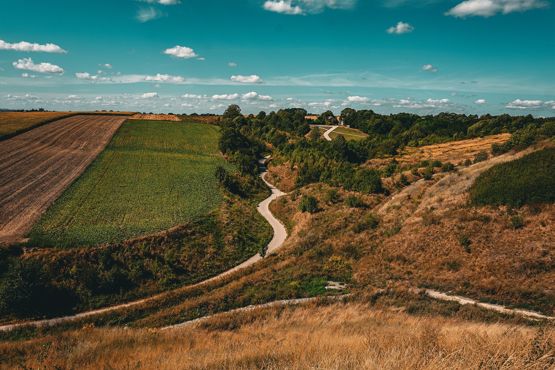
Similar to the roads leading through the hills in Bronocice, clear changes have occurred here in recent years as well. The white road winding at the foot of the stronghold, formerly covered with characteristic chalky deposits, has been entirely paved with asphalt. And while the old track could cause problems for both residents and tourists—if only due to the rising clouds of bright dust—the area, and particularly the so-called “Kraków Florence,” has lost some of its original character.
Questionable quality infrastructure linked to today’s costly and fashionable revitalizations is, unfortunately, becoming an increasingly common phenomenon. Aside from climbing the ramparts of the stronghold, it is also worth stopping at a nearby clearing to which the aforementioned asphalt road leads. Even just driving through the loess gorge makes a big impression, and from the clearing itself, there is a very good view of the massive slopes of the main fort. This landscape, however, like many other sites identified with ancient pre-Christian culture, has been marked by a cross driven into the ramparts.
In the case of the Vistulan strongholds, this is particularly intriguing because, according to the account contained in the legend “The Life of St. Methodius,” Christianity reached the upper course of the Vistula much earlier than the Warta. According to this account, the first baptism in the territories of modern-day Poland was allegedly accepted by Wiślimir as early as around 880.
Regardless of whether the story of the baptism of the Vistulans is a historical fact or merely a legend, the need to stigmatize earlier forms of culture and symbolically “mark” space as a victory over the old religion seems increasingly anachronistic today. Such practices should rather fade into oblivion.
Wiślica
We leave the stronghold behind and head toward an equally important and equally old settlement, which is Wiślica. On the way to the probable capital of the Vistulan State, we pass several more interesting features. Zawinnica Hill, built like most of the surrounding hills from Cretaceous marls, was chosen for human settlement as early as by representatives of the Linear Pottery culture, i.e., the first newcomers from the south. In the vicinity, later settlements have also been recorded from the Funnelbeaker, Corded Ware, Bell Beaker, Mierzanowice, Trzciniec, and Przeworsk cultures, as well as a somewhat earlier presence of the Celts. It is due to the settlement of the latter and a series of discoveries related to them that such an extensive description of the location and the raising of issues little related to motorcycling appears.
On the slope of the hill, we will also find another stronghold, which probably represents the remains of Władysław I the Elbow-high’s castle.
We, however, head from the hills further into the Nida valley and to Wiślica, situated on the banks of the river—a center that was for many years the smallest town in Poland. At this point, however, it is worth reassuring travelers: the competitor that took over this honorable title can be found less than a 14-minute drive from Wiślica. Besides, a significant loss of influence and, partly, population by urban centers is common in this region. And based solely on this type of degradation, an entirely separate route could be mapped out.
Today, Wiślica can be described as a village with its own basilica. And not just any basilica; the Collegiate Basilica of the Nativity of the Blessed Virgin Mary in Wiślica is one of the oldest and best-preserved Gothic monuments of its type in Poland. Right next to it is also the historic, Gothic Długosz House—the very Jan who, as we informed you, will be appearing on the route quite frequently.
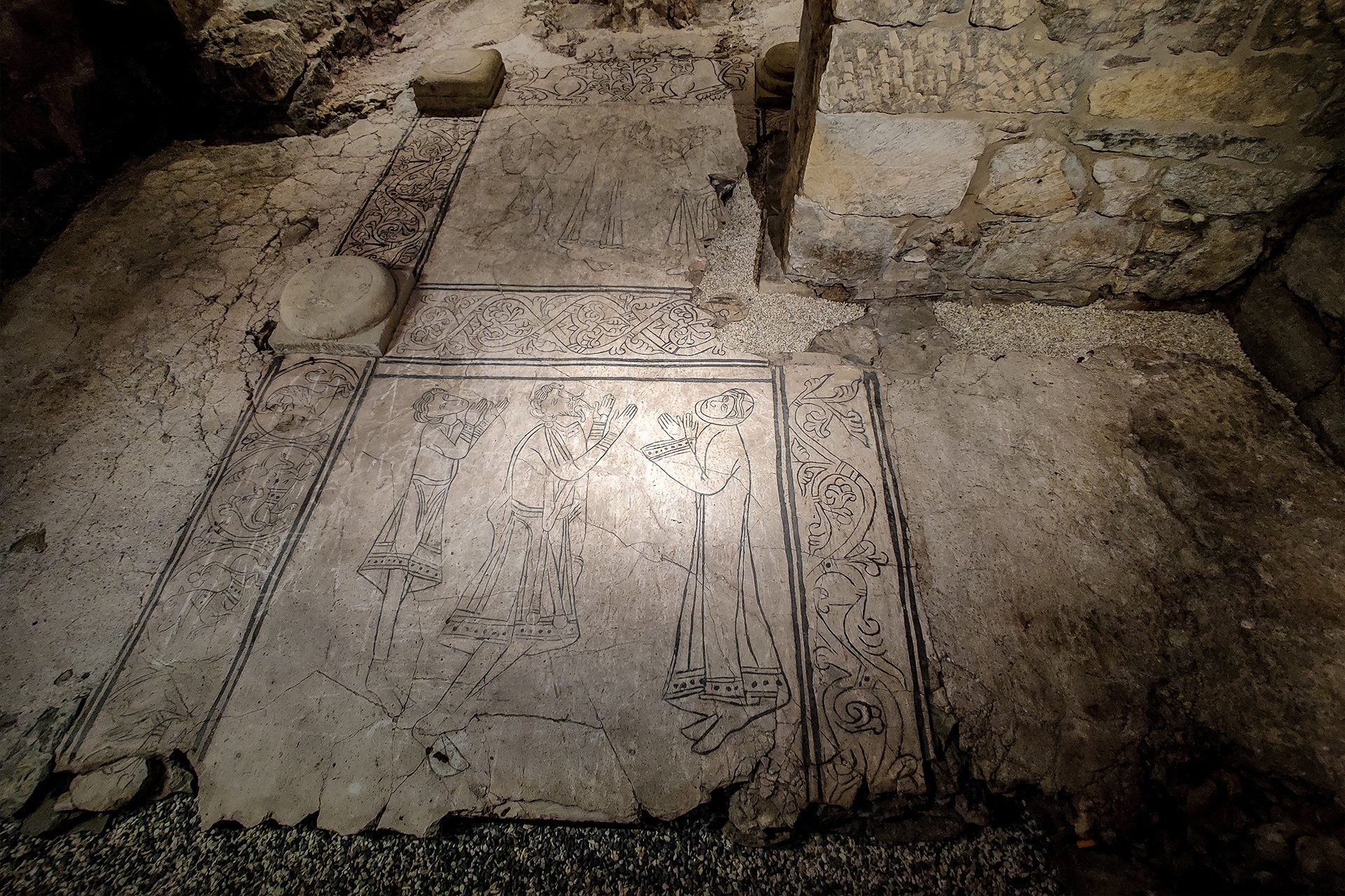
Material manifestations of the late Middle Ages, as is usually the case, stand on the foundations of their predecessors. And in the case of Wiślica, and particularly the aforementioned basilica, this is especially visible. Namely, the collegiate church was erected on the site of two older Romanesque churches, and importantly, we can recently view their relics thanks to the Archaeological Museum in Wiślica, the entrance to which is located on the opposite side of the building. One could consider the tour route to be a small substitute for the underground route in the Louvre, and it is definitely worth a visit.
Regardless of whether you manage to circle the foundations of the collegiate church, or if visiting the museum is postponed to another time, we step back even further from the high Middle Ages and head to the stronghold island. Aside from the fairly obvious purpose of the early medieval layout, it is worth pointing out that the stronghold represents the first encounter with the elements most characteristic of this stage of the trip. We are talking about the gypsum from which the hills in the Nida valley are built. Right at the entrance to the stronghold, we find an impressive gypsum dome with clearly visible saber-like crystals, constituting a protected natural monument in its own right.
The Nida Valley
Saber-like gypsums will accompany us from now on all the way to the main point of the route. We will find subsequent outcrops of these characteristic geological formations in nearby Chotel Czerwony and in the Przęślin nature reserve, among other places. These might not be locations that immediately catch your eye with monumentality, but they are definitely worth visiting to see how incredibly diverse the nature of this region can be. After this route, even patching ordinary potholes with gypsum won’t feel the same.
The next section leads through a landscape that is one of the most characteristic of this part of the Świętokrzyskie Voivodeship—full of hills, karst valleys, and caves. The Skorocice Cave, which we visit along the way, is the best example of this. It is the longest gypsum cave in Poland and simultaneously one of the region’s most valuable natural assets. What is more, there are a total of 26 of them within the territory of the same reserve.
Escaping from landscape parks and nature reserves on this route is practically impossible anyway. Just a minute’s drive from the Skorocice reserve lies the Winiary Zagojskie reserve, and a few more minutes further on is the documentation area in Siesławice. Reaching Busko-Zdrój, which highlights its connections to local natural values and mineral waters by its very name, we turn west to visit the next natural monument.
Pine on Stilts
The “Pine on Stilts” in Wełecz stands out for its characteristic, exposed root system. This gives the impression that it is not roots growing from the trunk of this unusual tree, but limbs on which it is about to walk off in its own direction.
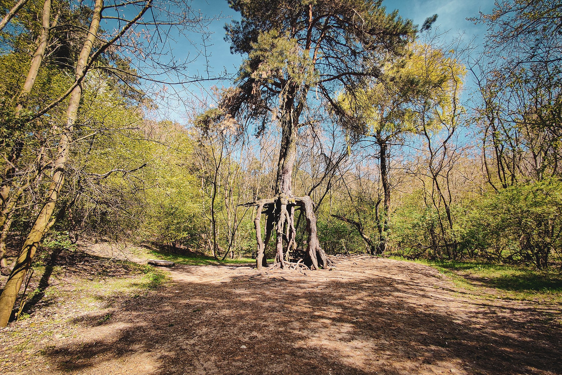
Of course, unusual forms of this type are largely the result of human activity—and it is no different in this case. The unnatural exposure of the tree’s roots is connected to past sand extraction by the local population.
Chroberz
To reach the destination point of the route, the natural choice would be to cover a short stretch along road 767. However, the journey so far has accustomed us to both picturesque landscapes and negligible traffic. Wanting to maintain this character of the route, we turn south and head toward Chroberz. After skirting the Skotniki Górne reserve—this time from the west—we cross the Nida again and climb a hill sharply undercut by the river’s waters.
Chroberz, which we reach by following the course of the Nida upstream, is traditionally linked with Bolesław I the Brave. According to local lore, the ruler was said to have erected a castle here during his return from the Kiev expedition. And indeed—one can find both an old stronghold and the relics of a castle in the village, beneath which, interestingly, numerous underground tunnels are said to stretch.
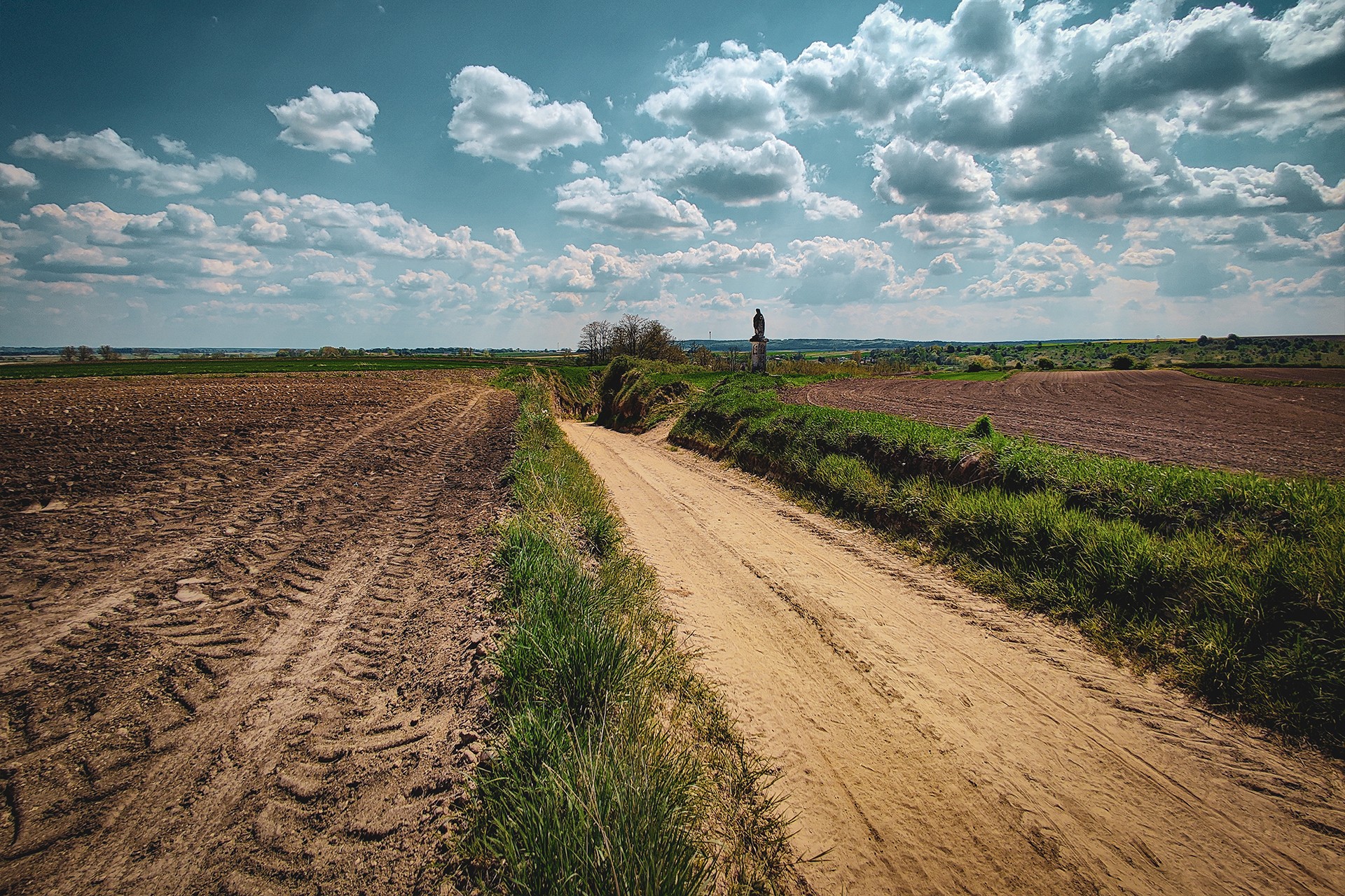
Moreover, this is not just one of many local legends characteristic of such places. The existence of underground passageways finds partial confirmation in sources and accounts from residents, though the scale and state of preservation of these structures remain a mystery. Investigating them more thoroughly could turn out to be an enterprise just as fascinating as it is risky.
Aside from medieval structures, Chroberz also offers much younger monuments. Here we find, among other things, the Wielopolski Palace surrounded by an extensive landscape park, as well as a historic late-Gothic church, which is one of the more important elements of the local architectural heritage.
Among Hills, Gorges, and the Baroque
We leave Chroberz behind and head further toward Mozgawa. At the crossroads we reached from the southeast—leading southwest to the already visited Działoszyce and north toward Pińczów, which is our final destination—it is worth stopping for a moment.
This is because many interesting places are located within a relatively small area. Here we find, above all, the impressive Monument to the Pińczów Republic, commemorating the uprising of the local population and serving as a reminder of earlier attempts to liberate themselves from occupation; the characteristic Byczowska Góra, whose steep slopes are among the most recognizable elements of the local landscape; and a collection of roadside Baroque statues occurring in large numbers in this area, which you have probably already noticed along the route. There is also no shortage of impressive loess gorges in Bugaj and Mozgawa.
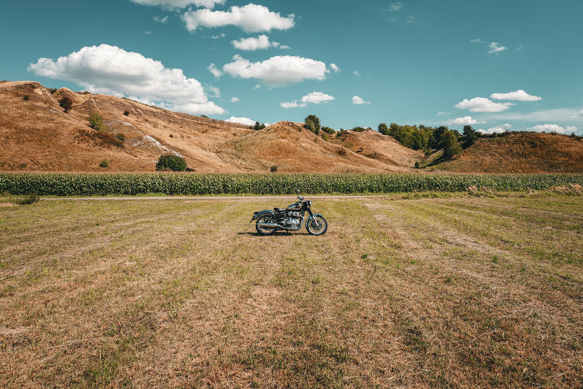
We suggest, after familiarizing yourself with selected elements of this area, driving through the latter. Unfortunately, as in the case of the previously discussed Bronocice or Stradów, this extremely characteristic track did not escape the attention of local authorities, who are paving and concreting successive sections of old roads with great consistency.
Despite the controversy surrounding the lining of the bottom of the gorge with concrete slabs, the loess slopes, their height, and their incline still make a big impression.
Pińczów
Due to time constraints, we do not stop and head toward Pińczów. The ridge of the Pińczów Hump, stretching over a length of about 60 km all the way to the vicinity of Pacanów—“where they shoe the goats”—provides an excellent vantage point over the Nida valley and the wider surroundings.
The past rulers of these lands were also aware of this, erecting an impressive castle and the Mannerist Chapel of St. Anne on its slopes. Unfortunately, practically nothing remains of what was once one of the most magnificent magnate residences in Lesser Poland. The fortress was not destroyed as a result of invasions, however, but was dismantled by decision of Elżbieta Wielkopolska. Aside from a garden pavilion and fragments of walls, virtually no relics of the castle have been preserved.
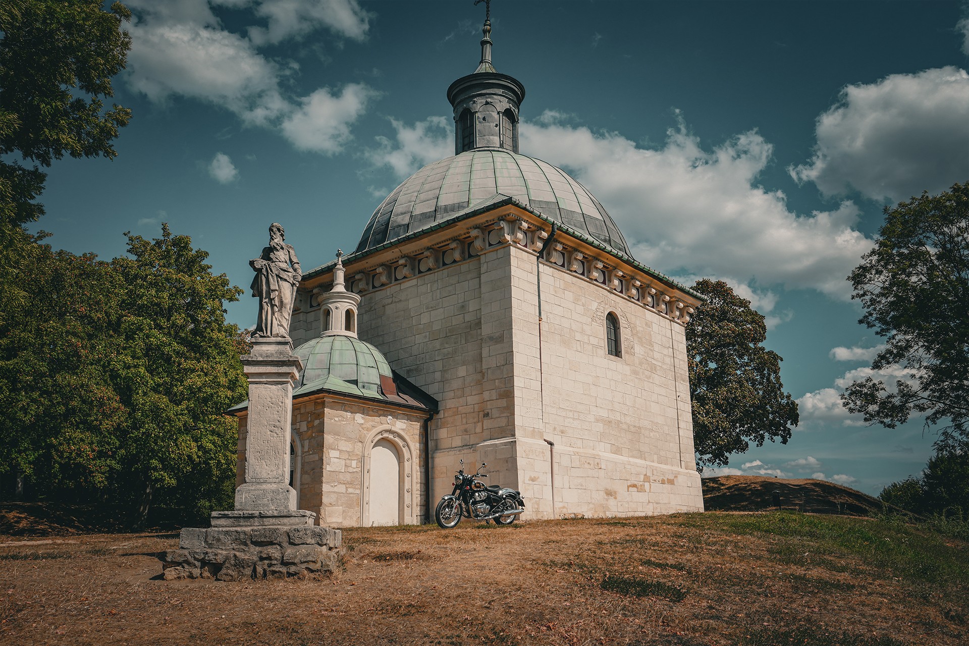
Fortunately, the aforementioned Chapel of St. Anne survived the destruction and today belongs to the most characteristic points of the entire route. Until recently, driving up the hill was restricted by a prohibition sign, but during recent visits, it was no longer there, allowing you to reach directly to the chapel itself without violating regulations.
In Pińczów itself, there are also many interesting monuments and places worth attention. These include the former Pauline and Franciscan monasteries, the Wielopolski palace, the Old Synagogue, the so-called “Arian House,” and several smaller structures. The town’s architecture—resulting from its private character (similar to Działoszyce) and the strong influence of Italian culture and art, as well as the availability of local building material—gives a more Mediterranean impression than a typically Polish one. It should be emphasized, however, that later, post-war spatial transformations largely blurred this image.
Heading from Pińczów toward the culmination of the Pińczów Hump, at the top of which lies another stronghold and a reserve of the same name—Skowronno—we pass the inconspicuous village of Kopernia. Although today it is a settlement of about 300 residents, it etched its name into the pages of history in a special way—at least in the context of the 100KRK website.
It was right here, on June 5, 1257, that Bolesław V the Chaste issued the location charter for Kraków. Of course, Kraków had already existed as an important administrative and economic center for hundreds of years, but this fact remains an invariably significant point in its history.
The Pińczów Whale
The surrounding monuments and excellent viewpoints from the promontory where the Chapel of St. Anne is situated, as well as from the Skowronno Stronghold and viewpoints located on the Pińczów Hump between the aforementioned locations, are not all that this area has to offer.
Pińczów limestones, which to a large extent build the Pińczów Hump and other surrounding elevations, have constituted a sought-after building material for hundreds of years. It was in Pińczów that Italian masters worked, including Santi Gucci, contributing to the beautification of Polish lands. During the Renaissance, Pińczów was the most important stonemasonry center in Poland. Traces of this history include the names of villages in the area that reference this tradition, such as “Włochy” (Italy).
The soft light-colored limestone works perfectly not only as an easy-to-process material but also as a medium and “archive” of ancient life forms. It was in it that three specimens of baleen whales from the Cetotheriidae family were discovered. Although the complete skeleton of Pinocetus polonicus is located in the Geological Museum in Kielce, it is worth mentioning less famous finds here as well. However, so as not to wander too far from the idyllic landscapes and the theme of the 100KRK website, in this case, we refer you directly to external sources: https://echodnia.eu/swietokrzyskie/co-stalo-sie-z-wielorybem-z-pinczowa-firma-won-chamie-splaj/ar/c7-16423577
Imielno and Pasek
After getting to know the attractions of Pińczów, we head further north to Imielno. This point was chosen not only because of the church with Romanesque origins located in the village and the preserved details from that period, but also because of the views stretching from here over the Nida delta and the picturesque landscapes that accompany us on the way back south.
Traversing the region of the Pińczów Hump and the Wodzisław Hump, it is impossible not to mention its rather characteristic residents. We are talking here about, among others, the troublemaker and diarist of the Baroque era known throughout Poland, Jan Chryzostom Pasek.
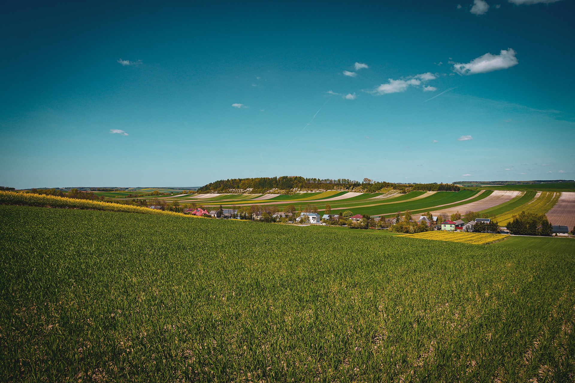
Although this nobleman came from Mazovia, it was in these parts—in the Church of St. James the Greater in Mieronice—that he married Anna Remiszewska-Łącka in 1667 and spent a significant part of his life. It was here that he leased Miławczyce and Bieglów, took over the village of Smogorzów (courtesy of his wife), and purchased Skrzypiów and Zakrzów.
We, trying to protect ourselves from the outlaw, head further south. Along the way, features worth noting include the Deskur Palace in Sancygniów and the stronghold located on the opposite side along with its accompanying settlement. Due to the state of preservation of the structures and the lack of possibility to tour them, this time we take a nearby but less frequented road.
Reserved for the Few
After a dozen or so minutes, we reach the foot of Cybowa Góra—one of the most characteristic hills in the area, resembling a miniature Pińczów Hump. We already had the opportunity to view this mountain and its accompanying depression, reminiscent of the Nida valley undercutting the aforementioned hump, from the Szczotkowice burial mound visited earlier.
Looking at it up close, it is impossible not to notice the Cretaceous marls from which Cybowa Góra is built. Just like in the case of the Pińczów limestones, they constitute an excellent record of the region’s geological history and are virtually “stuffed” with various types of fossils: ammonites, corals, sea urchins, belemnites, and sponges. Their number and degree of preservation clearly attracted paleontology amateurs who—judging by the tracks left behind—visit this place quite often, unfortunately in a manner that leads to the degradation of the protected area by digging up the hillsides with pickaxes. The traces of these interventions are distinct enough to be visible even in LiDAR data.
After passing Cybowa Góra, we head toward the Miechów Hills, passing successively the Grzemałów reserve, the Natura 2000 Kalina–Lisiniec area, the village of Kalina Mała, and driving through one of the favorite sections for cyclists—the region of Sławice Duchowne.
Return to the Loess
Descending from the Wodzisław Hump and the Miechów Hills, we head to one of the last points on the route—the Romanesque Church of St. John the Baptist in Prandocin. On the way back to Kraków, it is also worth paying attention to the ruins of the synagogue in Słomniki, the Wodzicki Palace in Niedźwiedź, and the manor house passed in Goszcza.
Of course, there are far more places and points that etched their names into the history of Poland or the region on this route—it would be impossible to visit them all even cursorily in a single day. So we head back toward the starting point, pass Raciborowice once again, this time entering it from the north, and end our journey by crossing the border of Kraków.
Summary
Regardless of whether you already have the route discussed here behind you or are seeing it for the first time, the number and diversity of attractions distributed along its course certainly stand out. Of course, these are only selected places intended to create a sort of collage of the region. There are narrow country lanes leading through fields and forests, archaeological sites, burial mounds, earthworks, prehistoric and somewhat later strongholds, Romanesque and Gothic churches, geological sites, nature reserves, marls and gypsums, as well as palaces, manor houses, hills, and gorges.
It is a literal mishmash, because of which—although it can be driven through in one day—it definitely deserves much greater attention. For this reason, separate routes dedicated to individual topics, such as the Kościuszko trail, the Pińczów Republic, or the Jewish diaspora, will certainly appear. All the more so because the presented route largely skips both the Proszowice Plateau and the Solec and Połaniec Basins. Even a variant dedicated to the most interesting outcrops of Cretaceous marls, taking into account the types of fossils embedded in them, could be an interesting—though obviously niche—topic for a separate trip.
Leaving this more specialized subject matter aside, however, it is worth emphasizing that every path and road in this region offers distinct landscapes that are definitely worth seeing. Therefore, we encourage you once again to visit these areas, and for now, we say goodbye to you.