
Along Dłubnia and Prądnik rivers
Autumn weather does not usually encourage longer rides. And although this September was exceptionally kind in terms of weather, falling temperatures, cold gusts of wind and damp conditions are hardly surprising at this time of year.
That is precisely why it is worth keeping some shorter routes close at hand. They allow us to avoid getting chilled and make it easier to escape an approaching shower. And since water has not always been in plentiful supply in recent years, it seemed the right time to plot a route on the map with a direct connection to this very element.
Following two rivers that reach their end in Kraków — the Dłubnia and the Prądnik — this route is, to a large extent, a journey through a world that is gradually disappearing. A journey through history that is quite literally slipping through our fingers.
Much like springs that dry up and return with the changing seasons, the history of Kraków and its surroundings is constantly changing. Some traces of the past can still be preserved, while others disappear forever. For many of the sites along the route, this may be the last chance to experience the atmosphere of the “old” world.
The quotation marks are no accident. The term “old world” may not quite match the historical reality. The overwhelming majority of the remnants described here date from the nineteenth and twentieth centuries, which are not all that distant in historical terms. Yet, given the transformations that took place around the turn of the millennium, these places are now relics of an entirely different reality. A world in which electricity, medical care, universal education, motorised transport and even access to running water were either completely out of reach for most people or only just beginning to find their way into everyday life.
But let us start at the beginning.
For convenience, our journey begins in the vicinity of Plac Centralny in Nowa Huta. This place deserves at least several separate discussions covering political and cultural change, architecture, the struggle for freedom, urban planning, art and nature. Today, however, we will treat it simply as our starting point.
It is worth pointing out from the outset that the choice of stops along the route, as well as the decision to skip some of them, is entirely subjective. You can treat this as an enjoyable motorcycle ride, or focus on social change, industrial heritage, wooden and medieval architecture, natural features, defensive structures, geology, palaeontology or archaeology.
Although the route is just under 100 kilometres long, it is packed with fascinating details from a wide range of fields. If we opt for a pleasant ride, we can cover it in less than three hours. If, however, we decide to stop at every site that catches our interest, even three weeks might not be enough.
We therefore need to decide what we want to see and what we can realistically fit into the time available. It is also worth remembering that some sites can only be visited on certain days of the year, while the opportunity to appreciate others depends largely on the season.
Either way, let us return to the beginning.
The Parish Cemetery in Mogiła
From Plac Centralny im. Ronalda Reagana, we head west along Jana Pawła II Avenue towards Mogiła. Although the first stop on our route is not exactly a cheerful one, it is closely connected to several themes that we will return to later in our journey.
The parish cemetery in Mogiła is a place where the “world of the past” has left a distinct mark. One of the necropolis’s most characteristic features is the Rogoziński family tomb. Rescued from structural collapse, it is the final resting place of, among others, Kazimierz Rogoziński, a teacher who arrived in Mogiła with his family in 1838. He was also the first owner of the plot on which the distinctive villa that still stands in this part of Kraków was later built. The villa replaced an earlier wooden house erected by the family for their own use and to accommodate a school.
Another site worth mentioning is War Cemetery No. 390 - Mogiła, where 71 soldiers of the Austro-Hungarian Army who fell or died during the First World War are buried. Cemeteries of this kind are not uncommon in Kraków and its surroundings. The one in Mogiła, however, remains relatively little known, probably because it forms part of a larger complex that has itself largely faded from public awareness. This is despite its location within the city limits. Until quite recently, its condition was also deplorable.
This site is connected to another thread in our story. Along the route, we will have the opportunity to visit at least four sites associated with the Kraków Fortress, as well as other defensive structures located beyond the city limits.
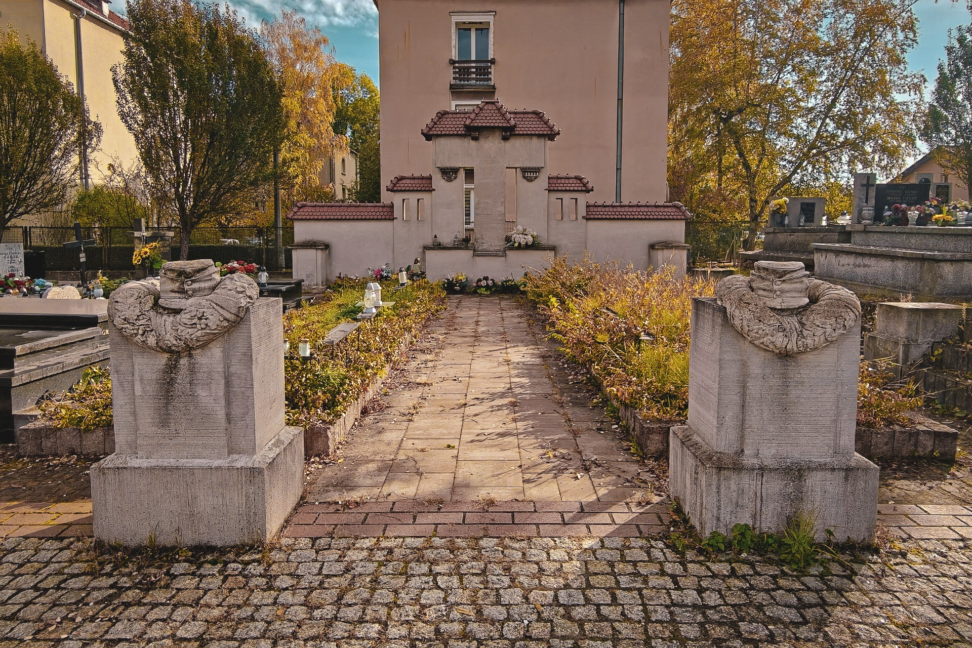
On a more human level, the parish cemetery in Mogiła, administered by the Parish of St Bartholomew, holds far more than traces of the past. It is the younger of the parish’s two cemeteries, but another, seemingly less conspicuous and more scattered aspect of its history deserves particular attention. Right beside the war cemetery and the oldest gravestones, we find numerous children’s graves dating from the early twentieth century.
Their presence alone is deeply saddening, but they also draw attention to a problem we tend to associate with much more distant historical periods: the appallingly high rate of child mortality. As the gravestones attest, the local community continued to struggle with this reality long after the turn of the nineteenth and twentieth centuries, right through to the post-war period.
One grave in particular stands out: that of three children, Władzia, Wacuś and Alinka Kusibab. Beyond serving as a poignant reminder of the realities of medical care at the time, so different from those of today, their story connects with other themes explored on our journey. Above all, it points towards the lives of people whose destinies were inseparably linked to the rivers, especially the Dłubnia.
According to information I came across some years ago, the children belonged to a family of millers who leased one of the numerous mills in the area owned by the Cistercians of Mogiła Abbey. And mills will prove to be among the most numerous and, at the same time, most fascinating categories of sites along our route. We will discover why before long.
Whether we have chosen to pause and disturb the peace of the dead for a moment or decided to skip the cemetery altogether, a little further on we turn right into Klasztorna Street. There, history, architecture, art and industrial heritage enthusiasts will find more than enough to explore.
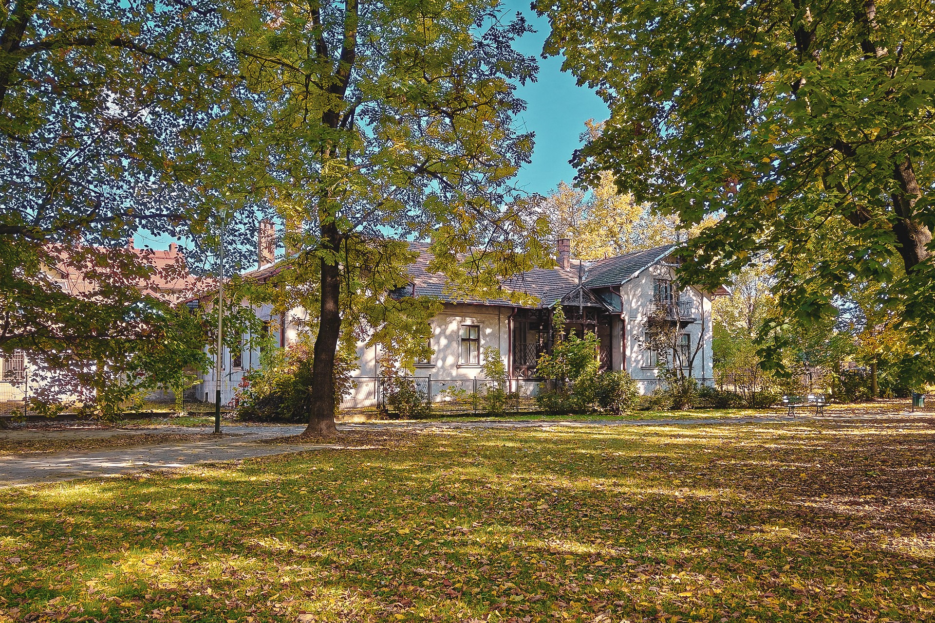
The first buildings we pass once belonged to the Rogoziński family, mentioned earlier, whose history was closely tied to both Mogiła and local education. The most significant of these, however, is the Rogoziński Villa introduced above. It was built in 1880 by descendants of Kazimierz Rogoziński and his wife, Agnieszka Biczówna, replacing an earlier wooden building.
The villa is particularly interesting in the context of Kraków’s architectural heritage because alterations made by subsequent owners introduced elements of the so-called Swiss style. Or, at the very least, its porch can be described as an example of this style. We will encounter other examples of this architectural trend along our route. There are also several houses elsewhere in Kraków that display its features to varying degrees. The style is not particularly widespread in the city, which makes this example worth noting.
Clarify the cemetery’s two locationsSoften uncertain historical statements
The Church of St Bartholomew the Apostle in Kraków
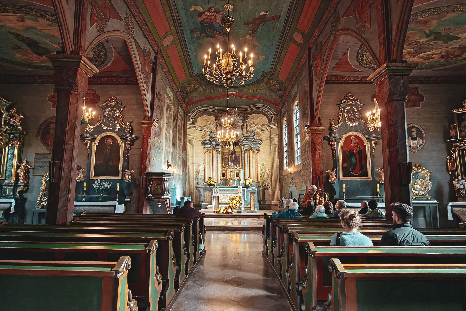
Another unusual site along our route, located around 100 metres further on, is the Church of the Nativity of the Lord and St Bartholomew the Apostle. Not everyone may appreciate ecclesiastical architecture, but the distinction of being the oldest wooden church in Poland with three naves arranged in a hall-style layout is certainly noteworthy. Above all, the fact that the building has survived to the present day deserves recognition.
Although the church did not escape Baroque and Rococo alterations, it has retained many Gothic features. The most valuable of these is the portal carved by Maciej Mączka in 1466. Given the apparent fragility of wood and the turbulent historical events that repeatedly affected this area, the very survival of the building is rather remarkable.
It is worth emphasising that Mogiła, including its Cistercian abbey, whose main buildings stand just across the street, has quite a story to tell when it comes to surviving historical turmoil.
As early as the fifteenth century, the monastery suffered two disasters: it was first partially damaged by an earthquake and later ravaged by fire. The monks and local residents had to contend with another blaze in the mid-sixteenth century. Not long afterwards, in 1587, Maximilian III of Habsburg entered the abbey with his army while advancing on Kraków.
In 1656, the Cistercians received Swedish troops at the monastery, although describing this as a visit or a stay would be stretching the meaning of the word “hosted” rather considerably.
Immediately after the Swedes had finished looting the abbey, local peasants came to claim what they considered “theirs”. The following year, allied Austrian forces occupied the monastery. More fires and further military upheavals followed, including the German occupation. And so, in broad strokes, we arrive at modern times.
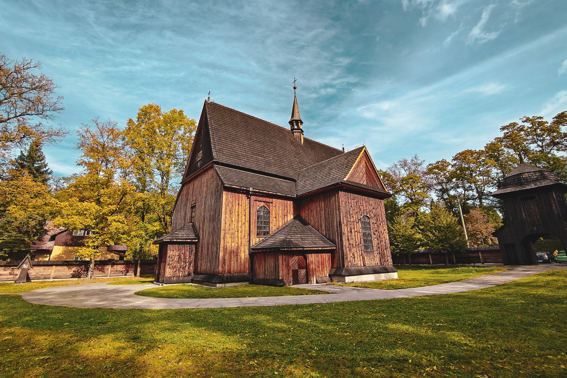
To sum up, the fact that the wooden Church of St Bartholomew has survived in this form for around 560 years is no small achievement.
Getting inside is not always straightforward, but neither does it require any special arrangements. Although visiting hours are rather limited, it is still possible to see the interior relatively often during tours organised on Sundays, outside the dates listed in the publicly available visiting schedule.
Clarify the church’s official nameTighten the monastery history
The Cistercian Abbey in Mogiła
One could write more than a single doctoral thesis about the historic monastery and the Church of the Assumption of the Blessed Virgin Mary and St Wenceslaus. We will limit ourselves to noting that this is one of the largest and oldest monastic complexes in Kraków and Poland as a whole. It was Bishop Iwo Odrowąż who brought the Cistercians to Mogiła in 1225, a figure we will encounter several more times along our route.
The foundation of the abbey coincided with a period of intensive activity by the bishop, who was involved in establishing religious institutions and encouraging the settlement of new communities. It is hardly surprising, then, that the monastic buildings contain numerous Romanesque and Gothic remains. In the case of Gothic architecture, even the word “remains” hardly does justice to what has survived. We begin to appreciate this as soon as we pass through the gate and see the eastern façade of the abbot’s palace.
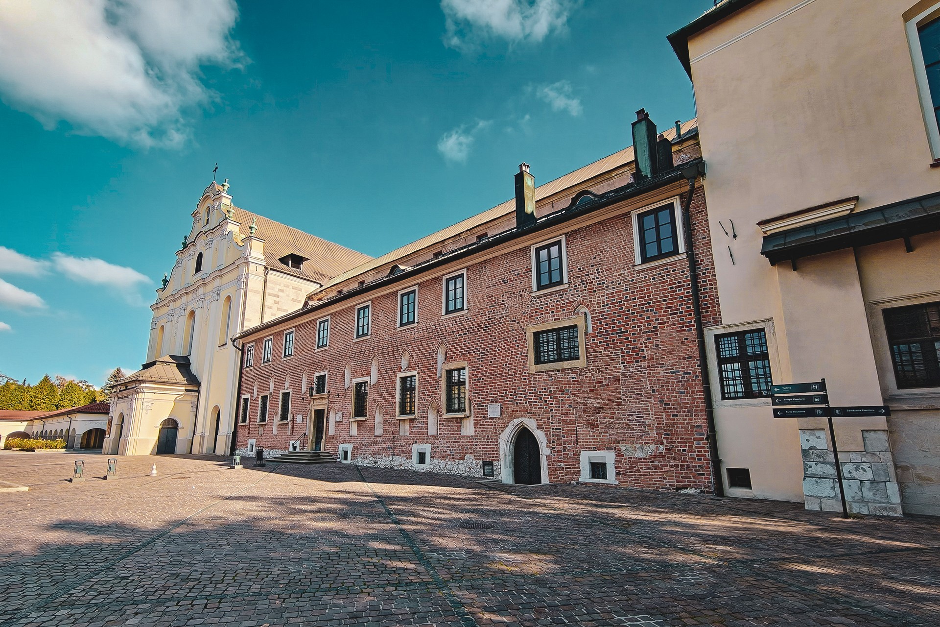
Those with a deeper interest in the history of the abbey and, more broadly, the Cistercian order may wish to visit the recently opened Cistercian Museum in Mogiła. It is worth taking some time to explore this subject, especially as the area surrounding the monastery holds a wealth of historical complexities associated with the divisions and transformations that shaped this part of Kraków. Clergy, and the Cistercians in particular, played a significant role in these developments.
While the museum still has that unmistakable new-building smell, the monastery’s library collections carry a very different scent. Although their holdings have been considerably depleted over the centuries, they remain among the richer and more valuable collections of their kind. This, however, is a subject for another story, one that would require a somewhat different approach and consideration of other constraints. It is worth noting, though, that a substantial part of the monastery’s archival material has been digitised and can also be explored online.
When discussing the abbey and its many fascinating aspects — precisely the kind of subject matter that forms a significant part of this website — it is worth remembering that the presence of the clergy and the arrival of successive religious communities in Poland were not limited to pastoral work. This is particularly evident in the case of monasteries.
Scientific and industrial activity, the organisation of education, and the management of extensive landed estates and the people who lived on them — all particularly visible in Kraków and its surroundings — extended far beyond the religious sphere. These activities also involved the accumulation of considerable material wealth and valuable written collections, creating a need to protect them. Monasteries were not merely centres of religious life; they were also important economic, intellectual and administrative hubs, as well as integral components of the political systems of their time.
Today, a systemic understanding of Islam as a framework integrating faith, social norms, law and politics generally encounters little resistance. Applying a similar approach to Catholicism or other branches of Christianity, however, remains controversial, despite its consistency with historical realities.
Even when discussing a well-known, albeit temporary, resident of Kraków such as Nicolaus Copernicus, accounts often emphasise the astronomer’s supposed fear of the clergy’s reaction. What is frequently overlooked, whether through ignorance or deliberately, is that Copernicus himself belonged to its ranks and was one of its most prominent representatives. The ecclesiastical system of the time was also closely intertwined with secular authority.
One might get the impression that a similar pattern emerges when we encounter extensive defensive structures surrounding monasteries: walls, moats, towers and earthworks, often exceeding in scale the fortifications protecting secular centres of power.
Although reaching the Cistercian Abbey in Mogiła today presents little difficulty, it is worth remembering that the complex was once surrounded by walls and towers, protected by earthworks and natural barriers formed by the waters of the Vistula and the Dłubnia, as well as nearby ponds. Importantly, parts of this former defensive system can still be identified today. This is largely thanks to LiDAR data visualisation, but not exclusively: remnants of the old fortifications can still be examined on site. One of the best examples is a seventeenth-century tower concealed behind the monastery buildings.
Returning to the industrial and commercial activities of the clergy, it is worth mentioning that the abbey grounds once housed not only a paper mill, a copper works and a flour mill, but also a brewery. And that is without even taking its livestock farms and gardens into account.
The lands owned by the monastery or forming part of its endowment extended far beyond the abbey itself and encompassed a variety of economic enterprises. We do not, however, need to venture even ten metres from the main buildings to discover another trace of this activity.
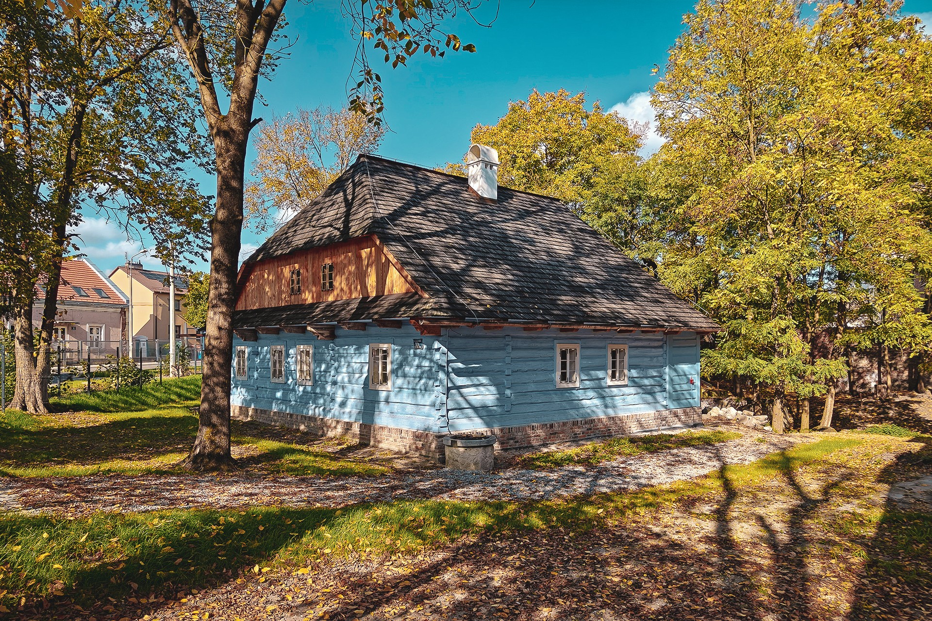
Right next to the gate stands the Miller’s House, a building with a long history that has just undergone a thorough renovation and has only recently been restored to use. Beside it, remnants of the former mill have survived, serving as a reminder of the site’s industrial past.
Make the historical argument more conciseStrengthen the route-focused transitions
A Forgotten History
Before turning into Żaglowa Street, it is worth mentioning two more aspects of the area surrounding the monastery. On the escarpment overlooking the wetlands of Nowa Huta, on the grounds of what is now the Stefan Żeromski Specialist Hospital, human life flourished long before even the earliest beginnings of Polish statehood, let alone the arrival of Christianity.
Although the area around Mogiła has been inhabited since at least the Neolithic period, it is particularly associated with traces of Celtic activity, especially their coin-minting operations in the region. The mint discovered here is considered the oldest site of its kind found in what is now Poland.
Rather than constantly interrupting our narrative to discuss artefacts already unearthed or traces of the past still concealed beneath the ground, let us simply note that the former villages of Mogiła and Krzesławice are rich in archaeological sites. These include remains dating from the Roman period and much earlier eras, as well as evidence of the Slavic communities that later developed in the area.
As is often the case in Kraków and its surroundings, traces of the past can be found almost everywhere. Sometimes all it takes is a closer look around to discover that history is literally beneath our feet.
We actually encountered the second subject almost at the very beginning of our route. As we headed towards Mogiła, on our right, in the area now occupied by the Centrum housing estate, there was a forced labour camp known as Baulager 15/XIV, which operated during the Second World War. Over time, the site fell into obscurity and has almost entirely disappeared from the collective memory of local residents.
The Second World War will undoubtedly feature on this website many more times. Nevertheless, this particular site deserves a mention now, especially as the popular-culture image of wartime events, shaped to a considerable extent by productions such as Steven Spielberg’s Schindler’s List, is itself becoming part of history. Meanwhile, local traces of the occupation, often lacking physical markers or commemorative monuments, are gradually disappearing from the memory of successive generations.
Clarify the chapter’s route connectionTighten the opening historical overview
The Lelito Mill
We leave the more densely built-up part of Mogiła and follow Żaglowa Street towards its older, more rural section. Along the way, just beyond the monastery buildings, it is worth looking to the left and trying to spot the remnants of the abbey’s former fortifications mentioned earlier.
It is also worth noting that part of our route follows the now-vanished Młynówka, an artificial branch of the Dłubnia that once supplied water to the monastery’s mills, including the one operating beside the Miller’s House, which has survived to this day. The watercourse remained in use until the 1950s, making it possible to reconstruct its course from most maps dating to that period.
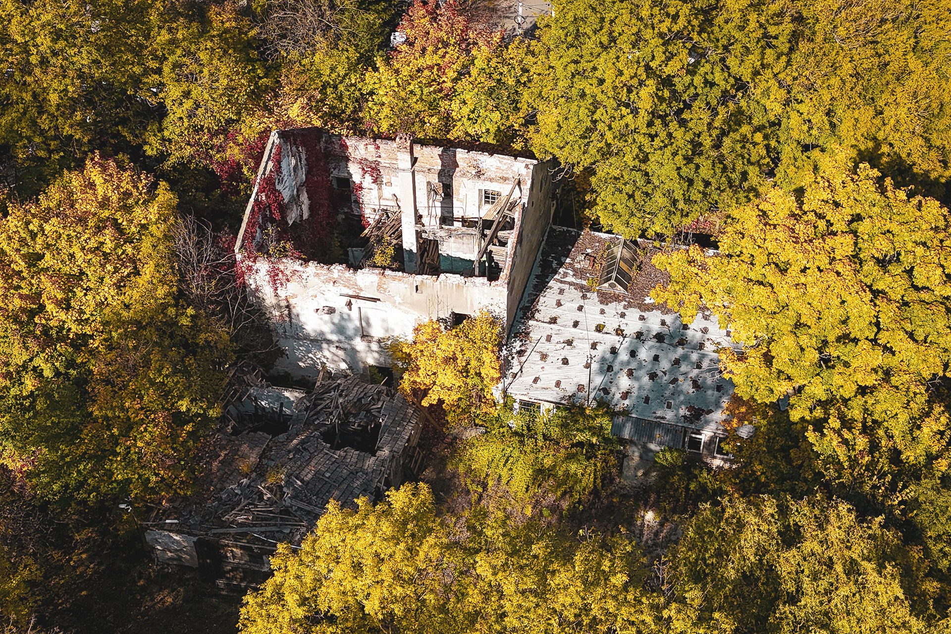
It was along the Młynówka, near its junction with Stare Wiślisko Street, that we find the second mill on our route. It belonged to Franciszek Lelito. The mill buildings still visible today represent a modernised, brick-built version of an earlier mill, equipped with features including a steam engine.
Over time, the site lost its economic function and, together with the filled-in watercourse, began to fade into the past. Today, it quietly falls into disrepair, almost unnoticed by the people who pass it every day.
Make the historical transition smootherStrengthen the ending’s emotional impact
A Mound in Mogiła
After travelling a few hundred metres further, we reach the junction of Żaglowa and Podbagnie streets. Here, we need to make a decision: do we continue our journey along the Dłubnia, or extend the route slightly to visit the site from which the village of Mogiła takes its name? The answer, of course, is Wanda’s Mound, known for centuries simply as a mogiła — a burial mound or barrow.
If we decide to make this additional stop, the best option is to head towards Longinusa Podbipięty Street. After changing its name to Jerzego Giedroycia Street, it will take us to the junction with the new alignment of Igołomska Street. We cross it and continue towards Wanda’s Mound, following the road northwards.
The first site we encounter along the way is Fort 49½a Mogiła. Nearby once stood Artillery Battery B3 Mogiła, which, like many other elements of the Kraków Fortress, has not survived to the present day. The fort itself was more fortunate. It remains standing, has undergone renovation and is now occasionally open to visitors, including during Kraków Fortress Days. While the surrounding area still feels as though it has been frozen in the 1990s, the fort itself is no longer in a state of disrepair. Today, it serves as an archaeological storage facility.
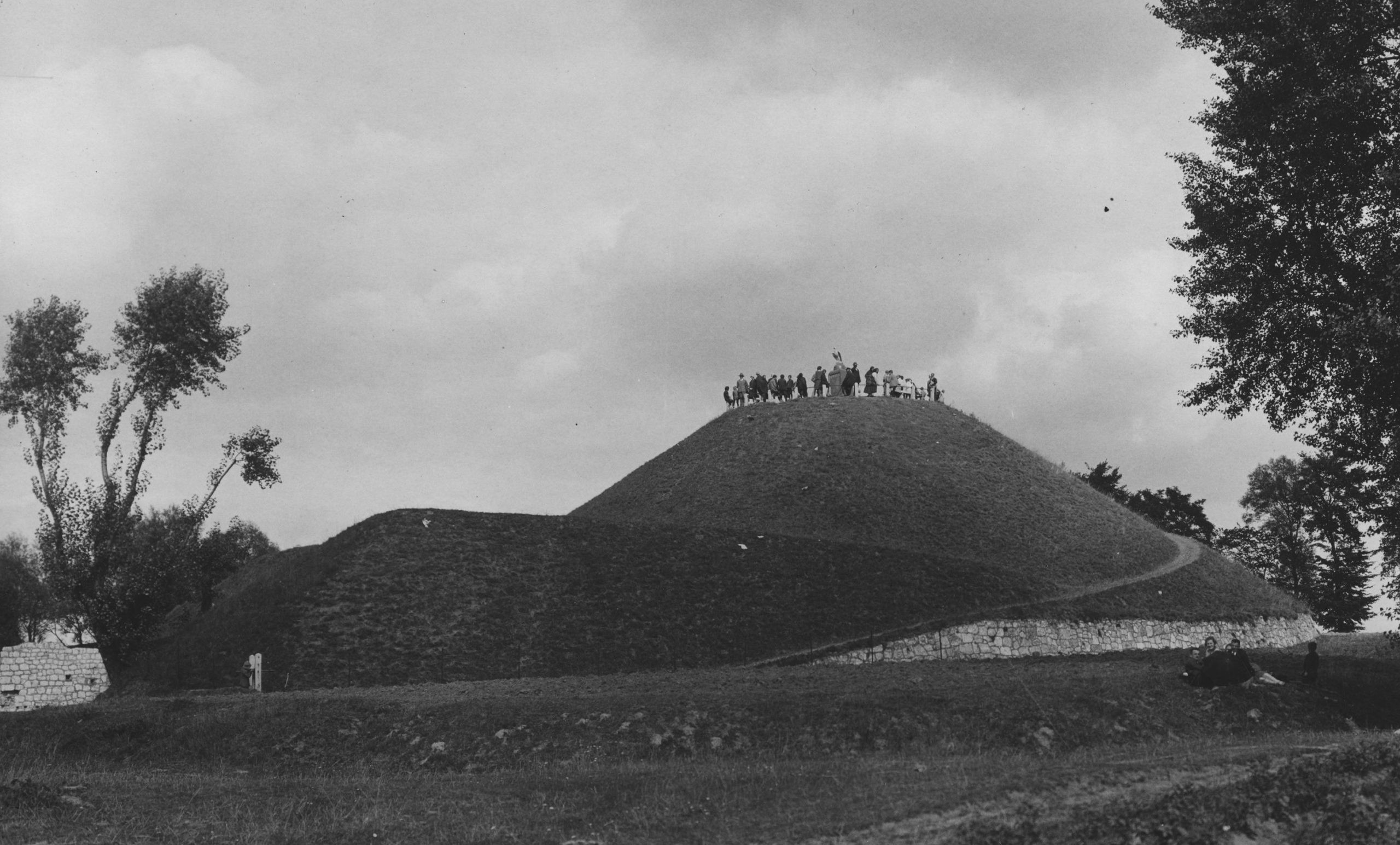
To reach the mound, we turn right. If we have already taken the road leading to the fort, we simply return to the former alignment of Igołomska Street and continue north. At the next fork, we once again follow this direction, eventually arriving at the foot of Wanda’s Mound.
It is difficult to overlook the fact that, despite its significance and a history stretching back to times far beyond the written record, this place has largely been forgotten, overlooked and, certainly, neglected.
This is evident not only in the condition of the roads we have travelled and the lack of adequate signage, but also in the state of the mound itself. It still requires comprehensive protection, conservation and further research. It is worth noting that, apart from non-invasive geophysical surveys carried out using ground-penetrating radar in 2016, archaeological investigations have focused primarily on the uppermost part of the mound.
Reconstructing its original appearance is further complicated by alterations associated with Austrian military fortifications. During the period of the partitions of Poland, Wanda’s Mound was first incorporated into a system of earthworks and subsequently used as part of Fort 49, known as “Kopiec Wandy”. We also cannot be certain whether the investigated summit formed part of the original mound or resulted from later construction work that raised its height.
It is worth remembering that Wanda’s Mound, like Krakus Mound and Kościuszko Mound, was used by the military as an observation point.
The mound’s history during the German occupation is also intriguing. It centres on the concealment of the statue that once crowned its summit, designed by Jan Matejko. Thanks to Jan Rusinek, the figure was saved from destruction. After the war, the eagle was returned to its place, although the one we see today is a cast made from the original, which had been severely damaged.
Today, the surroundings of Kraków’s mounds, whose origins reach far back into the past, appear orderly and largely devoid of visible traces of the former landscape. It is nevertheless believed that both Lasota Hill and the area around Mogiła may once have been dotted with smaller burial mounds, forming part of much more extensive funerary complexes.
The abundance of artefacts found around Wanda’s Mound suggests that the area was once far more intensively used by people. Some finds can even be seen protruding from the ground, exposed by erosion and the passage of time. Fragments of early medieval pottery, as well as ceramics from later periods, can be encountered even during an ordinary walk along the path leading to the top of the mound.
Clarify the route directionsReduce repeated descriptions of neglect
A Decaying History
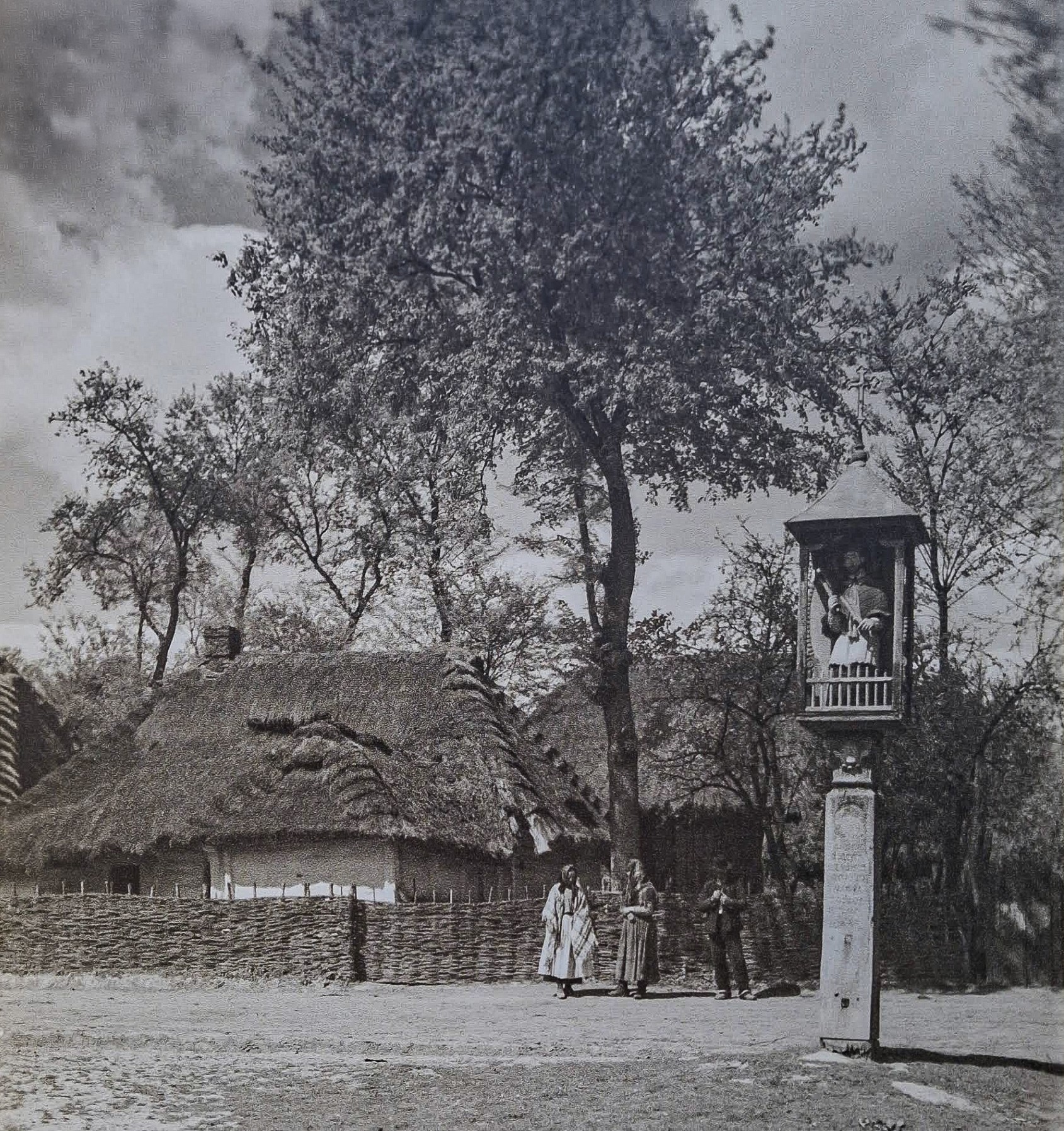
Whether or not we have included Wanda’s Mound in our itinerary, the next landmark is the shrine of St John of Nepomuk, located in the former village of Mogiła. Although today it is merely part of the landscape of Kraków’s eighteenth district, Nowa Huta, it once played an important role in the life of the local community.
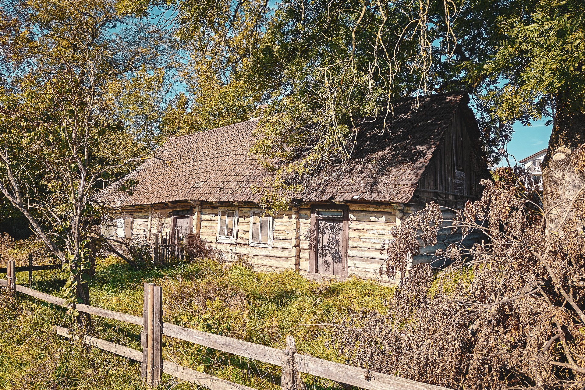
The shrine is a feretory-style structure, meaning that it has images on both sides. One depicts St John of Nepomuk, a patron saint invoked, among other things, for protection against floods. The other bears an image of the Virgin Mary, to whom the faithful also turned for protection. The shrine was brought to this location during a ceremonial procession in the 1860s. The aim was to protect the village from the floods that regularly afflicted settlements along the Vistula.
It is worth remembering that the Vistula followed a markedly different course at the time. Rather than flowing hundreds of metres away, the river passed just a few metres from the village buildings, posing a genuine threat to local residents. Traces of the long-vanished bend in the Vistula can still be identified using LiDAR maps and orthophotography. Its former right-hand arm is now occupied entirely by farmland, along with an elongated section of the Dłubnia’s channel. The Dłubnia once flowed into the Vistula almost at the very centre of the village.
Mogiła was inseparably connected to the waters of the Vistula, the Dłubnia, its industrial branch and the numerous ponds that once shielded the Cistercian abbey from the west. In the nineteenth century, as many as four privileged mills belonging to the Cistercians operated here. The process of abolishing serfdom — a change that, as one might imagine, was not necessarily welcomed enthusiastically by the clergy — also involved converting the mills to a rent-paying system. Ultimately, these changes brought their traditional mode of operation to an end in 1833.
Later, as many as three grain-processing establishments operated in the very centre of the village. Only one has survived to the present day. Neither its current use as a residential building nor its name, Gwoździarnia (“Nail Factory”), reveals much about its original purpose. The latter suggests that, at some point, nail production replaced traditional grain milling. It is an interesting example of how economic change gave former industrial buildings new functions while their original histories gradually faded from local memory.
What stands out most in the former village, however, are its last surviving buildings, whose style and form differ considerably from modern standards. These are, of course, traditional wooden cottages, many of which have retained much of their original character and appearance.
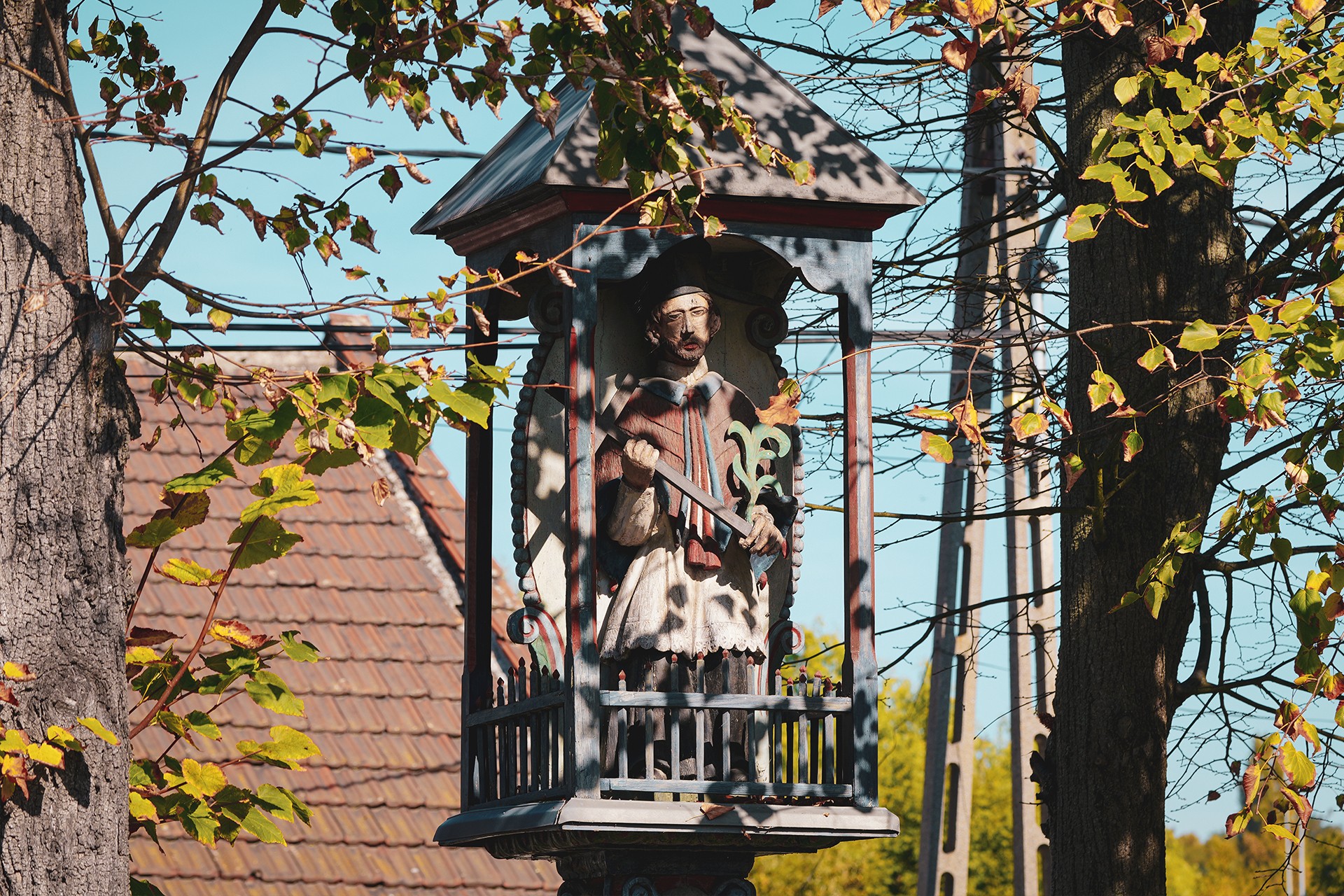
During the communist era, concrete roof tiles partially replaced thatched roofs, although roofing felt was more commonly used instead. Nevertheless, the way the structural elements fit together, along with the absence of foundations, still offers clues to the period in which these buildings originated. The scene is quite different from what we might expect to see in an open-air museum. In particular, it contrasts with the image presented by the developing Branice Educational Park, which offers a glimpse of the open-air museum in Kraków that has been planned for many years.
When discussing the last surviving cottages, it is worth mentioning that accounts by former residents are available, including recollections from the 1950s and 1960s. They describe everyday life at the time and the arrival of modern conveniences which, contrary to what one might expect, made their way into Mogiła and many similar villages surprisingly slowly. And even that is putting it mildly.
It would hardly be an exaggeration to say that, during the second half of the twentieth century, Mogiła — already part of Kraków and not particularly far from the city centre — still retained living conditions that many people would associate more readily with the early Middle Ages than with a period of rapid industrialisation. Electrification did not reach Mogiła until 1949–1951, largely as a result of the construction of the new industrial complex on land that had been incorporated into Nowa Huta.
Clarify the shrine’s timelineTighten the mill historyStrengthen the transition to cottages
The Mogiła Experiment
On the other hand, and as something of a niche historical curiosity, it is worth noting that Mogiła was one of the first villages in the surrounding area to receive electricity. The only catch was that the current was not intended to benefit local residents, but to deliver an electric shock to any potential enemy. Inspired by the German high-voltage barbed-wire defences introduced at the Poznań Fortress in 1915, the Austrians decided to conduct an experiment of their own in Mogiła.
With assistance from Siemens, an experimental and innovative defensive line was established between Mogiła and Krzesławice, supported by transformer bunkers. Although plans to extend the system further along the Dłubnia were abandoned, the results of the experiment were later put to use against enemy forces on the Italian front.
The remains of this electrified defensive line still lie buried in the surrounding ground, awaiting archaeological investigation.
Make the historical tone more neutralClarify the defensive system’s chronology
The Final Warning
Returning to the old world, which was still represented far more extensively in the first decade of the twenty-first century than it is today, and whose character was closer to that of the eighteenth century than the twenty-first, it is worth taking a closer look at Mogiła and the nearby villages of Krzesławice and Pleszów. This remains one of the most fascinating areas in which to explore the conditions of rural life in the past, offering a picture far closer to reality than the one we know from open-air museums.
The cottages displayed in such museums tend to present a somewhat idealised picture, one that does not always reflect the true conditions of everyday life. It should be noted, however, that many of the buildings that have survived around Mogiła already represent interwar standards and therefore belong to a later stage in the development of rural architecture.
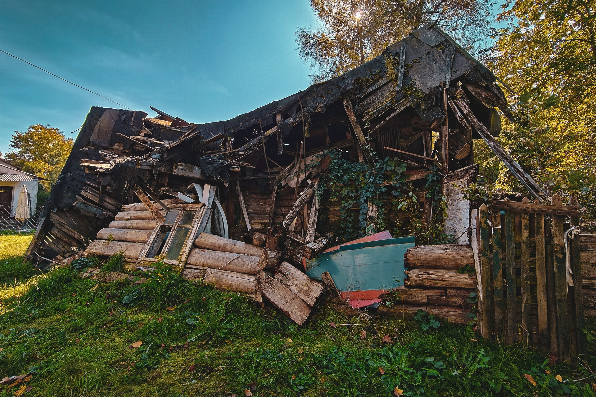
While a modern building inspector would probably approach the threshold of more than one surviving cottage with considerable apprehension, the mere fact that some of their nineteenth-century predecessors are still standing might, in itself, be cause for astonishment.
It is worth emphasising that the surviving cottages are now nearing the end of their existence. Once they disappear, the last tangible traces of an old world will vanish with them — a world that cannot be reduced to simple generalisations or recreated through the idealised images familiar from open-air museums.
Importantly, the buildings we pass in Mogiła, like those encountered further along the route, are largely included in the Municipal Register of Historic Buildings, yet they are not subject to statutory heritage protection and have not been earmarked for relocation to an open-air museum. No painstaking reconstruction or second life in a museum setting awaits them. Their most likely fate is gradual decay, a process we can witness with our own eyes. With each passing year, further fragments of the old landscape disappear, taking with them the traces of everyday life that no museum exhibition can truly bring back.
Break up the opening sentenceReduce repetition about the old world
Crossing into Krzesławice
Following Bardosa Street, we leave the old part of the village of Mogiła, brutally severed from its surroundings by the tram line and the access roads to Kraków’s fourth ring road. Before the road network was redeveloped, the street’s unnaturally winding course led directly towards Wanda’s Mound. Today, as a result of those changes, it leads practically nowhere.
Once we reach its far end, we turn into Księdza Jana Korzonkiewicza Street, which now terminates at the gates of a water intake facility. It once followed the Dłubnia riverbed all the way to the Nowa Huta Reservoir, however. Urban redevelopment forces us to take a different route, turning at the fork into Melchiora Wańkowicza Street, which looks almost as though it had been added to the map as a joke. In reality, it is now little more than a track running through a thoroughly overgrown part of Nowa Huta.
This section presents no significant technical challenges and should be manageable on any type of motorcycle. Riders who are more particular about the type and quality of the surface can bypass it using the S7 expressway or Bulwarowa Street. The important thing is to rejoin Melchiora Wańkowicza Street, which is crossed by Solidarności Avenue.
At the end of this off-road alternative, another example of a vanishing world awaits us: a dilapidated wooden cottage and the equally gloomy Mogiła Ammunition Bunker. As is often the case in Kraków, this military relic is accompanied by an archaeological site documenting traces of Neolithic settlement and remains dating from the Late La Tène period.
After crossing another obstacle in the form of Solidarności Avenue, we must use the connecting road towards the steelworks to turn around and regain our intended direction. The first site worth stopping for, particularly in the context of our journey following the Dłubnia, is the Kirchmayer family’s turbine mill, built in 1902.
Remarkably, the mill remained in operation until 2009. Although its brick walls gave it a somewhat more modern appearance, the remaining structural elements and machinery, together with the sounds, rumble and smells accompanying its operation, brought to mind scenes from The Quack (Znachor), Jerzy Hoffman’s cult 1981 film starring Jerzy Bińczycki. I can vouch for that personally. ;)
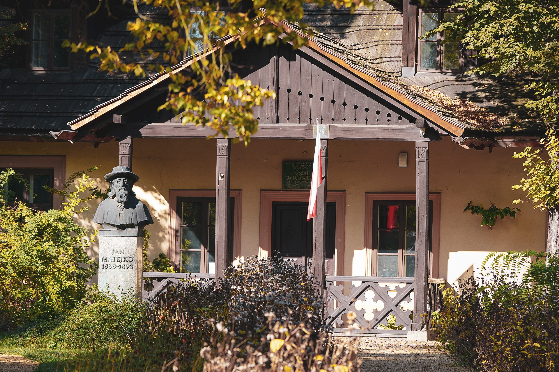
The next stop is the Krzesławice Club building, which belongs to the Kraków-Nowa Huta Cultural Centre. In fact, it was once a school funded by Jan Matejko, whom we have already mentioned in connection with Wanda’s Mound. The painter would occasionally stay in nearby Krzesławice.
Right next door stands the filial Church of St John the Baptist and Our Lady of Mount Carmel. This is an authentic seventeenth-century church that fits perfectly into its surroundings, complementing the local wooden architecture trail. Originally, however, it served the inhabitants of Jawornik, near Myślenice. Until its relocation in 1983, it was dedicated to the Finding and Exaltation of the Holy Cross and St John the Baptist.
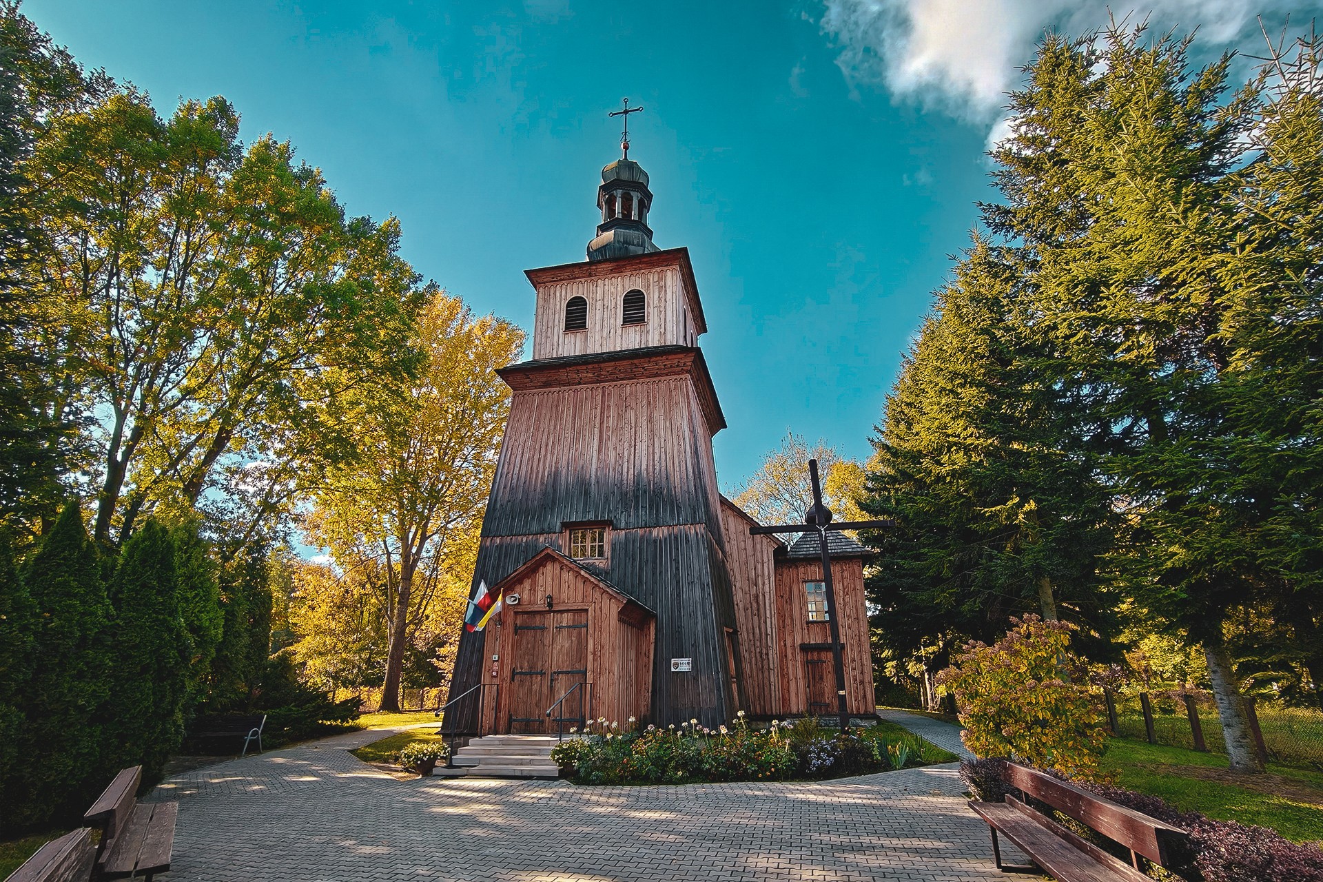
The reason for relocating the church was a plan to establish an open-air museum in Kraków on this very site. As we can see, bringing that ambition to fruition has proved a long and bumpy road, with successive decades failing to deliver the anticipated outcome.
The next building intended to form part of the planned Krzesławice open-air museum complex was, of course, Jan Matejko’s Manor House, located just a few dozen metres away. This was where the painter would come from nearby Kraków, saying he was going to the countryside. Today, the expression might raise a smile, but even in the 1970s it would not necessarily have seemed particularly odd. All the more so if we travel back to the period before Nowa Huta was built, and especially to the artist’s lifetime (1838–1893).
It is worth remembering that Kraków only began tentatively expanding beyond its old city walls in the eighteenth century. Even in the early decades of the twentieth century, and in some places well after the Second World War, urban buildings stood alongside wooden cottages and rural homesteads. Beyond them stretched miles of fields and meadows, punctuated here and there by small settlements. Mogiła stood out among these for its size and importance, appearing particularly imposing against the surrounding countryside. The construction of Nowa Huta finally and irreversibly transformed this landscape, blurring the boundary between town and village. Although even that interpretation is open to considerable debate.
As we make our way through Krzesławice, we are bound to notice the number of wooden cottages and how well — or poorly — they have survived. It is difficult to find such a concentration of traditional rural buildings even beyond the city limits. This is one of those areas where the old landscape has endured despite ongoing urban development.
Near Stanisława Wojciechowskiego Street, above the still-preserved Młynówka millstream, we can find the ruins of another mill. This time, however, we will give it a miss. The condition of the building, its surroundings and the difficulty of reaching the site on two wheels all argue against a visit. Another obstacle is the Dłubnia itself, whose current separates us from the remains of the former mill.
Beyond the historic wooden buildings, it is worth looking out for traces of the Second World War near the street’s exit. The most prominent is the Monument to Those Executed in Krzesławice, commemorating the victims of German executions. Another remnant of the area’s wartime defences also survives nearby, associated with the railway line known locally as the Kocmyrzówka: a concrete anti-tank barrier of the Fallkörpersperre type. Its operating principle was simple: a support at the base was blown apart, causing the concrete pillar to topple onto the railway tracks or road, blocking passage in the event of an enemy attack. Similar structures can also be found elsewhere in Kraków.
Tighten the route directionsClarify the open-air museum thread
Bieńczyce
Crossing Kocmyrzowska Street and, at the same time, making our way over the Dłubnia, we bring our ride through Krzesławice to an end and enter Bieńczyce, another significant village in the area. This time, we will skip the subject of the burial ground discovered on the riverbank and move — or rather ride — on to the next stop on our route: the Bieńczyce mill.
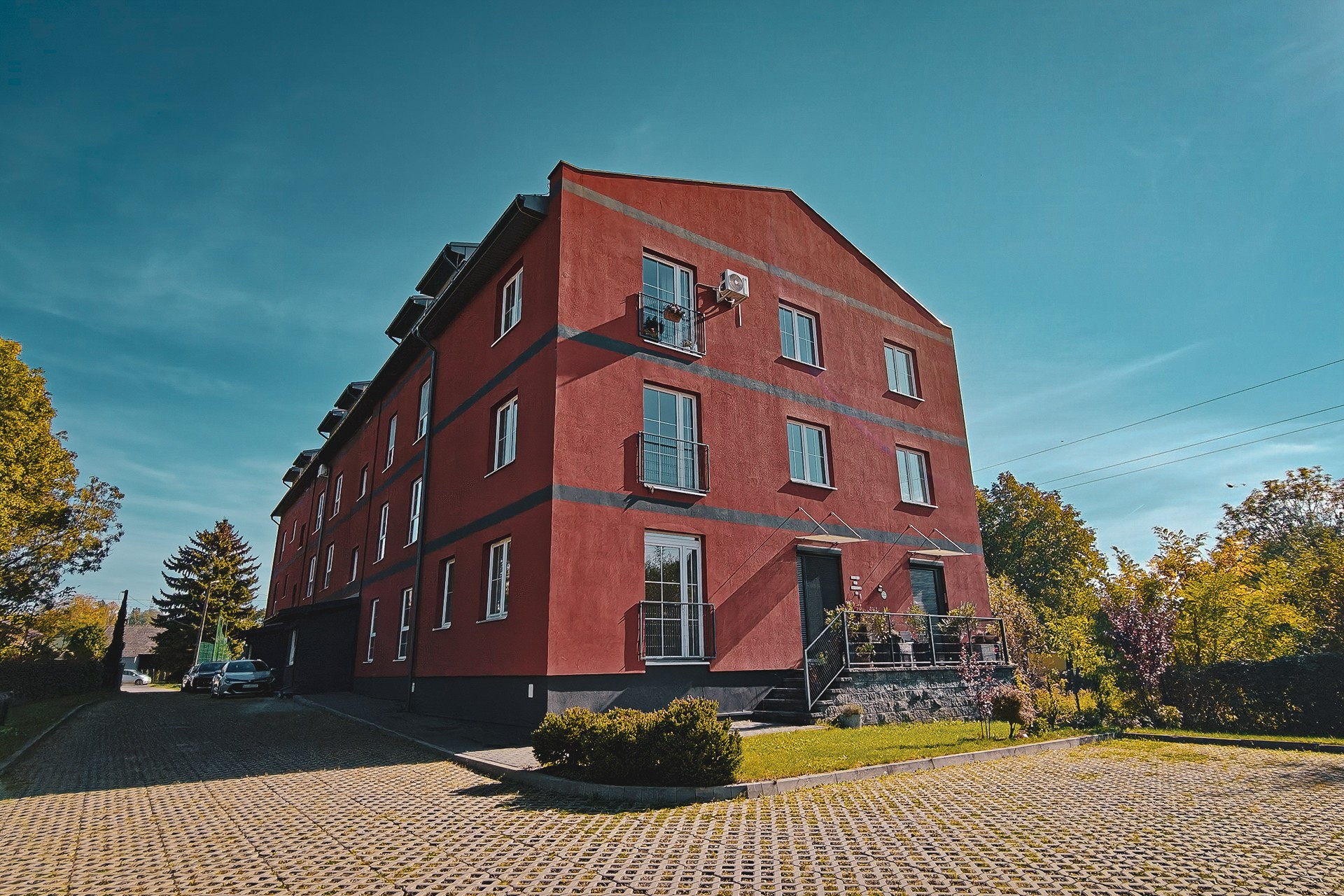
Today, the site is essentially Faktoria Młyn, a residential development whose architecture offers a fairly liberal interpretation of the buildings of the former Lelito Mill, which were still falling into disrepair until relatively recently. The name may ring a bell from our earlier account of Mogiła. This time, however, we are talking about Władysław Lelito, who acquired the mill after a fire in 1915. Before that, it had belonged to the Wasserberg family, while an earlier incarnation of the site had been a sawmill.
The mill finally ceased operating in 1990, when a court ruling required the mill, nationalised after the war, to be returned to its rightful heirs. The removal of the machinery essential to its operation, the vandalism of the buildings and, eventually, a fire sealed the fate of this industrial site. Little remains of the original mill today, and its former character is gradually giving way to new development.
While discussing the milling industry, it is also worth mentioning the pond on Kaczeńcowa Street, which we pass along the way. Although it is now designated as an ecological site, its role extended beyond adding a natural feature to the surrounding landscape. Above all, it served as a reserve water reservoir, once ensuring an adequate supply of water to keep the mill downstream operating efficiently.
Franciszek Ptak
After visiting or passing the former mill in Bieńczyce, we turn into Cienista Street. Almost immediately, we come across a building that is difficult to mistake for a typical example of architecture in this part of the city. Both its design and its unmistakable period style give away the era in which it was built. And indeed, the building has a rather extraordinary story to tell.
Built in 1909, the Sokół House is associated with one of Poland’s oldest gymnastics societies, the Sokół (Falcon) movement. In the case of the Bieńczyce building, however, what makes it interesting is not merely its architecture, which still stands out distinctly from its surroundings, but also the circumstances of its construction. The initiative came from a peasant, Franciszek Ptak, who was also one of its principal benefactors.
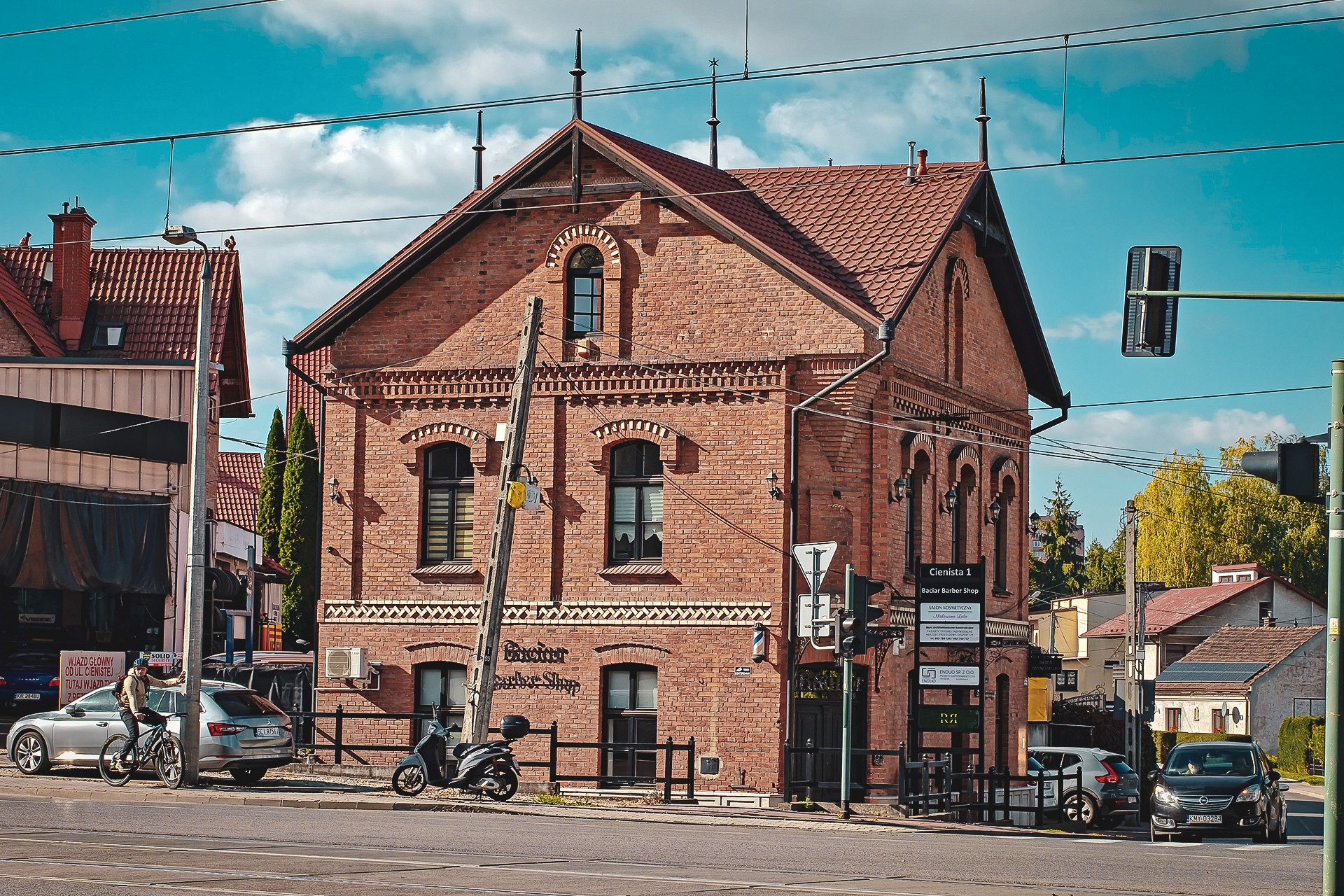
Ptak was such a colourful character that he is said to have served as the model for Czepiec, a character in Stanisław Wyspiański’s celebrated play The Wedding (Wesele). This should come as little surprise: Ptak maintained contacts with a considerable part of Kraków’s artistic bohemia, and his activities extended well beyond local affairs.
This is a figure who certainly deserves a more detailed account. However, given that we have not even left Kraków yet, we will have to save that story for another occasion. Besides, like several other figures encountered on today’s ride, Franciszek Ptak will feature again along our route. In this case, though, it would be more accurate to say that we will have the opportunity to visit places associated with him.
Mistrzejowice and Zesławice
After turning into Fatimska Street and passing the Church of Our Lady Queen of Poland, popularly known as the Lord’s Ark (Arka Pana), we head towards Mistrzejowice. Although regarded as one of the most distinctive examples of twentieth-century Polish ecclesiastical architecture, the church bears clear similarities to the Chapel of Notre-Dame-du-Haut in Ronchamp, France, designed by Le Corbusier.
Today, Mistrzejowice forms part of Nowa Huta, and most residents associate the name primarily with the housing estate several kilometres east of our current position. Historically, however, the village was closely connected with the Dłubnia valley, and as recently as the 1970s, its rural character and setting were far more apparent than they are today.
Once owned by the Kraków Cathedral Chapter, Mistrzejowice had both an inn and a mill, yet remained a small settlement until the expansion of Nowa Huta. Its population hovered around a hundred people.
The history of neighbouring Zesławice, which belonged to the Cistercians of Mogiła, was much the same. An inn, a manor farm, a mill, archaeological sites and forts belonging to the Kraków Fortress system all formed part of a small village with a long history, whose rhythm for centuries had been shaped primarily by local conditions and agricultural activity.
It was only the plans to build Nowa Huta that brought fundamental change. In the 1950s, a brickworks was established here, clay extraction expanded to supply brick production and the steelworks, and the Zesławice Reservoir was created to provide water for the developing city. In this way, both villages, previously on the fringes of major urban transformation, came within the sphere of interest of a much wider section of Kraków’s population.
Leaving Kraków Behind
We leave Mistrzejowice and Zesławice behind and enter Batowice. Just beyond the ring road, the willows growing along the road and the Dłubnia valley catch our attention. In fact, they are hard to miss, although not necessarily for the reasons we would like. Left without proper care for years, the trees have taken on a rather gloomy appearance, and their condition poses a genuine safety risk. Overgrown branches break off from time to time, falling straight onto the road.
Pollarded willows were until relatively recently a common feature of the Polish rural landscape. Regular pruning served a primarily practical purpose. The shoots were used for basket weaving and for building walls and fences, while thicker branches ended up in the stove.
Around Kraków, the area near Tyniec offers a good example of this traditional approach to tree management. The road to Batowice may not be quite as scenic, but in terms of the number of willows that were maintained in good condition until relatively recently, it would be difficult to find a rival.
It is worth noting, however, that the situation is not entirely unchanged. Work is currently being carried out on some of the trees to restore their traditional form. Even if these efforts fail to preserve the distinctive landscape, they may at least help improve safety.
The avenue of willows stretches from Spacerowa Street to Na Łąki Street. We leave it earlier, however, crossing the Dłubnia over a bridge that takes us straight into Raciborowice.
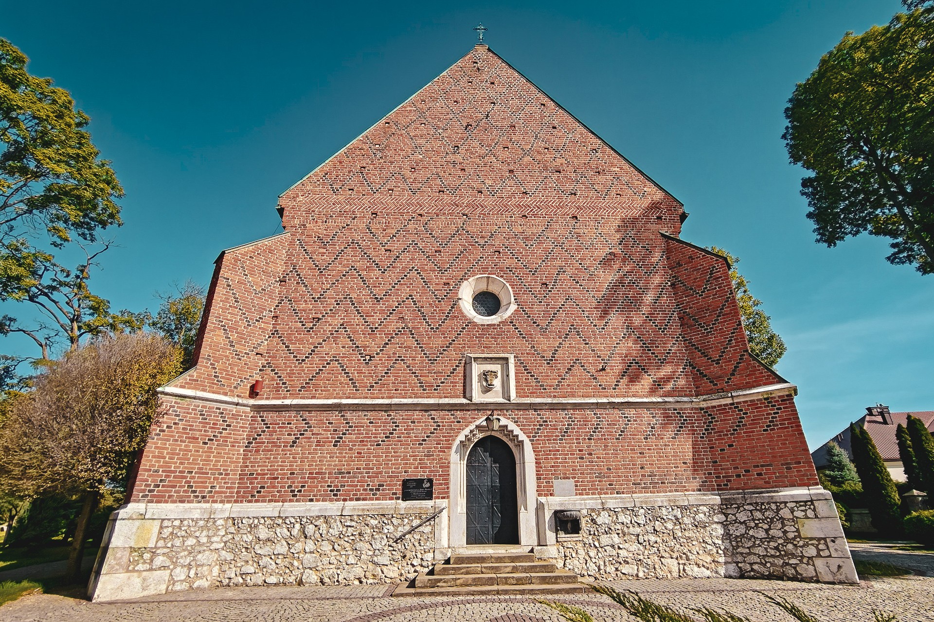
This village, too, has a long history. In the thirteenth century, it came under the authority of the Kraków Cathedral Chapter, and its past is also linked to Jan Długosz, the Kraków canon and chronicler who recorded the settlement in his writings. He is credited with founding the local Church of St Margaret, which has, remarkably, survived to the present day with relatively few changes to its external appearance.
This does not mean that the church has retained its original character in every respect. While its overall form and façade still reflect its medieval origins, the interior was substantially remodelled in later centuries in keeping with Baroque aesthetics.
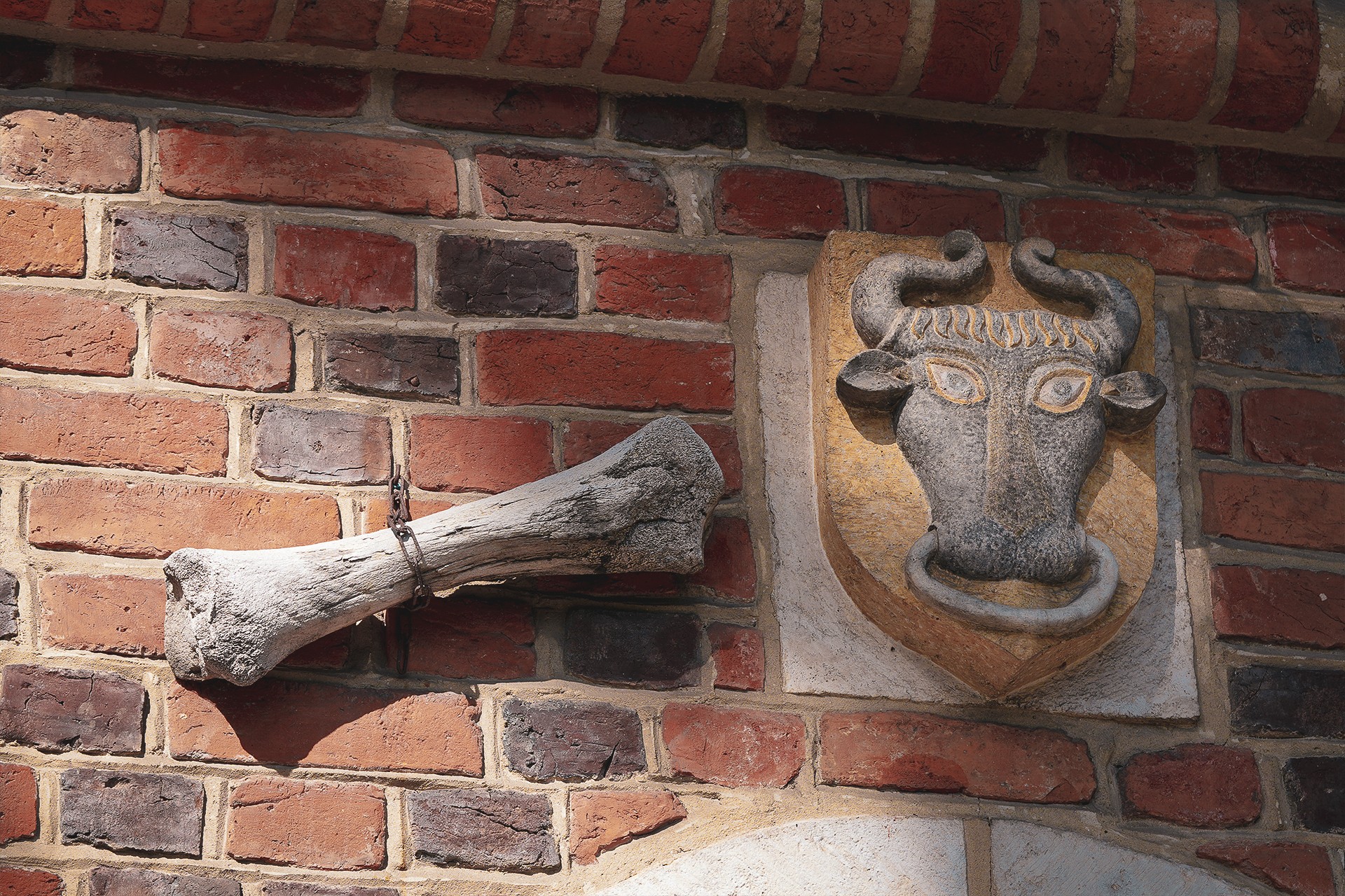
There is an intriguing detail about the church in Raciborowice that tends to go unmentioned: Wawel is not the only place in Kraków to house a bone whose fall is supposedly destined to herald the end of the world. A similar ‘dragon bone’ hangs above the church’s southern portal in Raciborowice, and according to local accounts, it was placed there by Jan Długosz himself. Would its fall really spell the end of the world? We cannot say. Most likely, however, the bone belongs to a woolly rhinoceros and is part of its femur.
Raciborowice is also where the Bieńczyce innkeeper, Franciszek Ptak, makes another appearance on our route. It was in the family tomb at the local cemetery that this colourful and complex character was laid to rest, a man who fitted perfectly into the realities of the Young Poland period.
While visiting Raciborowice, it is also worth mentioning another wooden mill, dating from 1897. The milling tradition at this site, however, stretches much further back: mills had already been operating here more than five centuries earlier.
The Road to Michałowice
As we leave Bieńczyce behind, there is one rather subtle point we have yet to mention. This is also where we cross a geographical boundary and enter the Proszowice Plateau. The heavily urbanised surroundings and tree-covered hills make this transition difficult to recognise today. However, if we could travel back less than a century and follow the course of the Dłubnia, the change would be hard to miss. Once we pass through the natural gateway formed by the hills around Krzesławice, we enter the relatively deep valley of the Dłubnia. Importantly, we will remain in this valley until we reach the vicinity of the river’s main sources.
Between Raciborowice and Zawadka, we will pass at least five surviving mills and at least three substantial manor complexes. Given our limited time, as well as ownership issues that often make these sites difficult to visit — or even prevent access altogether — we will leave them without a more detailed description.
Until relatively recently, some of the historic buildings along our route could be explored without much difficulty. Looking at their sometimes almost terminal state of disrepair, however, one might conclude that passing into private ownership is not necessarily the worst possible outcome. Even if renovation involves significant changes to the original layout of the buildings, it is better for them to survive in a somewhat altered form than to disappear from the landscape for good.
The manor and park complex in Michałowice deserves a mention, if only because the architecture of the residence itself reveals the identity of its designer. And since Teodor Talowski was a great architect — or, at the very least, one of our personal favourites — it is difficult to pass his work without taking notice.
A typically niche regional curiosity is the promotion of Michałowice as a locality within the Kraków-Częstochowa Upland. This designation appears in various promotional materials. The Michałowice municipality is also a member of the Association of Jura Municipalities, while local businesses use the word Jura in their names. None of this, however, means that the municipality actually belongs to that geographical region.
In reality, almost the entire area occupied by the village of Michałowice and the municipality of the same name lies on younger Cretaceous deposits. Although Jurassic, Cretaceous and Miocene limestones can look similar at first glance, the differences between them are significant.
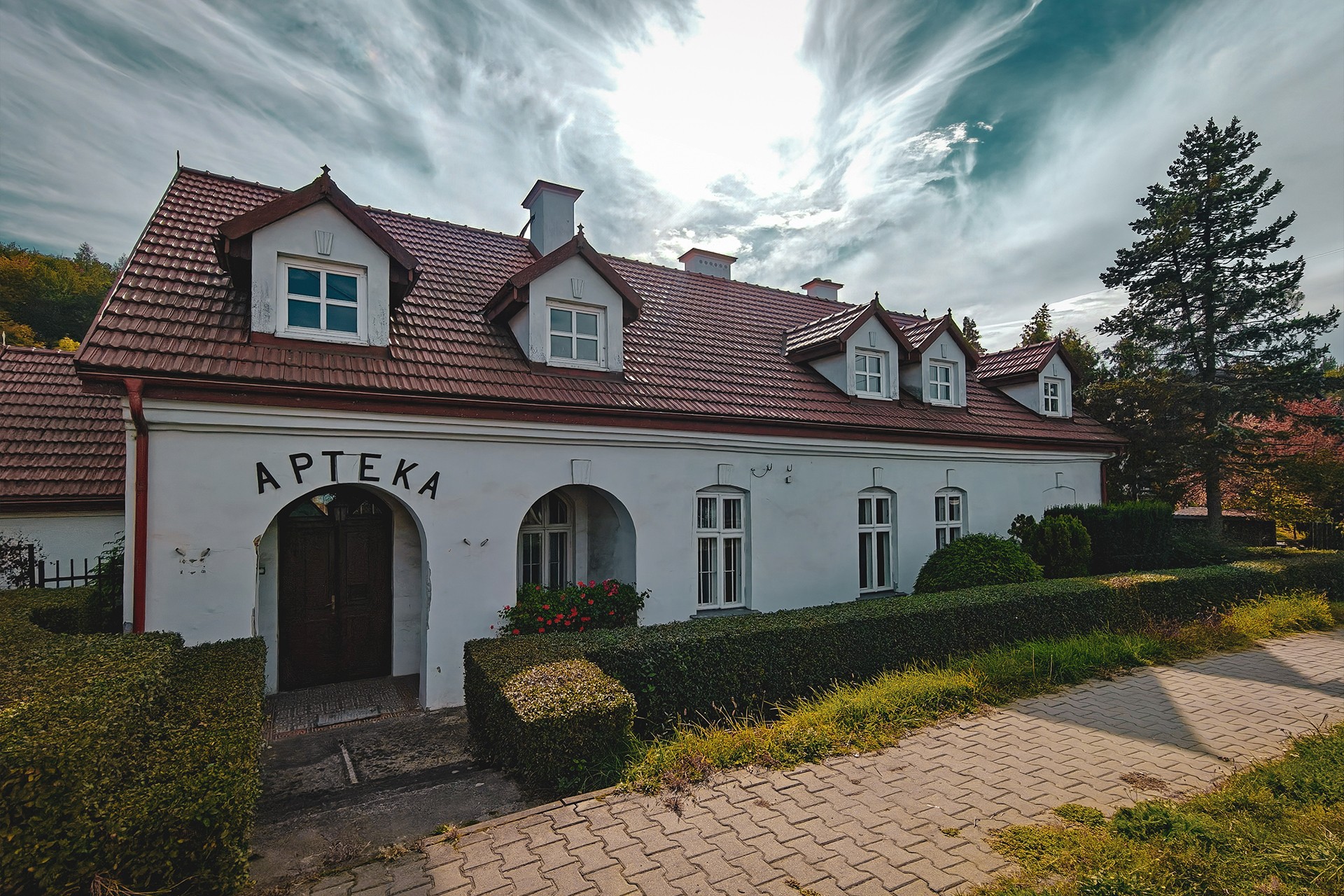
Once we have passed through Michałowice, regardless of whether we consider it part of the Jura or prefer another geological label, we reach Zerwana. Here, we turn north once again, continuing our journey through the Dłubnia valley. In Zerwana itself, it is worth looking out for a building quite unlike the historic structures we have encountered so far: a former pharmacy dating from 1917.
Towards the Sources
In Wilczkowice, we pass two mills situated close to one another, both now serving somewhat different purposes, before continuing upstream. Historically, however, we briefly travel back to the Middle Ages, and even further into the past. We will see why after about three kilometres, when the hill on our left reveals the hillfort at Damice, sometimes referred to, as is common with sites of this kind, as Wały — the Ramparts.
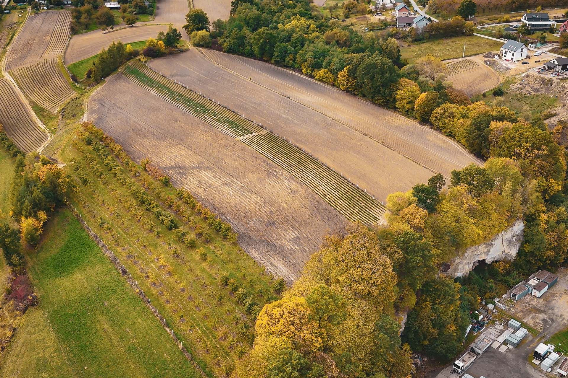
This projecting headland, rising above the river and offering favourable defensive conditions, was inhabited as early as the Neolithic period. Traces of settlement also date from the Iron Age, but the remains of the early medieval stronghold are the most prominent and best documented. Brought back to the attention of the scholarly community in the early twentieth century by Leon Kozłowski, the site covers approximately seven hectares, making it one of the largest fortified settlements of its kind in Małopolska. By comparison, the main stronghold at Stradów covers around 1.5 hectares, while the one at Wiślica occupies just 0.7 hectares. Against this backdrop, the hillfort at Damice appears positively enormous.
As we travel along the river, it is also worth mentioning the nearby Mirosław Spring, one of the first substantial Dłubnia springs we encounter on our route.
We, however, continue towards Iwanowice — first the manor-owned settlement, then the village of peasant holdings. Unfortunately, we have little time to explore the history of this place in detail, although traces of its past can be found at every turn.
As we enter the centre, our attention is drawn to a renovated, rather distinctive building that now houses the PTTK Regional Museum. Both the roof covering, which does not quite suit the character of the building, and its overall form might raise a few questions. It is difficult to imagine a similarly broad, single-storey building being constructed in the centre of a small settlement today. Yet its shape gives away its original purpose. And if any doubt remains, the chimneys positioned in the middle of the roof offer a clue, as does the arch above the entrance, which now accommodates a modern door.
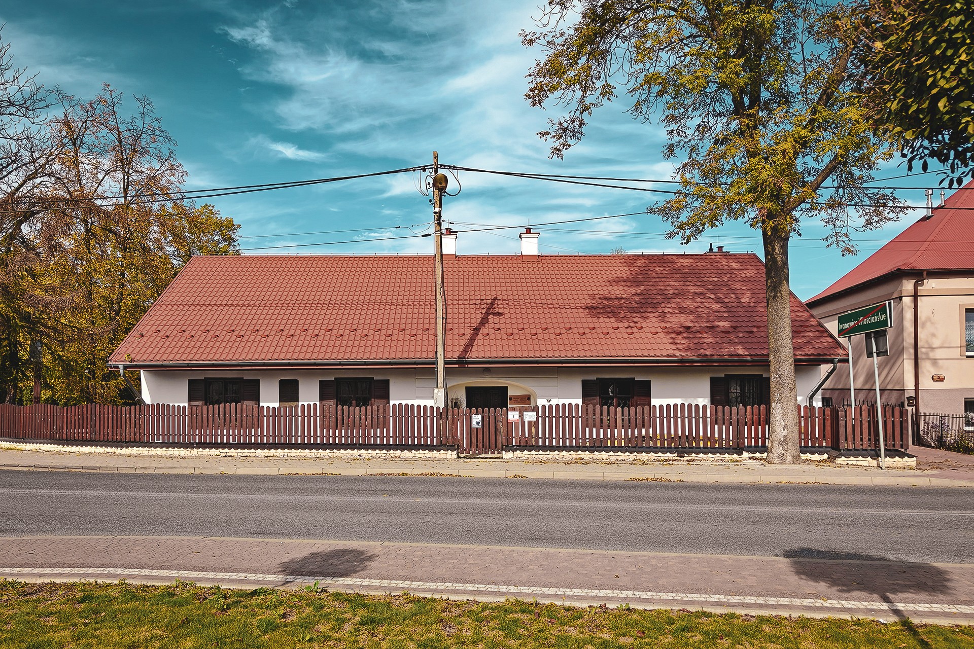
This is, of course, a former inn — one of the types of buildings once commonly found along major routes. Originally, the opening now occupied by the door must have been a wide gateway, allowing travellers to ride in on horseback without dismounting and enter the so-called stan, the part of the building intended for horses and carts. A modern equivalent might be an underground car park at a shopping centre: travellers could leave the road and shelter under a roof with their horses rather than having to leave them outside.
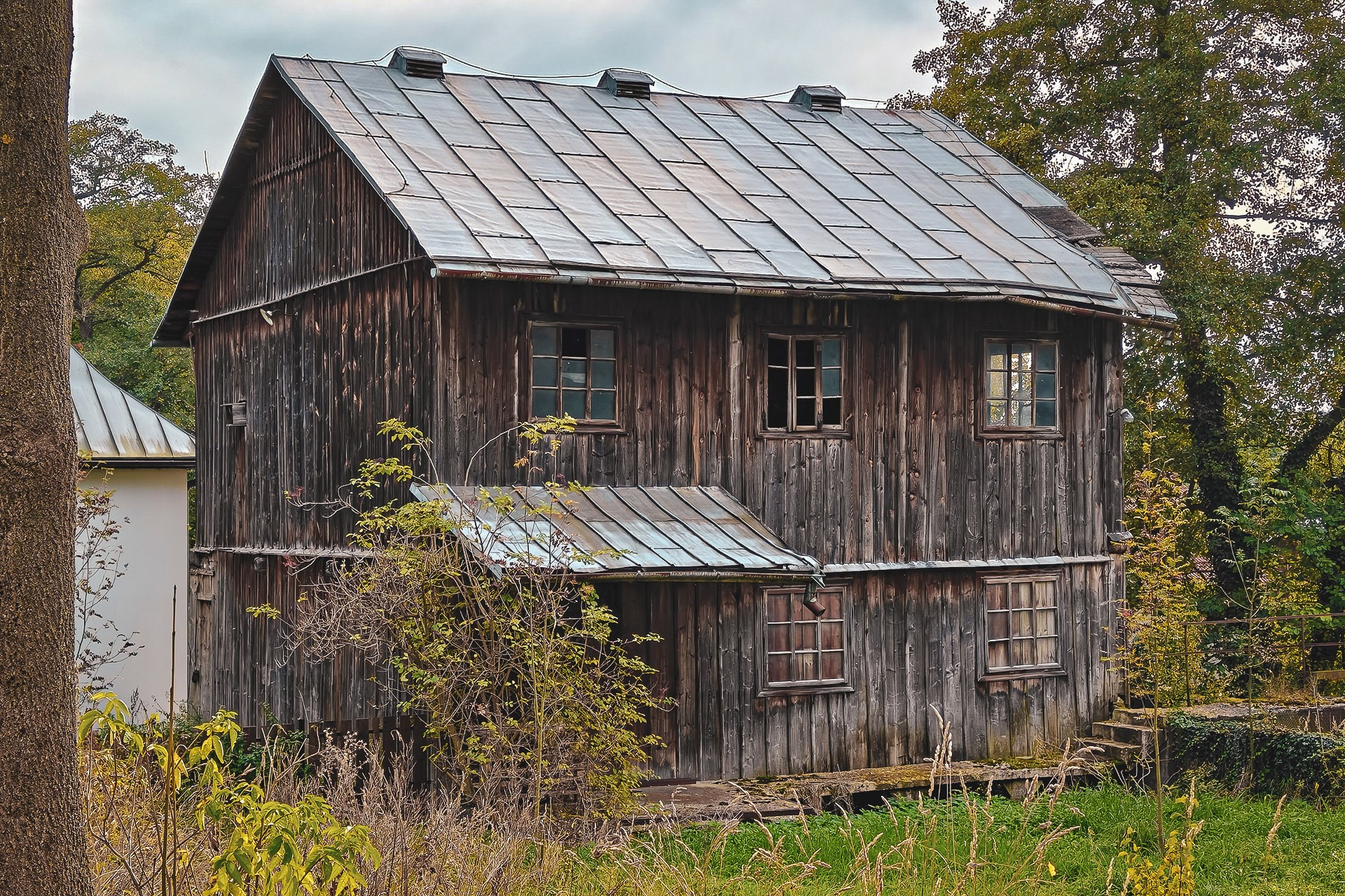
In Iwanowice, alongside smaller monuments and roadside shrines, we can also visit the parish Church of the Holy Trinity, built in 1745. The church stands out for its rather unusual silhouette, with two towers, and its furnishings include three Gothic sculptures associated with the workshop of Veit Stoss.
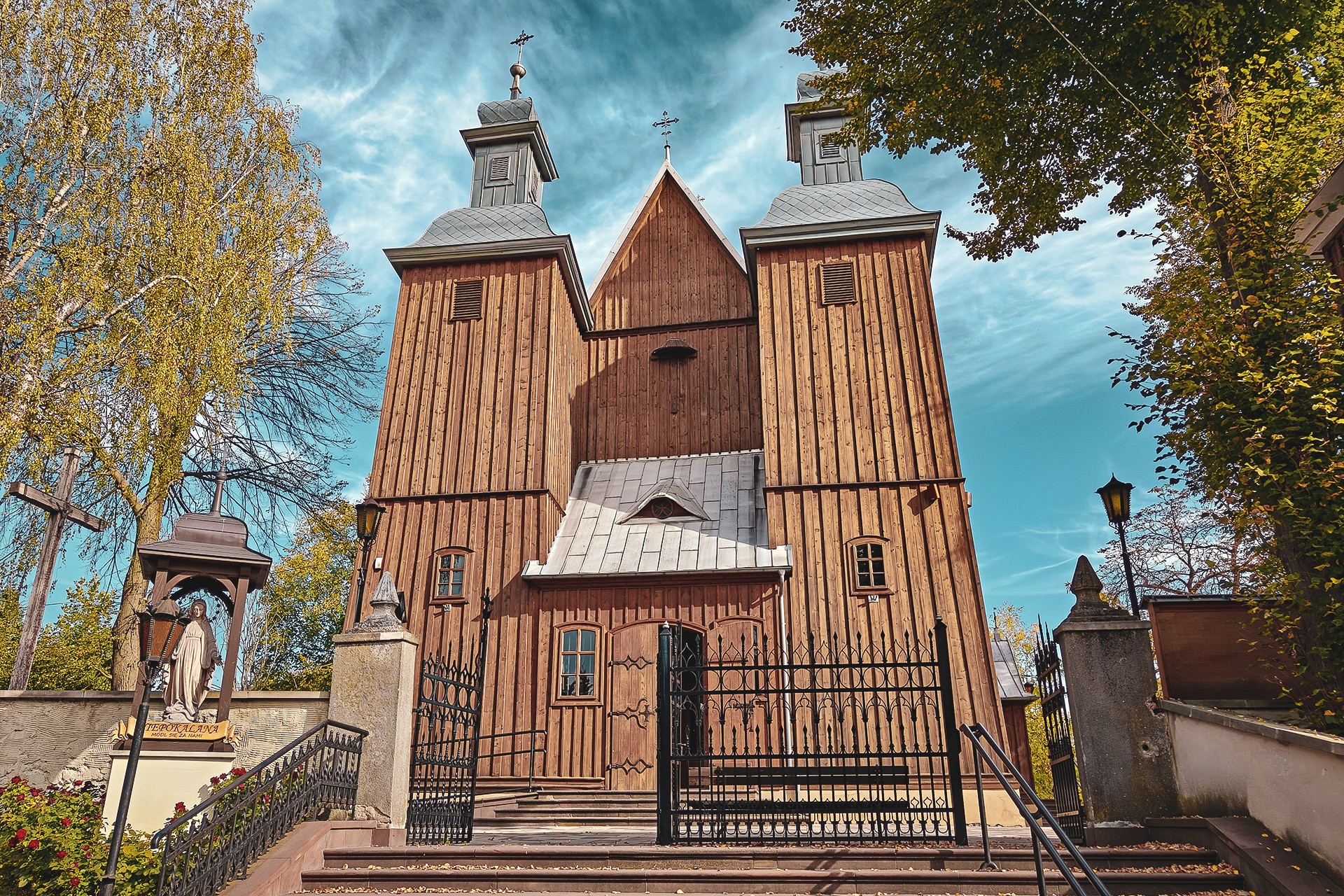
On the road out towards Słomniki, another watermill awaits us. We must, however, settle for viewing it from the outside, as ownership restrictions prevent us from freely entering the grounds.
We turn left and, passing through Biskupice, reach Sieciechowice, where two interesting historic sites await: the Gothic Church of St Andrew and a manor complex.
The latter deserves a mention for its successful, award-winning revitalisation. The collapsed section of the manor was reconstructed using glass walls, allowing the modern intervention to stand in clear contrast to the historic fabric of the building. A similar, though less striking, transformation has also been carried out on one of the buildings belonging to the University of Agriculture’s manor complex in Kraków’s Mydlniki district.
To keep the industrial theme of today’s ride in view, it is worth adding that just five kilometres from the mill in Iwanowice, we can see another wooden mill of this type. Dating from the pre-war period, the Jadzin mill stands in Grzegorzowice Wielkie.
We are gradually approaching the boundary of Kraków County. Once we cross into the neighbouring Miechów County, we will draw closer to the main area of the Kraków-Częstochowa Upland. It must be said, however, that we have already encountered geological outliers of this region, rising above the surrounding Cretaceous and younger deposits. A similar situation awaits us before Wysocice, one of the key stops on our route.
The reason is the Romanesque Church of St Nicholas in Wysocice, one of the finest examples of Romanesque architecture not only in the Małopolska region but in Poland as a whole. In many respects, despite being less widely known, this monument can confidently hold its own against Kraków’s Church of St Andrew. Admittedly, the church in Wysocice did not escape the Baroque ‘plague’ either, but it has retained much of its original austerity and remains one of the most distinctive Romanesque buildings in the country.
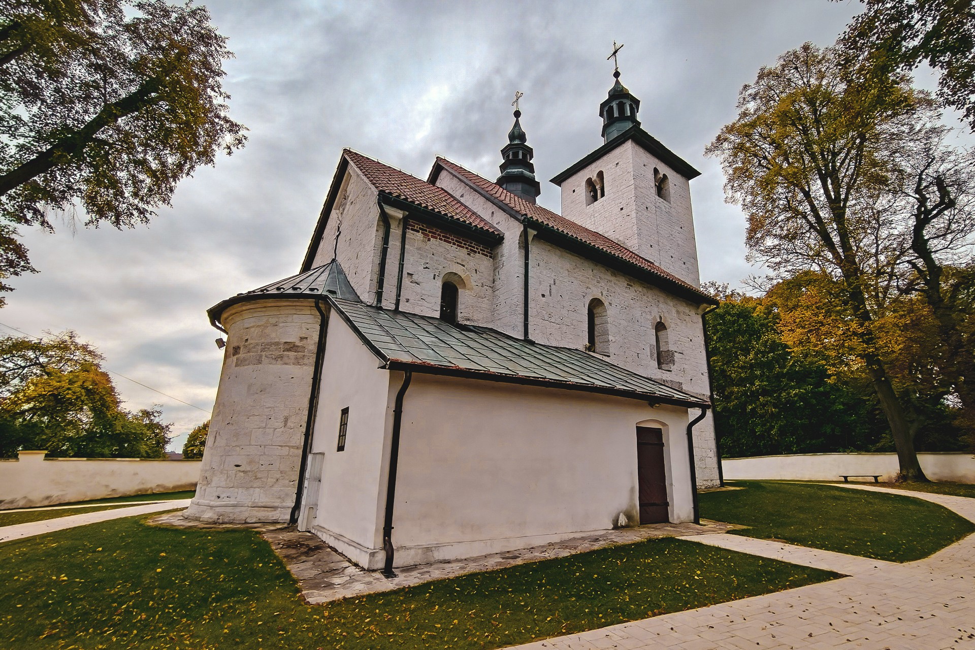
Here, it is worth returning to Iwo Odrowąż, who is credited with founding the church. But how much historical truth lies behind the story of how long the bishop supposedly needed to travel on horseback from Wawel to Wysocice? We do not know, although we have a few suspicions.
Even on motorcycles, and without stopping at any of the places along the way, we would struggle to match such a feat. But who knows? Perhaps the medieval bishop had an exceptionally swift horse, and we simply underestimate the capabilities of travellers in the past.
At the Sources
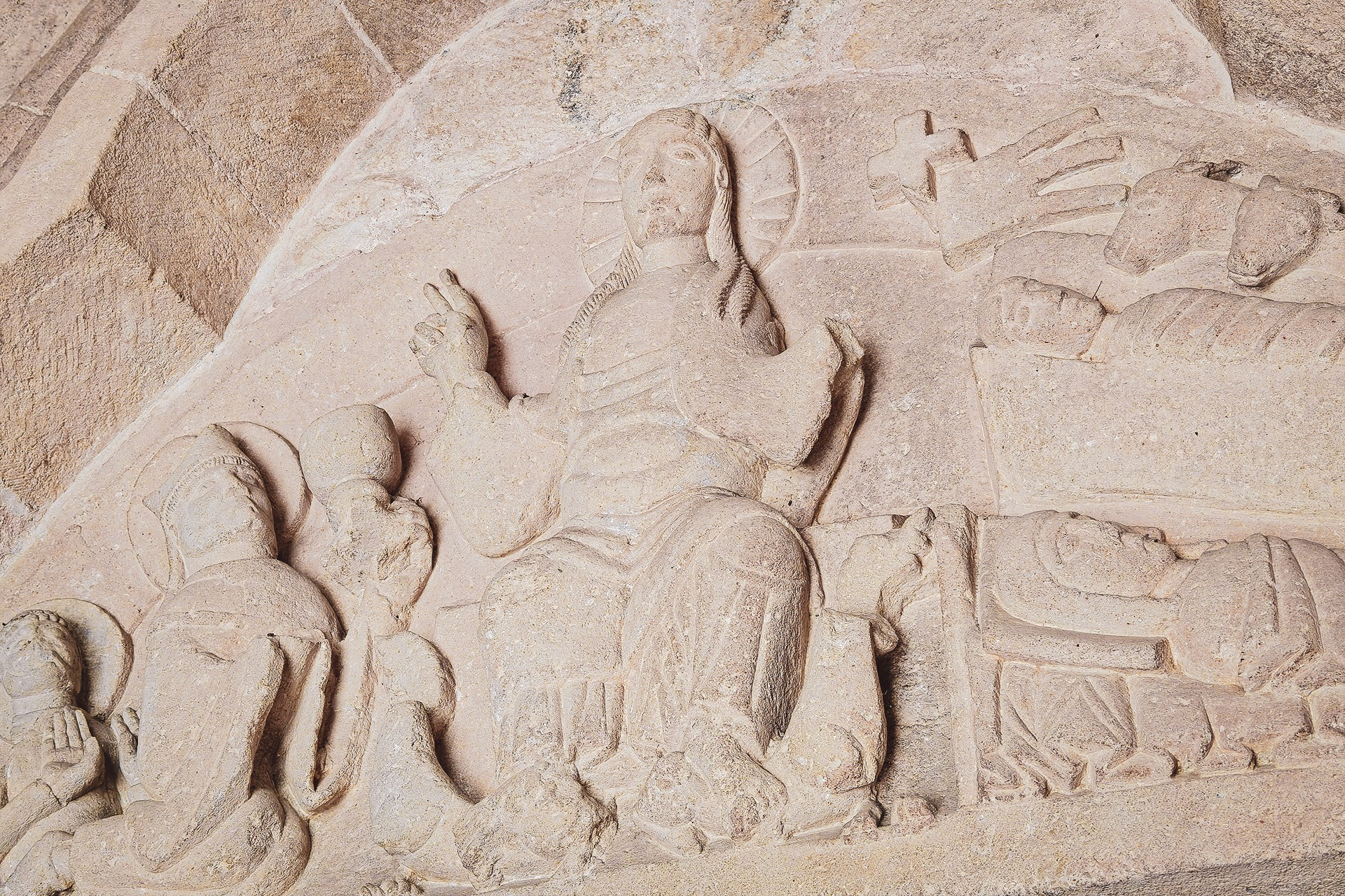
Just beyond Wysocice, one of the most spectacular and productive springs on the Miechów Upland awaits us. Jordan Spring feeds the Dłubnia with water flowing at a rate of up to 100 litres per second. Today, it primarily serves visitors, but in the past it was also used by the residents of the manor and the surrounding villages. Water was collected here, while its low temperature, around 10°C, also made it suitable for storing food. The spring was additionally the only known site in Poland for the caddisfly Hydroptila martini. The place is also associated with a tale of a carriage and horse said to have sunk into the spring’s exceptionally deep waters. We decided against investigating the story first-hand, however. We will still need the motorcycle for the rest of our journey.
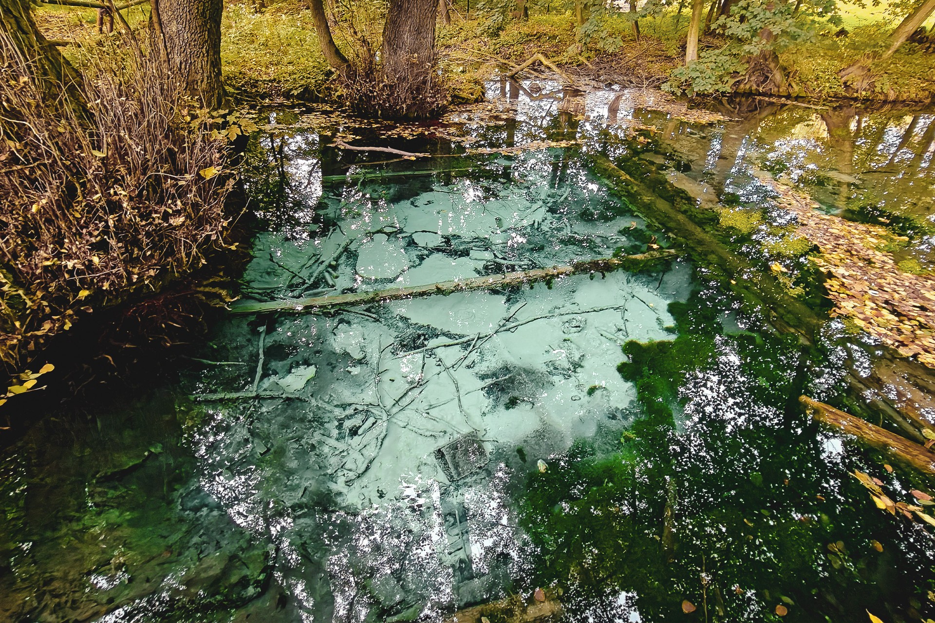
We therefore turn around, return to the bumpy dirt track and head towards Imbramowice.
The Norbertine convent in Imbramowice, the White House associated with the sisters and currently undergoing renovation, the historic Church of St Benedict the Abbot and several smaller buildings with long histories are, of course, all worth exploring. Our main interest, however, lies in another distinctive spring along the route, one that is well worth a visit.
There are two ways to reach the Hydrologists’ Spring. The first involves turning off just beyond the convent and is the simplest option, with little of particular interest along the way. The second takes us towards the aforementioned Church of St Benedict before descending into the valley. Just before reaching the spring, we encounter a shallow, concreted ford. From the bridge spanning it, we can observe the numerous stream fish that still inhabit these waters. It is a sight quite unlike what we have grown accustomed to around Kraków.
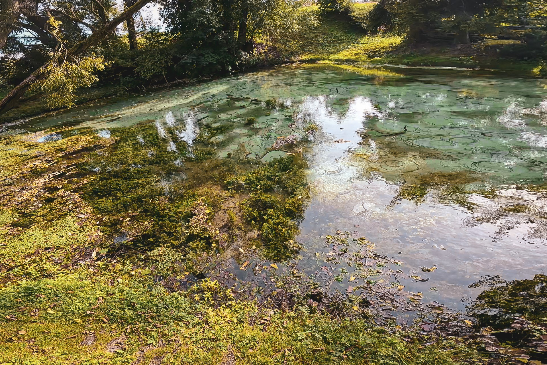
We reach the Hydrologists’ Spring by crossing the private grounds of a former watermill. Unfortunately, the owners periodically remove or alter the signs in an apparent attempt to discourage visitors from disturbing their peace. We will not attempt to determine how Article 233 of the Polish Water Law should be interpreted in the current circumstances, or whether there are grounds in this particular case for ensuring public access to the spring. Nevertheless, the matter deserves to be clarified so that the owners’ right to privacy can be reconciled with the public’s right to make general use of water.
Another large and impressive spring on our route is Ostrich Spring (Źródło Strusi), whose name refers to a nearby ostrich farm. To visit it, we need only make a short detour from our planned route near another ford on the Dłubnia.
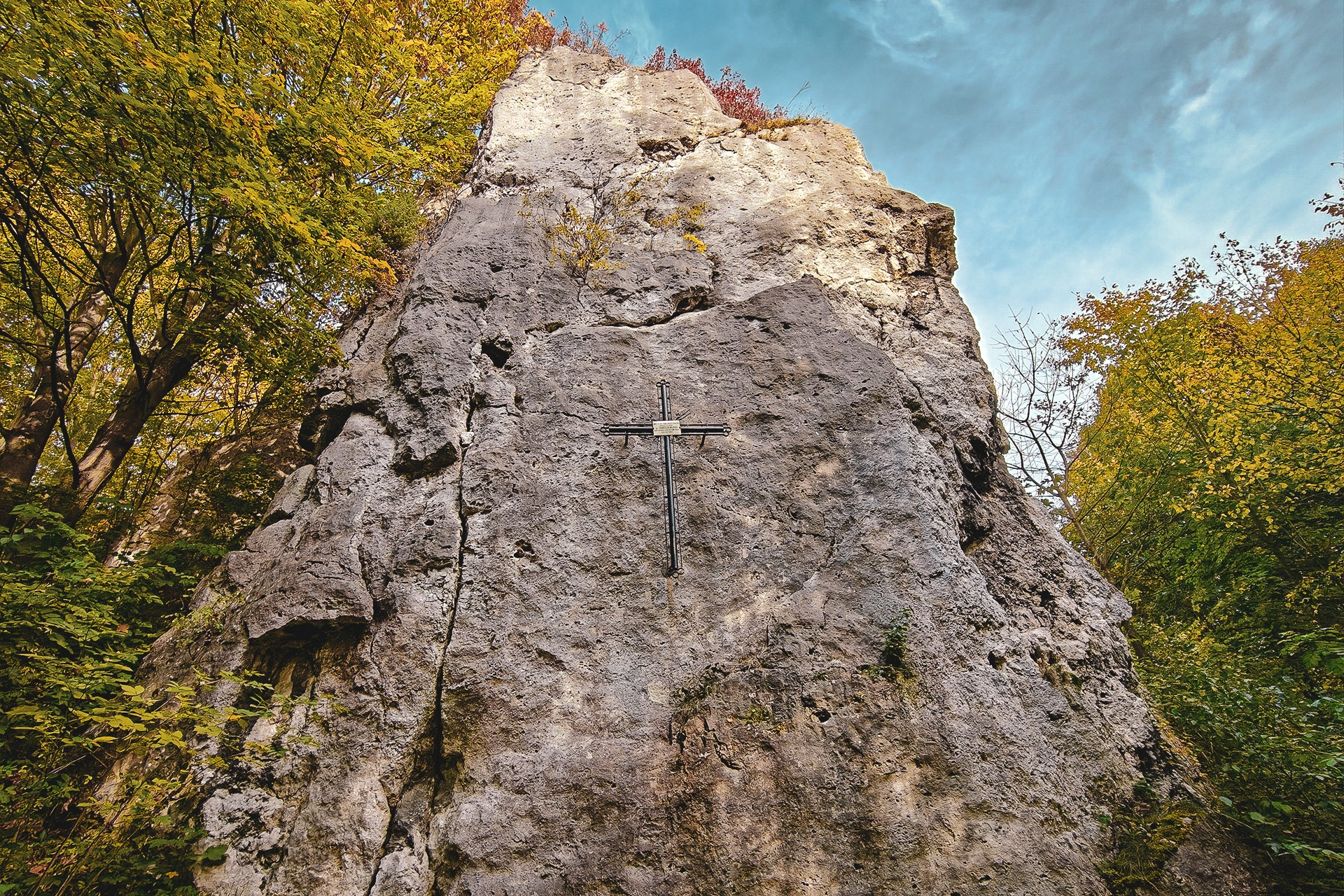
The descent towards the river also marks the beginning of a short but enjoyable off-road section. Just a few dozen metres from the water, we come across Skała z Krzyżem, or Cross Rock, a limestone outcrop bearing a cross commemorating the fatal fall of Franciszek Wójcicki in 1917.
The track, sheltered by a canopy of trees, can be muddy in places, but most motorcyclists should be able to negotiate this section without much difficulty, regardless of their motorcycle or tyres. If the surface does not appeal to us, however, we can bypass this stretch and head towards Trzyciąż, taking the road through Glanów or the route marked as Road 14 of the Fallen.
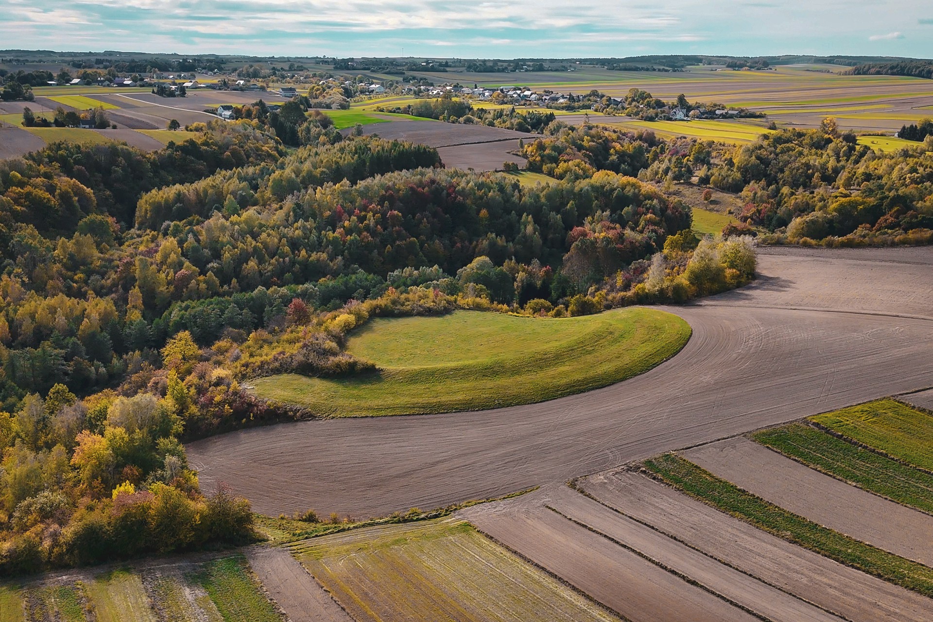
Along the way, we encounter another source of the Dłubnia, Aleksandra Spring, as well as the second major hillfort on our route: Imbram’s Hillfort in Zagórowa. Archaeological investigations at the site have confirmed traces of Neolithic settlement as well as later activity during the early medieval period. As with the hillfort at Damice, we are dealing with a place whose history reaches far beyond the surviving earthworks.
We can reach the hillfort from the valley floor, following a path or attempting to negotiate the field tracks leading towards it. And field tracks they are in the literal sense of the word, so it is worth taking current conditions and the state of the surface into account.
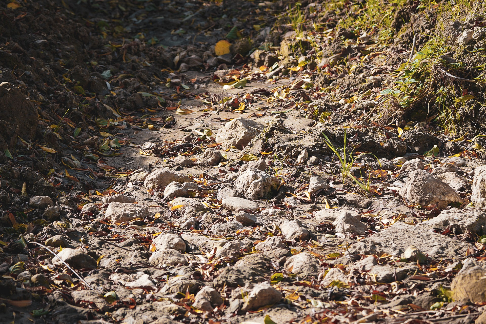
The next stop is Rogóża Spring, which we have yet to visit in person. The reason is its location in the woods, some distance from the road. Since photographic records of the site are difficult to find online, we intend to make up for this omission and finally discover what lies among the trees.
The Halfway Point
After reaching Trzyciąż, we quickly turn towards Jangrot, and for two reasons. The first is our destination: the source of the Dłubnia. The second is the opportunity to turn onto the so-called White Road, which runs through the Sułoszowa fields, now known far beyond Poland.
In either case, however, we may be in for a considerable disappointment, particularly if we last visited these places a dozen or so years ago. After years of drought that has only grown more severe, the Dłubnia’s riverbed is now bone-dry as far downstream as Aleksandra Spring. Meanwhile, the once atmospheric dirt track crossing the Sułoszowa fields has been asphalted from end to end. These days, its surface is in better condition than many sections of Poland’s national roads.
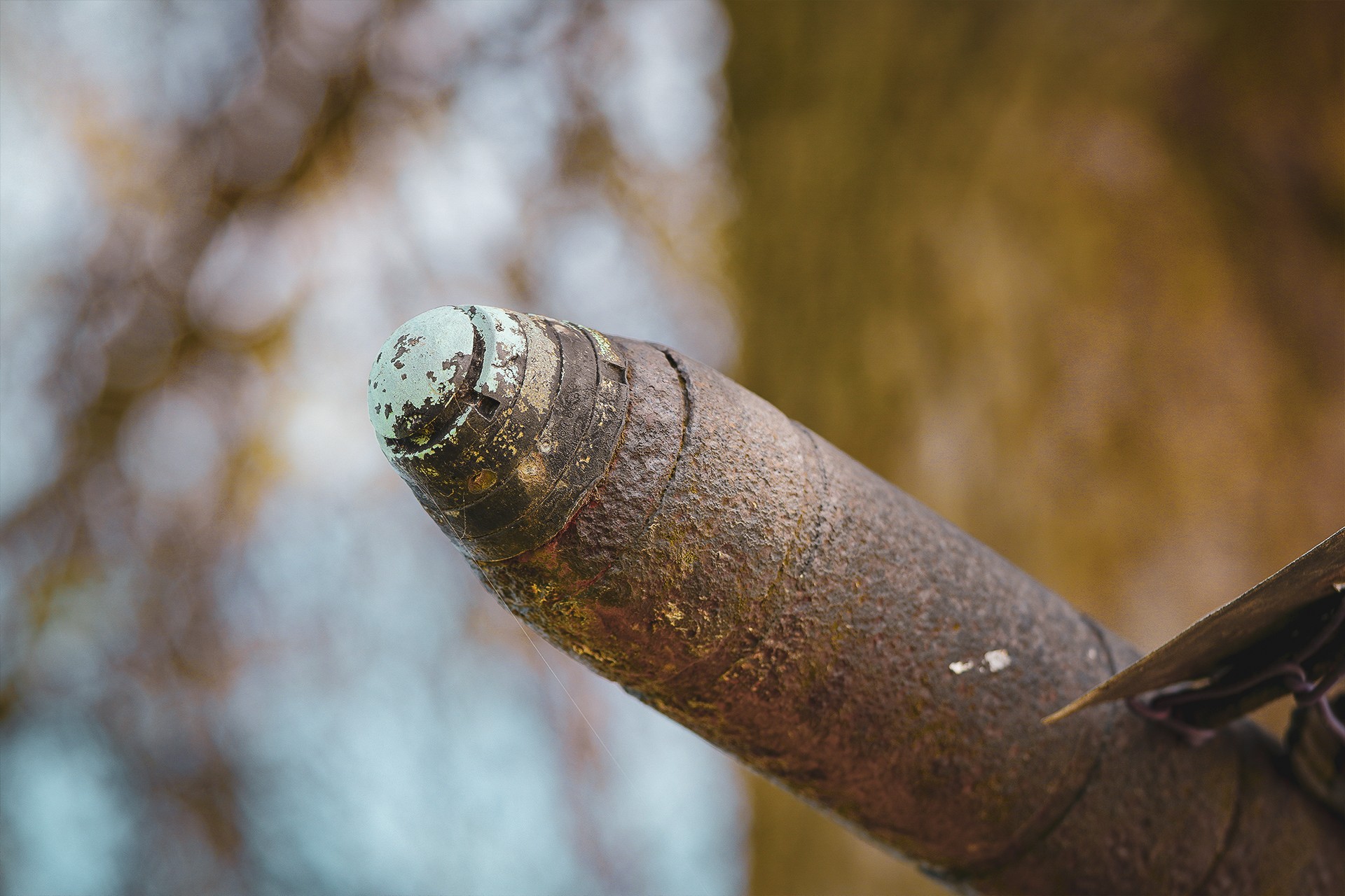
The so-called Hanged Men’s Tree has also disappeared, though it was mainly known to local farmers and cyclists travelling along this route. The fields themselves remain a local attraction, and roughly halfway along the main road, the unusual Shrapnel Cross still stands. As its name suggests, it was made from remnants of wartime ammunition. Similar crosses are most common in the Świętokrzyskie region and commemorate the largest armoured battle fought on Polish soil. Unfortunately, both the crops now grown here and the aforementioned asphalt surface have robbed the area of much of its former charm.
It is worth noting that once we reach Olkuska Street, we can continue riding through the Sułoszowa fields. We, however, turn left to follow the Prądnik, the second river of particular importance to Kraków. And, importantly, the source of this stream lies just a few hundred metres from our turn.
Through Sułoszowa to Ojców
We head towards Kraków, following a road that winds among the limestone outcrops of the Kraków-Częstochowa Upland and through one of the longest villages in Poland. It is worth taking a moment to explain what makes Sułoszowa so well known. The first reason is the impressive length of the village and its distinctive layout, with houses situated predominantly along the main road. This is an example of a linear village (ulicówka). The second is the picturesque patchwork of fields around Sułoszowa, whose recognisable appearance also stems from the elongated shape of the plots, reflecting the character of a chain village, also known as a forest-strip settlement.
We, however, leave this subject behind. Although we are still within Sułoszowa, another hillfort appears on our route. This time, it is a late-medieval hillfort on Kocica Hill. Shortly afterwards, we reach the first castle of our journey.
We will leave the details of Pieskowa Skała Castle for another trip. For now, humming the theme tune from Janosik — the series in which scenes involving the character of the burgrave were filmed at this very castle — we pass one of the most recognisable landmarks of the Kraków-Częstochowa Upland: Hercules’ Club.
Before reaching Ojców along one of the more interesting roads around Kraków, particularly from a motorcyclist’s point of view, we pass two more springs: Młynnik and the Spring of Joy (Źródło Radości). The latter lies in a valley that is perhaps not among the most popular in Ojców National Park, at least compared with those crossed by marked hiking trails.
The next stop on our route is, naturally, yet another hillfort. To put off anyone who has little interest in history or archaeology, we should add that this particular stronghold, called Grodzisko, is now located in a place also named Grodzisko — a hamlet belonging to the town of Skała.
This coincidence of names is no accident. It reflects the memory of an ancient stronghold, later replaced by the hermitage of Blessed Salomea and a monastery. For many years, however, awareness of the buildings at this site did not go hand in hand with an understanding of their earlier history.
Archaeological excavations have been carried out here over the past few seasons, bringing new findings about both the monastery and the stronghold that preceded it.
If you have had enough of hillforts by now, fear not: along the way, we have also passed numerous mills, both old and relatively modern. Another one stands just a few dozen metres from the archaeological site we have been discussing.
Here, we can turn towards Ojców, where even more structures of this kind await us, led by the popular Boroniówka Mill Settlement (Osada Młyńska Boroniówka).
We will leave Ojców itself, its attractions and its many curiosities for another time. Fitting them all into an article that is already rather lengthy would be a challenge. There is another reason, too: if we choose to follow this route by motorcycle, we must take into account the restrictions in force within the national park. In practice, this means our lawful journey would end near Ojców Castle, and exploring further would require a different means of transport.
Of course, the route can also be completed by bicycle. In that case, choosing the Prądnik Valley and riding through Ojców is not only possible but an obvious choice. A bicycle gives us the freedom to discover more of the valley’s hidden corners — places we cannot legally reach by motorcycle.
Towards Kraków, Along the Prądnik
We therefore leave the valley and head towards Skała. Once one of the more important urban centres in this part of Poland, the town was granted its charter as early as 1267. Despite its former significance and subsequent development, Skała lost its town privileges in 1870 and did not regain them until 1987. Little of its former glory remains, however. Apart from its preserved medieval street layout, there is little to suggest the historical importance the town once enjoyed.
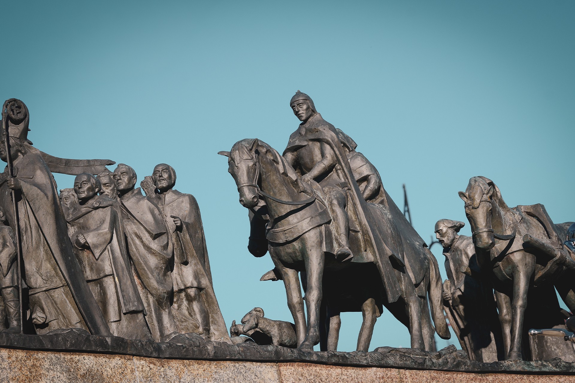
Although a faster, wider road connects Skała with Kraków, we opt for a quieter route through Smardzowice. Here, we can see a manor house saved from ruin, along with a Neo-Gothic church that opened in 1922. This allows us to avoid some of the heavier traffic and return more quickly to the road running close to the Prądnik — and to a stretch where motorcycles are once again legally permitted.
Along the way, we bypass Korzkiew Castle, although those interested can easily make a detour. Simply cross the small bridge on Korzkiewska Street, turn left and double back towards the castle.
Beyond its turbulent history, Korzkiew Castle is worth mentioning for the unauthorised alterations made to its structure. The added residential section, built using modern hollow concrete blocks, was for a time distinguished by an equally conspicuous satellite dish jutting out from the building. It is hard to imagine a more striking juxtaposition of medieval architecture and contemporary life.
There is also an interesting story involving its former owners. They were the ones who moved to Korzkiew after their castle in Biały Kościół fell into ruin. Its remains can still be seen today.
A little further on, in Januszowice, we have to use the road from Skała for a short stretch before drawing close to the river again beyond Giebułtów. Another option is to follow the ridge, which offers somewhat more interesting views. Since the aim of our route is to stay as close to the water as possible, however, we choose the less scenic alternative this time.
To avoid the increasingly troublesome traffic, we turn off towards the Church of the Nativity of the Blessed Virgin Mary just before reaching the centre of Zielonki. From there, we continue towards the unpaved tracks running parallel to the area of the former village of Witkowice.
Halfway along this stretch of dirt roads, we pass the remains of the Witkowice powder magazine and a historic bridge over the Prądnik, known by the name Białucha at this point. Both sites have plenty of stories to tell, and the history of the powder magazine is, quite literally, explosive.
In 1927, an explosion at the Witkowice powder magazine destroyed a substantial part of the nearby buildings. According to some accounts, the shock wave was powerful enough to shatter windows even in Kraków’s Cloth Hall. It is difficult to establish how much truth there is to this story today. What we do know is that the blast did not kill everyone in the vicinity. One of the survivors was Corporal Jan Nierząd, who was on guard duty when the explosion occurred.
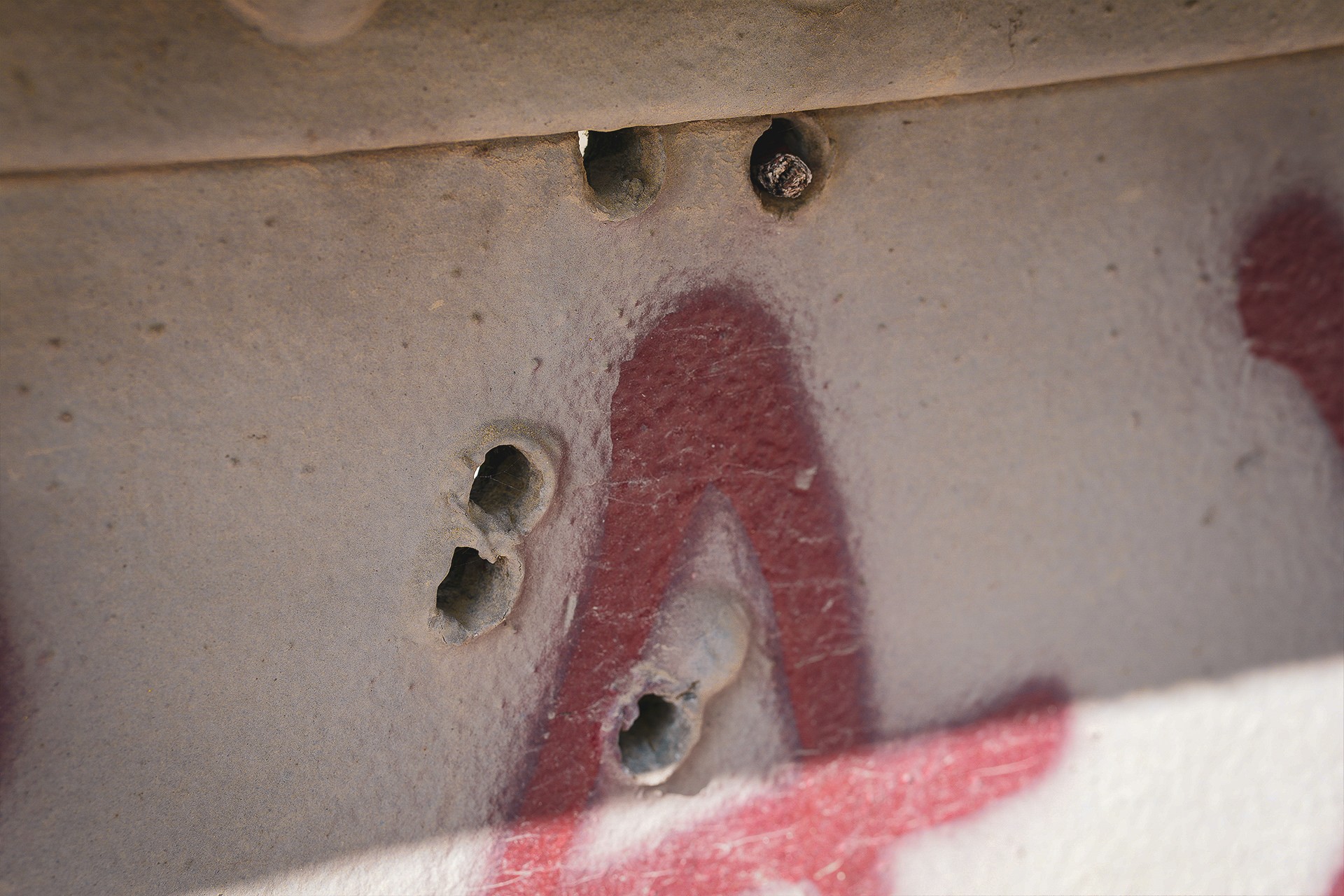
The nearby bridge is no less intriguing. In addition to its steel structure, it bears unmistakable marks left by large-calibre projectiles. Their distribution and the nature of the damage make it difficult to link them to the powder magazine explosion. It also seems unlikely that they were caused by shelling from Tsarist troops advancing from this direction. Both the calibre involved and the extent of the damage to the metal components argue against that explanation.
This leaves us with at least two hypotheses. The first is that the damage was caused by Soviet forces advancing on Kraków from the north during the offensive later described as the city’s “liberation”. The second is considerably less dramatic: the bridge components may have been used for weapons testing or shooting practice, either before they were assembled or after they had been installed in their final position.
It is difficult to say which, if either, of these explanations is correct.
The Final Stretch Along the Prądnik
We do not end our journey where the river does, but at Biały Prądnik Manor. This area has a rich milling heritage, although it was associated primarily with paper production rather than grain milling. It was here, in Prądnik Czerwony, that the first paper mill on Polish soil was established in 1491.
Although the area around the manor now falls administratively within Prądnik Biały, much of the former milling activity was concentrated here because of the river’s course and the ready supply of water. Two monastic farmsteads also operated in what is now Prądnik Czerwony. There, we can find a watercourse and even the remains of an old mill. It is difficult, however, to regard the Pocieszka, a small stream that still flows through this part of Kraków, as a watercourse with sufficient flow to power an extensive complex of milling machinery.
Biały Prądnik Manor itself holds far more history than its present appearance might suggest. A Baroque palace once stood here, preceded by a Renaissance building and, earlier still, most likely a manor house whose buildings may have served defensive purposes. Reconstructing the exact appearance of the entire complex at each stage of its existence is no easy task.
The ruins of Bularnia Mill, situated a few hundred metres from the Prądnik’s present course, offer another reminder of the area’s former water infrastructure. The remains of the old millrace — an artificial channel diverting water from the river — are evidence of how water was harnessed for industrial use in this part of Kraków.
Why, then, do we end our route here, several kilometres before the Prądnik meets the Vistula?
There are several reasons. The first is the need to navigate unattractive urban traffic, which hardly fits the character of our trip. The second is the course of the Białucha itself, which has been altered repeatedly over the centuries. The river was adapted to serve industrial needs; Swedish forces later diverted its course to drain the city moat; and, in subsequent years, substantial sections were buried underground to reclaim space for the expanding city. All these changes mean that the river’s present course does not always correspond to its historical layout.
Perhaps that is precisely why we may extend the route in the future to include the remaining stretch of the Białucha, following it towards its confluence with the Vistula. The history of this river and the transformations it has undergone over the centuries certainly deserves a story of its own.
For now, though, our journey comes to an end. We hope you enjoy the route, whether for the picturesque landscapes of the Kraków-Częstochowa Upland and the Prądnik Valley, or for the opportunity to adapt the journey to your own preferences. You can treat it as a shorter motorcycle outing, opt for the cycling version, or stop at the various points of interest and spend more time exploring the history of places that are all too easy to pass by without a second thought.
After all, it is not always about travelling as far as possible. Sometimes, all it takes is following a river to discover how much remains of a world that is slowly disappearing from the landscape around us.
J. Górski, Nowa Huta-Mogiła, stanowisko 55 (Kopiec Wandy). Wielofazowa osada kultury trzcinieckiej i łużyckiej, Narodowy Instytut Dziedzictwa [dostęp: 17.10.2026].