
What Does Czubatka in Rusocice Hide?
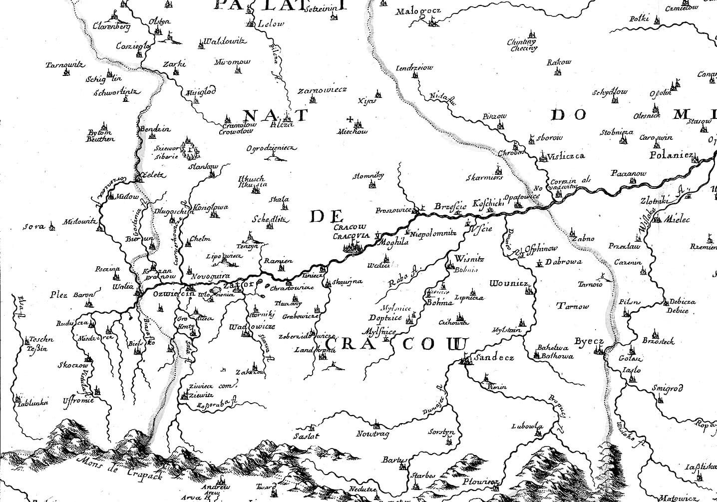
When heading west of Kraków for a hiking, cycling, or motorcycle trip, most people think along familiar lines. First comes the Prądnik Valley and the crowded Ojców. Next are the small valleys of the Dolinek Krakowskich Landscape Park and the Jurassic Valleys reserve, followed by the much quieter forests of the Tenczyński Ridge and the castle in Rudno on their edge.
Located closest to the Vistula — and therefore somewhat different from the areas mentioned above — the Rudniański Landscape Park is visited mainly by cyclists riding the riverside Vistula Cycling Route (Wiślana Trasa Rowerowa / Velo Metropolis).
Although this region is less popular than the areas to the north, it is by no means less interesting. Quite the opposite — it is an area packed with curiosities that usually escape broader attention.
It could hardly be otherwise, considering that for at least 10,000 years the queen of Polish rivers has been carving her way through this landscape, leaving behind dozens of ponds, oxbows, and everything her waters carried with them.
As Małopolska is the most mountainous region of the country, the river has always accompanied those on the move — merchants, armies, migrating peoples, and animals alike. River valleys served — and still serve — as natural highways through difficult terrain, while also providing reliable access to water and fish.
Whoever controlled the river controlled the movement.
For this reason, nearly every major watercourse cutting through the Małopolska uplands is lined with strongholds, settlements, fortifications, and castles from various periods. This is most evident in the Dunajec Valley, but it is just as noticeable along the Vistula.
Particularly in the area of the so-called Kraków Gate — a macroregion which, as the name suggests, opens the western approach to Kraków. Here, in the “jaws” of the Kraków Bridge (Pomost Krakowski), attention is drawn not only to the well-known Benedictine Abbey in Tyniec — the oldest existing monastery in Poland — but also to the Piekary rocks on the opposite bank. It was likely among them that Konrad of Masovia located his stronghold.
The feature that stands out most, however, is Grodzisko Hill. As is often the case, the name derives from defensive structures eagerly situated on elevations with natural strategic advantages. Grodzisko Hill — also known as Monastery Hill — with its prominence, very steep slopes, and direct position above the Vistula, must have attracted human attention from an early date.
It is therefore no surprise that the hilltop stronghold is regarded as the main — or one of the main — centers of the so-called Tyniec group, most likely associated with Celtic populations.
Westward
Moving further downstream along the queen of Polish rivers, another key point on the route was undoubtedly Wawel Hill. Its importance is reflected not only in the historic stronghold and the Royal Castle that still stands today, but also — perhaps above all — in its distinctive position amid former river backwaters.
But what controlled the route from the west?
Here the answers become less certain. The farther back in time we look, the more the story belongs to archaeologists. For sites that left no written record and survive only as subtle earthworks or faint local memories, identification is difficult and often requires costly, time-consuming fieldwork.
A breakthrough came with airborne laser scanning — LiDAR — technology capable of virtually stripping vegetation from the landscape and revealing what had remained hidden for centuries. Crucially, the results of these surveys are now widely accessible.
And this is where the story properly begins.
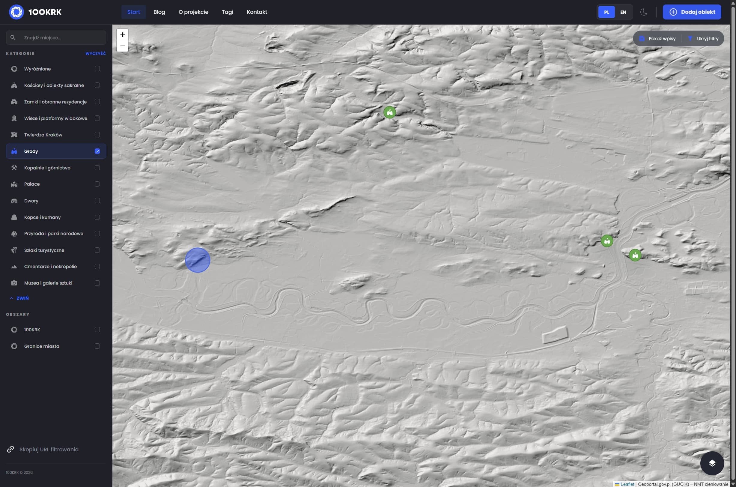
Sokola Hill — coincidence or clue?
With no confirmed defensive sites found in the literature, municipal publications, or thematic databases, the only option was to trace the entire stretch from Tyniec to the Skawa’s mouth using shaded terrain models.
After passing Czernichów — perched on a prominent hill that almost certainly conceals older layers beneath its modern fabric — the trail led to Rusocice, a village lying beside an old Vistula channel, seemingly pushed northward by waters and wetlands.
Water — the first key ingredient in the “recipe” for a stronghold, castle, or major settlement — is present.
Alongside the river bends and gravel workings that exploit its deposits, the village also features a small limestone quarry and lime kiln, common in this area. There are also traces of more recent visitors from the west — German field fortifications composed of numerous trenches and Koch bunkers.
Dominating the landscape is a memorial cross atop the limestone outcrop known as Czubatka. With a quarry and an isolated rock present, a hill is almost guaranteed — and with it, the second key ingredient for a potential stronghold.
A stronghold?
Access to water, a river valley forming a natural movement corridor, and an elevation with defensive potential — the setting is compelling.
Importantly, the southern slope of Sokola Hill ends in an exceptionally steep escarpment. Only the nearby tectonic scarp of Kajasówka and the previously mentioned Grodzisko Hill in Tyniec cast comparable shadows.
There was no shortage of reasons to look closer — especially since the site has long caught the eye of anyone venturing into the area, even before LiDAR data became widely available.
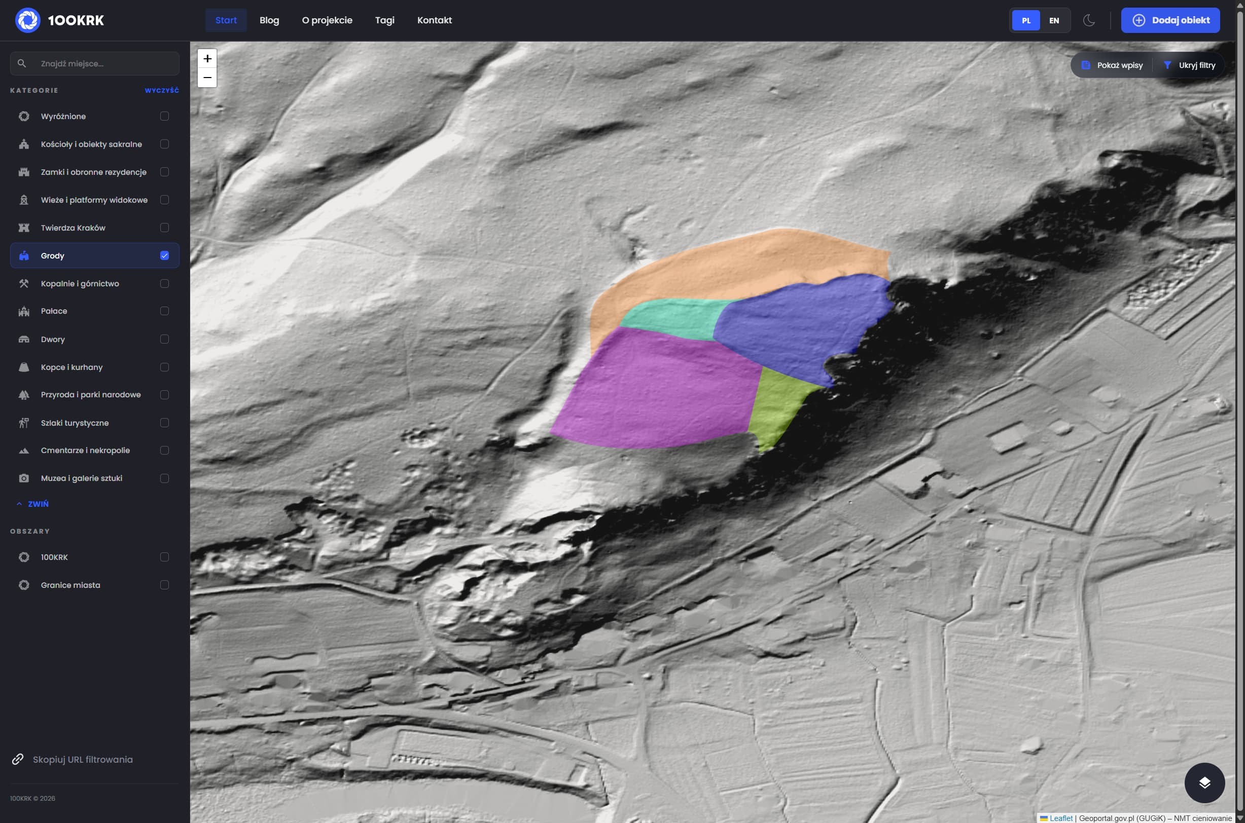
Zooming in on the terrain model revealed distinct elevations on the hill near the memorial cross and quarry. Their morphology is difficult to attribute to natural processes or typical agricultural activity.
A literature and database check followed: books, thematic portals, stronghold atlases, the Municipal Heritage Register, planning documents, environmental studies, geomorphological analyses, and the databases of the Archaeological Museum in Kraków and the National Heritage Institute.
Nothing.
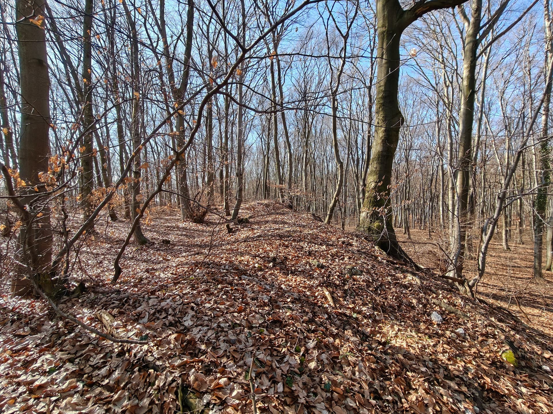
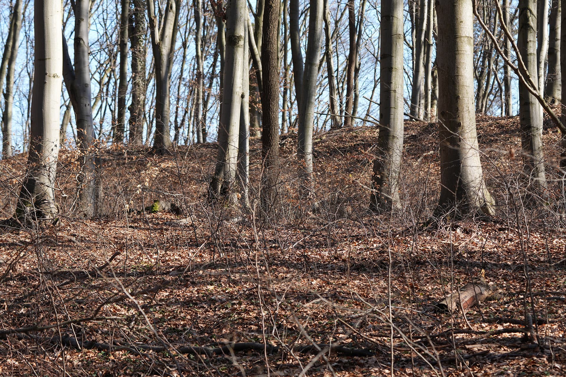
Earthworks
On reaching the edge of the presumed stronghold, the field impression was clear: the ramparts are higher than the model suggested and largely built of local limestone. This strongly indicates deliberate human activity — and, if confirmed as a stronghold, a substantial one.
Equally intriguing is a depression visible in LiDAR data reaching the outer rampart. In the field it proved to be a pronounced seep whose waters quickly disappear into a rock fissure beneath the embankment. Whether this feature is fully natural, anthropogenic, or natural but later modified by humans remains unresolved.
“New” strongholds and the heritage office
Recent years have shown that previously overlooked sites do come to light. Rather than speculate, the case was reported to the Voivodeship Heritage Protection Office in Kraków. Better to err on the side of caution than risk the unnoticed degradation of a potentially significant site.
It is worth mentioning the stronghold in the Zagórska forests, which had been noted years ago and long considered obvious due to its prominent location, but was only formally confirmed in 2018–2019.
Information about another newly identified stronghold, located in the center of the Włodawskie Forests, was published exactly on the day of the visit to Rusocice. This shows that the possibility of discovering or “reviving” forgotten traces of history remains very much real.
Not the end
Is this truly a stronghold? A defensive settlement? A feature connected with the royal Kamień? Or merely a deceptive landform?
One thing is certain: the area contains no shortage of terrain anomalies that clearly warrant closer inspection — and many signs suggest they will sooner or later become the subject of further field visits and reports.