
The Secrets of Buczyna Hill
Beech forests covering the Tenczyn Ridge and the tectonic depression of the Krzeszowice Graben are a popular destination for hiking, cycling, and motorcycle trips. Although these areas are frequently and willingly visited, just beyond the main trails lie many still unknown, forgotten, or at best overlooked curiosities.
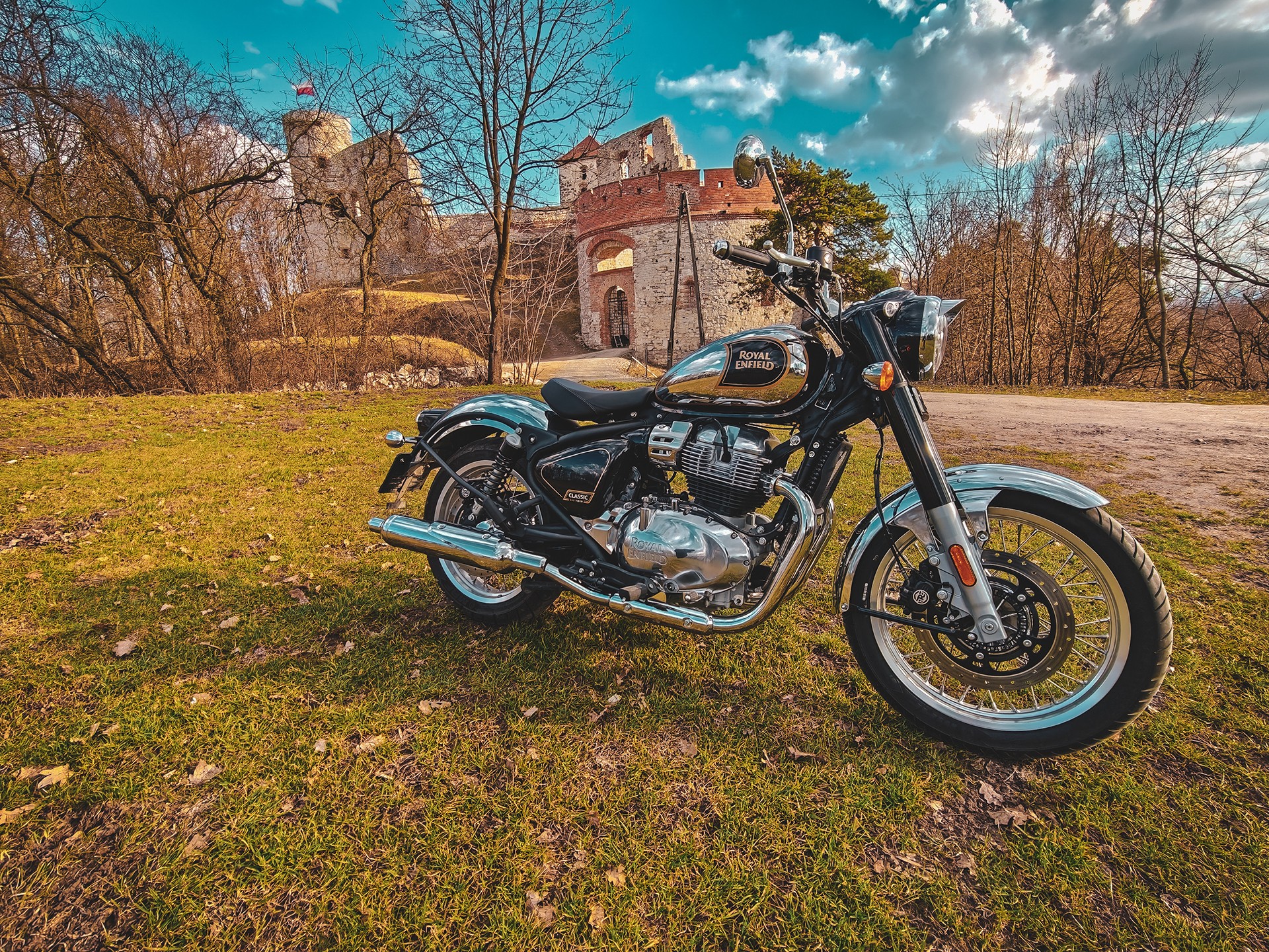
The early spring sun encouraged us to visit the area, starting from Zabierzów, through Morawica, the Kraków Switzerland, all the way to Tenczyn Castle in Rudno—or, as some call it, Rudno Castle in Tenczynek.
Undoubtedly, this ride and the photos taken along the way caught the attention of some ominous algorithms, which suggested a channel of one of the so-called “searchers” and his recent material on the castle’s surroundings.
Tenczyn Castle, also known as the “Little Wawel,” like many other defensive residences in southern Poland, holds numerous secrets. Anyone who remembers its condition even from the not-so-distant 1990s and has explored its underground passages knows that the site is far from fully understood.
It is believed that the first historically documented structure on the hill—already remarkable in itself, as it is the peak of a volcanic cone—was built by Castellan Nawój of Morawica, a village thought to be the seat of the notable Toporczyk family. Recent archaeological studies partially confirm this.
Our interest, however, was not in the medieval history of the castle and its surroundings, but in much earlier times. This is exactly what the aforementioned detectorist’s find refers to: a bronze arrowhead discovered on the castle slopes.
Anyone who has examined the castle hill area via maps, LiDAR, or in person knows it is an extremely attractive location, particularly defensively. Steep slopes, an ideal vantage point to the south and east, and the only noteworthy road running along the flat summit of the hill suitable for settlement make it an excellent spot.
Thus, it would have been an ideal place for a prehistoric or early medieval stronghold, which, due to the lack of sources, we can also call “prehistoric.”
One element, however, is critically missing in this otherwise perfect puzzle: water. While the castle surroundings remain a somewhat marshy area, with forests crisscrossed by small streams, this is not typical of larger or more populous forts and settlements. Of course, the terrain and hydrological conditions have changed over time, particularly since the spear’s owner lived perhaps 4,500–5,000 years ago, but it still remains an unusual sight.
In such a situation, it is reasonable to ask about other locations that might have attracted the owners of sharp-tipped tools. If not on the volcanic “peak,” then where?
The material published on Saturday evening by the detectorist and the artifact he found did not so much surprise us as motivate us to visit one of the locations marked on a map many years ago. Life, as it often does, postponed this personal visit year after year—ultimately resulting in a gap of over 25 years.
Over that time, however, modern technologies appeared, allowing a closer look at the supposed site: aerial LiDAR, as well as more “ground-level” tools like drones and cameras.
Prompted by the detectorist’s material, the very next day we returned to the Krzeszowice area to examine the location that, like the hill described in the Rusocice post, does not appear in the literature, on maps, or in online searches.
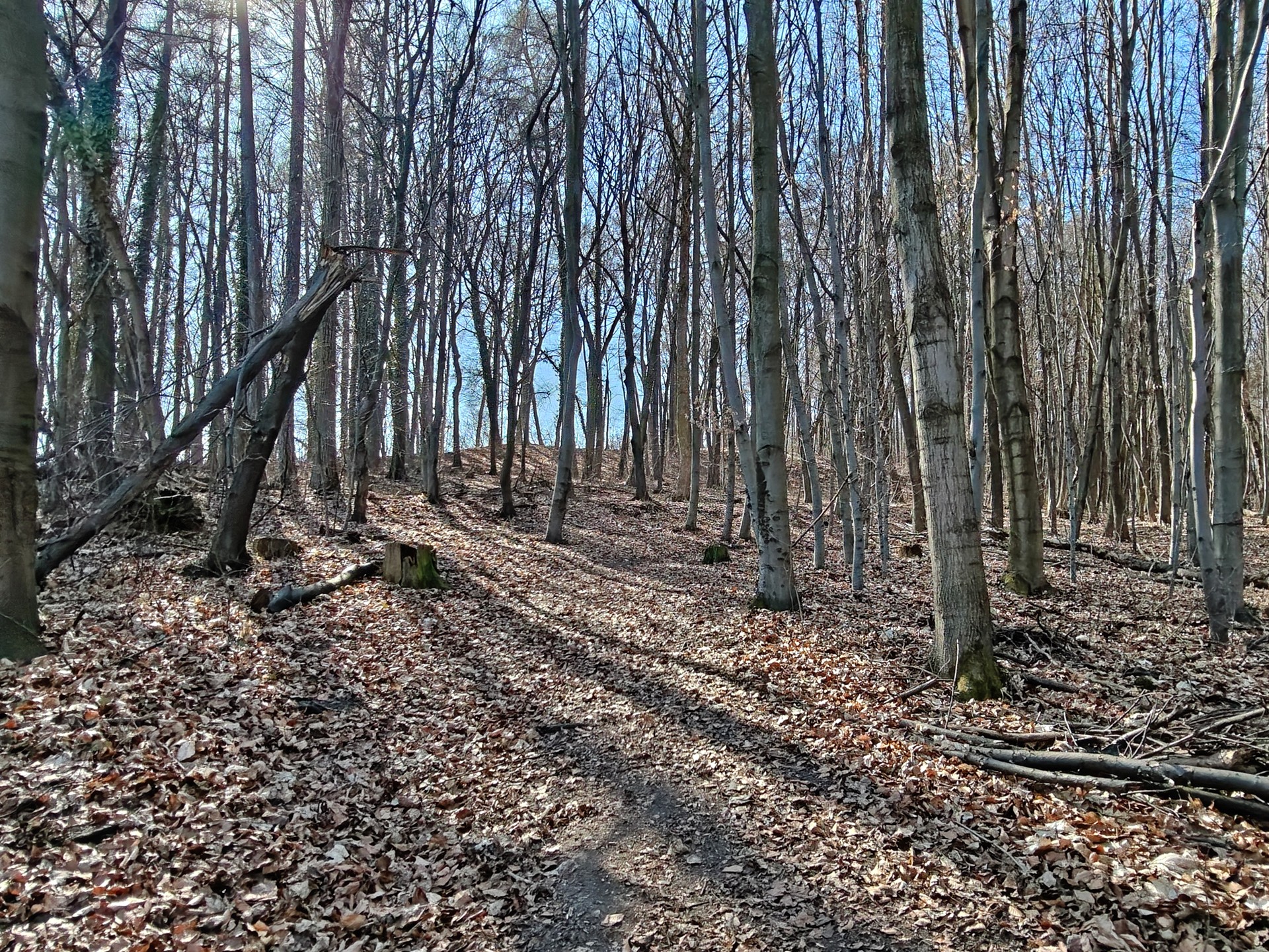
We are talking about Buczyna Hill in Tenczynek and the forest covering its summit, made, as one might guess, primarily of Subcarpathian Beech.
Buczyna Hill, whose peak reaches 330 meters above sea level, though not particularly popular—as evidenced by the limited state of the paths—is nonetheless extremely interesting.
Of course, given the previously discussed context regarding the find, the most important feature is its location just above the banks of two significant tributaries of the Krzeszówka: the Olszówka from the south and the Dulówka running from the west. Their waters join near the Rudawa River, along with another tributary, forming a river that residents of Kraków generally know well.
In the vicinity and within the hill itself, one should note not only the forks of the aforementioned streams but also much later activity related primarily to mining. This area is not only home to fascinating and active, but also surprisingly intensive, exploitation of coal and limestone.
Buczyna Hill is thus intersected not only by paths and mining shafts but also by karst depressions and tunnels dug for the Tenczynek Brewery located nearby.
We will surely return to discuss this brewery, which boasts a long and rich history—not merely the antics of its relatively recent owners.
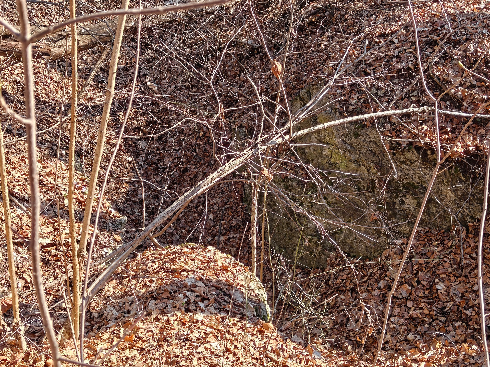
Beyond small wells and fissures, which attract cavers quietly exploring undocumented caves, there are structures that are fairly visible and—one could say—accessible to anyone. However, this accessibility is deceptive, as the condition of the structures directly threatens the safety of visitors.
We are talking about the entrance to one of the adits of a now-defunct mine and a partially collapsed tunnel or cavern, likely serving as the northern outlet for cellars dug for the aforementioned brewery and the aging of its golden brew.
On one hand, we do not wish to dwell too much on mining in the hill area, yet we cannot ignore the previously mentioned mine. By the term “nonexistent mine,” we essentially refer to three neighboring mines: Adam, Kmita, and Tenczynek. Adding the Katarzyna Mine, located just a stone’s throw away, one can see that this region was far from quiet as it is today.
The subject of these sites, as well as the entire Old Mining Trail, deserves not only a separate chapter but also a dedicated post.
After this rather long and somewhat chaotic introduction, it is time for a short summary and, as mentioned in the Rusocice post, a checklist of ingredients for a fortified settlement.
Access to water, a location with exceptional defensive qualities, and the ability to control communication routes make for a recipe for a successful stronghold.
The first element, favorable hydrological conditions, is already present. Hardly any location is better than a hill flanked on two sides by swift streams.
And if there is a hill, one can naturally assume it is a convenient place for observation, controlling the surroundings, and defense in case of attack.
A visit to the area near Krzeszowice reveals Buczyna Hill’s potential. For the local terrain, it is a prominent and solitary elevation. Although it borders Ponetnica Hill to the east, that hill is much smaller, highlighting Buczyna’s advantages and creating a small pass between them. Today, Kasztanowa Street runs through this pass, from which the most convenient path to Buczyna’s summit begins. Thus, Ponetnica does not threaten the defenders of a potential stronghold—it aids them.
Buczyna Hill’s location in the middle of the Krzeszowice Graben, near streams and at the exit of at least four deep valleys—the Eliaszówka and Czernka rivers, and Miękinia to the north, and the Rudno River to the south—offers excellent control over communication and trade routes, and makes troop movements more difficult. Everyone needs water, and climbing uphill requires effort, making Buczyna Hill a natural choice for settlement.
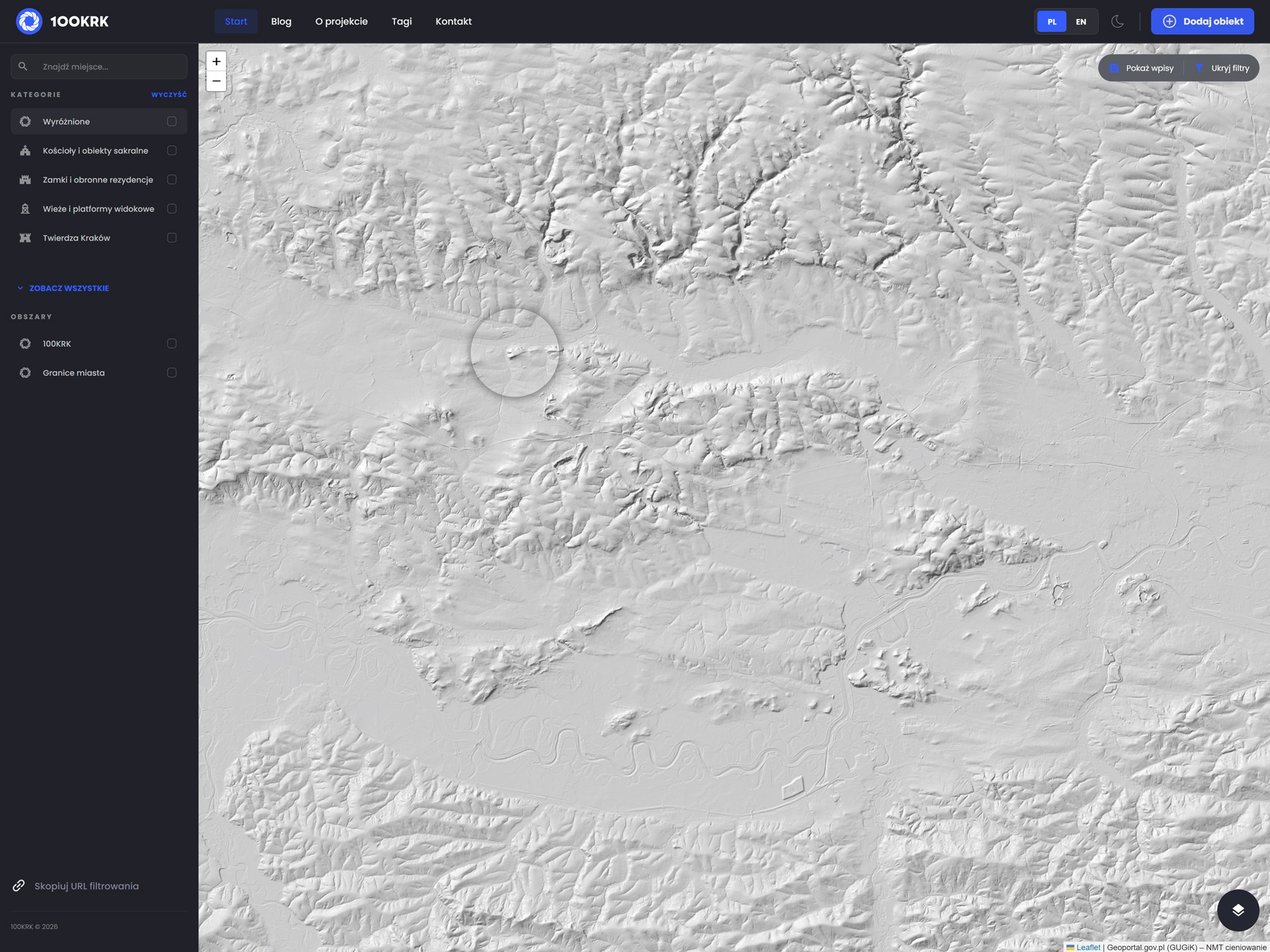
Such reasoning, combined with its location and visible features, suggests it was an excellent site for establishing a defensive settlement, fort, or stronghold. Modern technologies like LiDAR make this investigation even easier.
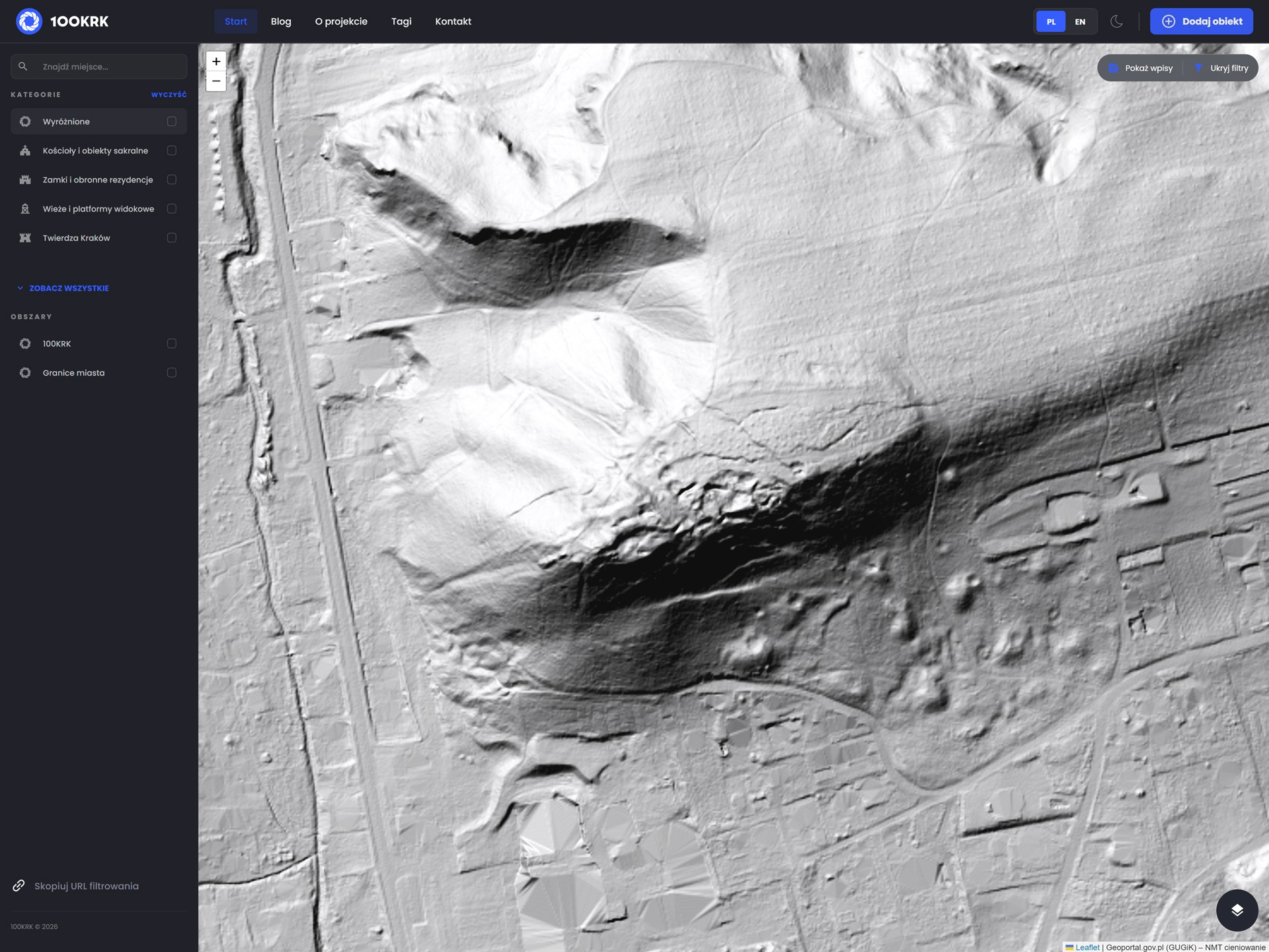
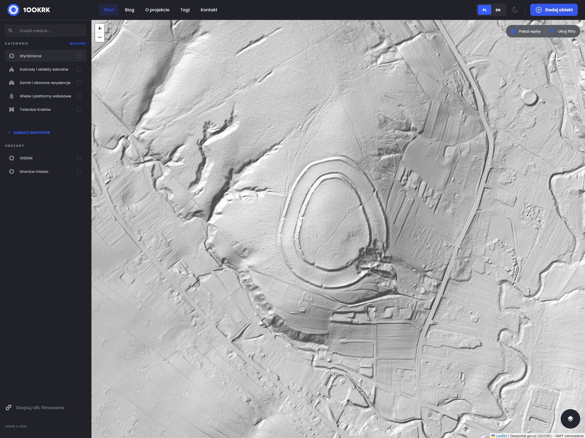
A LiDAR scan under the tree canopy immediately shows that all the features mentioned above were clearly noticed by much earlier visitors. Indeed, from a view spanning the Vistula lowlands in the east to the Upper Vistula Valley in the west, Buczyna Hill stands out as a strategic point.
Its prominence rivals that of Sokoła Hill in Rusocice, which likely also encouraged ancestors to establish a fort, as well as Grodzisko Hill in Tyniec or the Kajasówka tectonic fault, which, despite being prominent on the map, shows no signs of major fortifications—at least at first glance.
Examining Buczyna Hill up close, the absence of recorded archaeological sites is striking, a pattern similar to that of Rusocice. Although these are some of the most prominent points on the map of western Lesser Poland—aside from the Prądnik and Bolechowice Valleys—with clear summit features resembling defensive walls, they remain unrecorded in standard references, maps, specialized databases, or online searches.
At Buczyna, aside from new plantings and typical agricultural activity, the steepest spur, surrounded on the south, west, and north, shows clear leveling, surrounding embankments, and near the summit, a probable second line of fortifications.
Besides likely natural landslides, LiDAR reveals deep furrows cutting across the presumed fort. Are these atypical drainage ditches of mixed chronology—used by hill inhabitants, miners, and foresters? Or perhaps ordinary trenches from World War I and/or II? Or even earlier?
It is worth noting that the early medieval stronghold on Bartlowa Góra in Czatkowice, to the north, served northern arrivals during the Swedish Deluge, likely explaining its distinctive shape today. Perhaps Buczyna Hill owes many of its visible traces to the Swedes, if not all. A secondary southern camp, even as an observation post, seems reasonable, although the summit itself seems too small for the era’s needs.
Moreover, the depression at the highest point may indicate a building, protected not only by the southern cliff but also by a limestone moat to the north, limiting attacks from the west and further protected by the presumed lower bailey.
Attributing all visible anomalies on the summit solely to later human activity seems doubtful. Mining excavations are evident—likely much older than 19th- and 20th-century coal extraction—but quarrying limestone at the summit would be puzzling, as the resource is also available at the hill’s base. Unless these were true masochist miners, much like at Sokoła Hill in Rusocice.
Clearly defined embankments and summit leveling would also have limited significance for miners—unless they were aesthetically inclined masochists. Farmers could use the flat area, but its small size and poor soil quality on an exposed site made it only marginally attractive.
While we do not claim this is definitively an archaeological site or can assign a chronology, it is undoubtedly worth visiting and examining.
Regarding suspicions reported to the Provincial Office for the Protection of Monuments about a possible fortification on Sokoła Hill, we received no reply—unsurprising given the March 2, 2026, submission date and the time needed for a site inspection.
Is it worth bothering officials in this case, or is Buczyna Hill already known to scholars? It is hard to imagine such an unusual site escaping the attention of generations of specialists. We are not certain, but we will continue our investigation—purely out of curiosity. This curiosity inspired this post and its planned continuation. Perhaps it is time to bring the site “to the people” and first explore it in history-focused groups and forums. This is a rhetorical question, and we will soon act on it.
It should be emphasized that there are plenty of places like Buczyna Hill in Tenczynek. ;)